CountyAtlas Alabama
Alabama County Map with Cities — All 67 Counties
All 67 of Alabama's counties, mapped from official U.S. Census boundaries with population, income, and unemployment for every one. Colour the map by any measure, tap a county for its data, or download a print-ready copy.
Tap any county for its population, income, and more.
Alabama at a glance
- Scale. Alabama is divided into 67 counties across 50,652 sq mi of land — an average of 756 sq mi each. Census TIGER
- People. Its counties are home to 5,108,468 residents — an average of 76,246 each, or 101 per square mile statewide. Census PEP 2023
- Water. Another 1,768 sq mi is water — 3.4% of the state’s area, led by Baldwin County. Census TIGER
Alabama’s 67 counties, by the numbers
Every county’s population, median household income, unemployment, density, and land area — sortable by any column, so you can find yours or rank by what matters to you. A few patterns run through the data:
- Concentrated. Half of Alabama’s 5,108,468 residents live in just 8 of 67 counties, and the five largest hold 38.7% of the total. Census PEP 2023
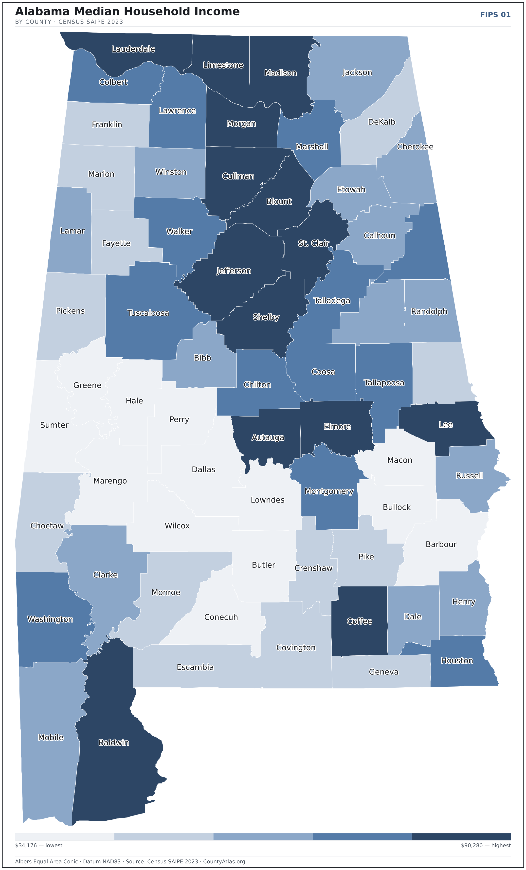
- Income tracks poverty. The gap from richest to poorest runs 2.6×, and the 10 highest-income counties average 11.4% in poverty against 30.1% for the 10 lowest. Census SAIPE 2023
- Mostly small. Half of Alabama’s counties have fewer than 34,079 residents, and half report a median household income below $52,504 — a few metros lift the statewide totals well above both. Census PEP 2023 · SAIPE 2023
- Lopsided density. Only 20 of 67 counties are denser than Alabama’s statewide average of 101 people per square mile — the rest are more rural. Census PEP 2023 · TIGER
| Autauga County | 60,342 | $68,857 | 3.1% | 102/sq mi | 594 sq mi | Prattville |
| Baldwin County | 253,507 | $74,248 | 3.0% | 159/sq mi | 1,590 sq mi | Bay Minette |
| Barbour County | 24,585 | $45,298 | 4.4% | 28/sq mi | 885 sq mi | Clayton |
| Bibb County | 21,868 | $56,025 | 3.3% | 35/sq mi | 622 sq mi | Centreville |
| Blount County | 59,816 | $64,962 | 2.9% | 93/sq mi | 645 sq mi | Oneonta |
| Bullock County | 9,897 | $36,204 | 3.6% | 16/sq mi | 623 sq mi | Union Springs |
| Butler County | 18,382 | $44,729 | 3.9% | 24/sq mi | 777 sq mi | Greenville |
| Calhoun County | 116,429 | $51,841 | 3.7% | 192/sq mi | 606 sq mi | Anniston |
| Chambers County | 34,079 | $50,390 | 2.9% | 57/sq mi | 597 sq mi | La Fayette |
| Cherokee County | 25,666 | $56,400 | 3.4% | 46/sq mi | 554 sq mi | Centre |
| Chilton County | 46,431 | $59,165 | 3.0% | 67/sq mi | 693 sq mi | Clanton |
| Choctaw County | 12,252 | $47,432 | 4.9% | 13/sq mi | 913 sq mi | Butler |
| Clarke County | 22,337 | $50,868 | 5.2% | 18/sq mi | 1,238 sq mi | Grove Hill |
| Clay County | 14,111 | $52,077 | 3.7% | 23/sq mi | 604 sq mi | Ashland |
| Cleburne County | 15,639 | $59,526 | 3.1% | 28/sq mi | 560 sq mi | Heflin |
| Coffee County | 55,643 | $64,737 | 3.2% | 82/sq mi | 679 sq mi | Elba; Enterprise |
| Colbert County | 58,361 | $57,770 | 3.5% | 98/sq mi | 593 sq mi | Tuscumbia |
| Conecuh County | 11,174 | $46,702 | 4.7% | 13/sq mi | 850 sq mi | Evergreen |
| Coosa County | 10,268 | $59,736 | 3.5% | 16/sq mi | 651 sq mi | Rockford |
| Covington County | 37,952 | $50,119 | 3.3% | 37/sq mi | 1,031 sq mi | Andalusia |
| Crenshaw County | 13,101 | $49,128 | 3.7% | 22/sq mi | 609 sq mi | Luverne |
| Cullman County | 92,016 | $61,231 | 3.1% | 125/sq mi | 735 sq mi | Cullman |
| Dale County | 49,871 | $54,697 | 3.9% | 89/sq mi | 561 sq mi | Ozark |
| Dallas County | 36,165 | $39,013 | 5.1% | 37/sq mi | 979 sq mi | Selma |
| DeKalb County | 72,569 | $50,614 | 3.0% | 93/sq mi | 777 sq mi | Fort Payne |
| Elmore County | 90,441 | $73,125 | 2.8% | 146/sq mi | 619 sq mi | Wetumpka |
| Escambia County | 36,558 | $50,333 | 4.2% | 39/sq mi | 945 sq mi | Brewton |
| Etowah County | 103,241 | $52,504 | 3.5% | 193/sq mi | 535 sq mi | Gadsden |
| Fayette County | 15,967 | $49,235 | 3.8% | 25/sq mi | 628 sq mi | Fayette |
| Franklin County | 31,802 | $49,682 | 3.1% | 50/sq mi | 634 sq mi | Russellville |
| Geneva County | 26,988 | $50,006 | 3.3% | 47/sq mi | 574 sq mi | Geneva |
| Greene County | 7,341 | $34,619 | 6.2% | 11/sq mi | 647 sq mi | Eutaw |
| Hale County | 14,888 | $42,380 | 4.8% | 23/sq mi | 644 sq mi | Greensboro |
| Henry County | 17,899 | $55,598 | 3.1% | 32/sq mi | 562 sq mi | Abbeville |
| Houston County | 108,462 | $59,412 | 3.4% | 187/sq mi | 580 sq mi | Dothan |
| Jackson County | 53,467 | $51,479 | 3.7% | 50/sq mi | 1,078 sq mi | Scottsboro |
| Jefferson County | 662,895 | $64,726 | 3.4% | 596/sq mi | 1,112 sq mi | Birmingham |
| Lamar County | 13,661 | $50,929 | 3.8% | 23/sq mi | 605 sq mi | Vernon |
| Lauderdale County | 96,814 | $63,895 | 3.6% | 145/sq mi | 668 sq mi | Florence |
| Lawrence County | 33,502 | $61,064 | 3.0% | 49/sq mi | 691 sq mi | Moulton |
| Lee County | 183,215 | $62,301 | 3.1% | 302/sq mi | 608 sq mi | Opelika |
| Limestone County | 114,654 | $81,811 | 2.9% | 204/sq mi | 563 sq mi | Athens |
| Lowndes County | 9,717 | $42,011 | 4.9% | 14/sq mi | 716 sq mi | Hayneville |
| Macon County | 18,370 | $40,710 | 4.6% | 30/sq mi | 609 sq mi | Tuskegee |
| Madison County | 412,600 | $86,172 | 2.9% | 515/sq mi | 802 sq mi | Huntsville |
| Marengo County | 18,684 | $47,228 | 4.2% | 19/sq mi | 977 sq mi | Linden |
| Marion County | 29,244 | $48,829 | 3.6% | 39/sq mi | 742 sq mi | Hamilton |
| Marshall County | 100,756 | $59,882 | 2.9% | 178/sq mi | 566 sq mi | Guntersville |
| Mobile County | 411,640 | $55,538 | 4.0% | 335/sq mi | 1,229 sq mi | Mobile |
| Monroe County | 19,229 | $49,314 | 6.2% | 19/sq mi | 1,026 sq mi | Monroeville |
| Montgomery County | 224,980 | $60,063 | 3.7% | 286/sq mi | 785 sq mi | Montgomery |
| Morgan County | 125,133 | $70,387 | 2.8% | 216/sq mi | 580 sq mi | Decatur |
| Perry County | 7,738 | $34,176 | 6.0% | 11/sq mi | 720 sq mi | Marion |
| Pickens County | 18,688 | $47,372 | 4.2% | 21/sq mi | 881 sq mi | Carrollton |
| Pike County | 33,137 | $50,675 | 3.9% | 49/sq mi | 672 sq mi | Troy |
| Randolph County | 22,786 | $57,148 | 3.8% | 39/sq mi | 581 sq mi | Wedowee |
| Russell County | 58,744 | $52,312 | 4.0% | 92/sq mi | 641 sq mi | Phenix City |
| Shelby County | 233,000 | $90,280 | 2.7% | 297/sq mi | 785 sq mi | Columbiana |
| St. Clair County | 95,552 | $78,349 | 3.0% | 151/sq mi | 632 sq mi | Ashville; Pell City |
| Sumter County | 11,727 | $37,021 | 4.7% | 13/sq mi | 904 sq mi | Livingston |
| Talladega County | 81,132 | $59,491 | 3.8% | 110/sq mi | 737 sq mi | Talladega |
| Tallapoosa County | 40,677 | $60,583 | 3.8% | 57/sq mi | 717 sq mi | Dadeville |
| Tuscaloosa County | 237,373 | $61,117 | 3.6% | 180/sq mi | 1,321 sq mi | Tuscaloosa |
| Walker County | 64,728 | $57,950 | 3.3% | 82/sq mi | 791 sq mi | Jasper |
| Washington County | 15,022 | $57,311 | 3.4% | 14/sq mi | 1,080 sq mi | Chatom |
| Wilcox County | 9,944 | $34,426 | 5.7% | 11/sq mi | 888 sq mi | Camden |
| Winston County | 23,611 | $52,280 | 3.6% | 39/sq mi | 613 sq mi | Double Springs |
All 67 counties, sortable by any column — click a heading. A suppressed estimate (coefficient of variation ≥ 0.30) shows a marker, never a guess. County seats are from Wikidata (CC0), each validated to a Census place inside its county; a county with no validated seat is left blank. See the methodology.
Download & print this Alabama map
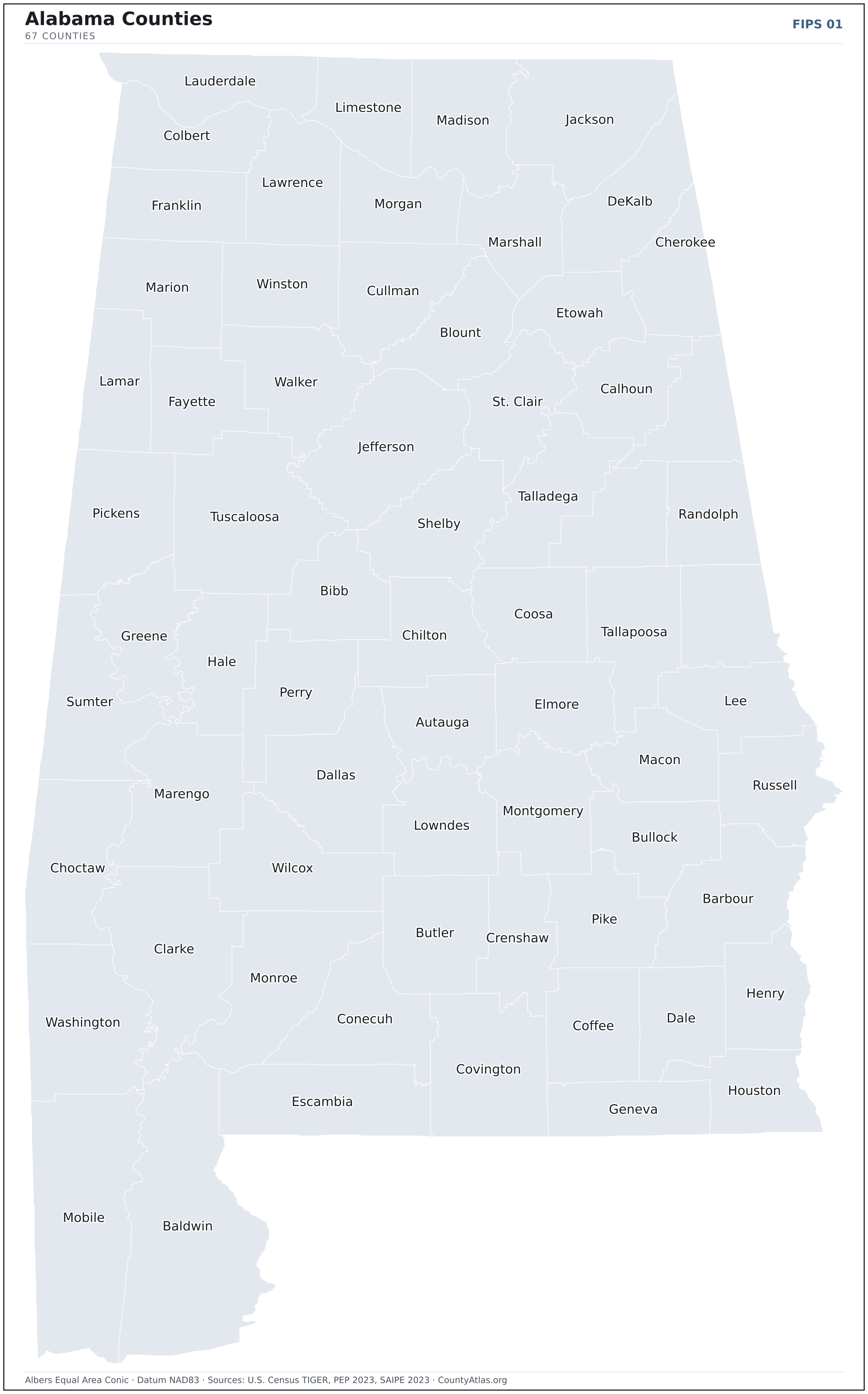
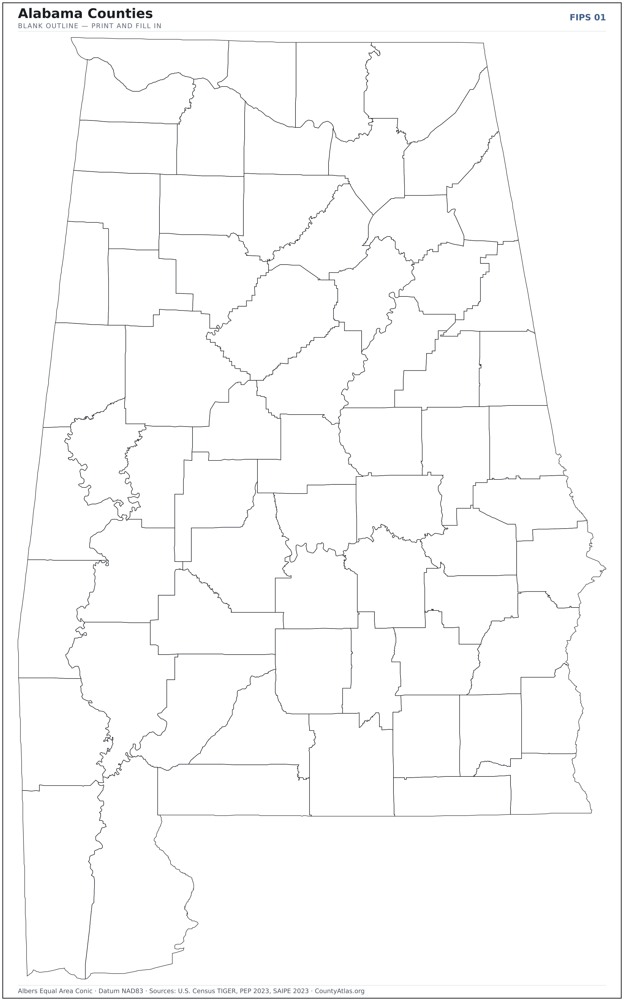
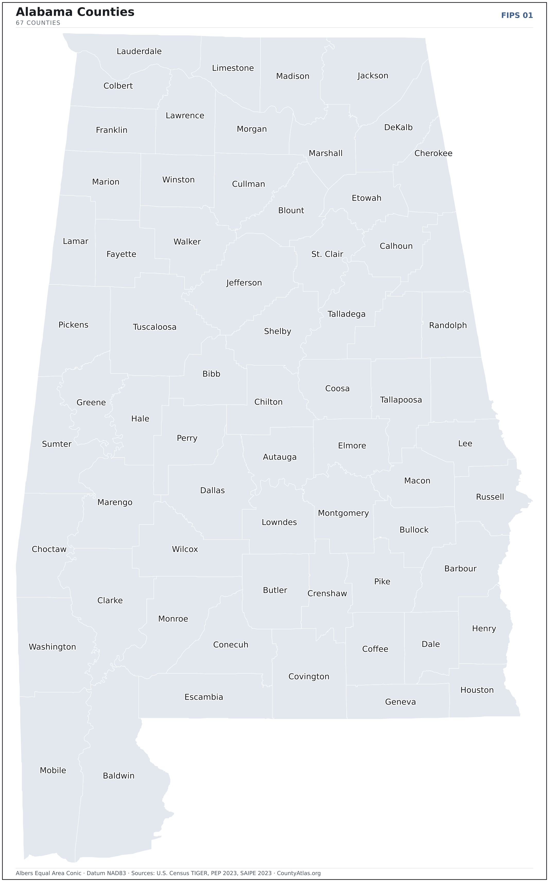
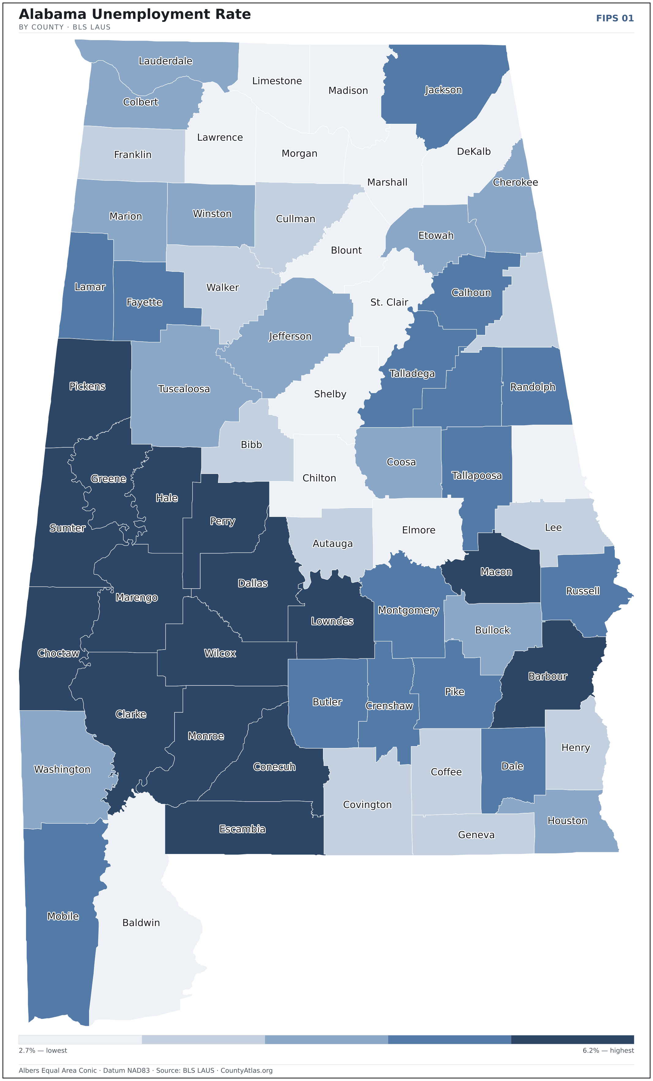
Alabama maps, coloured by the data
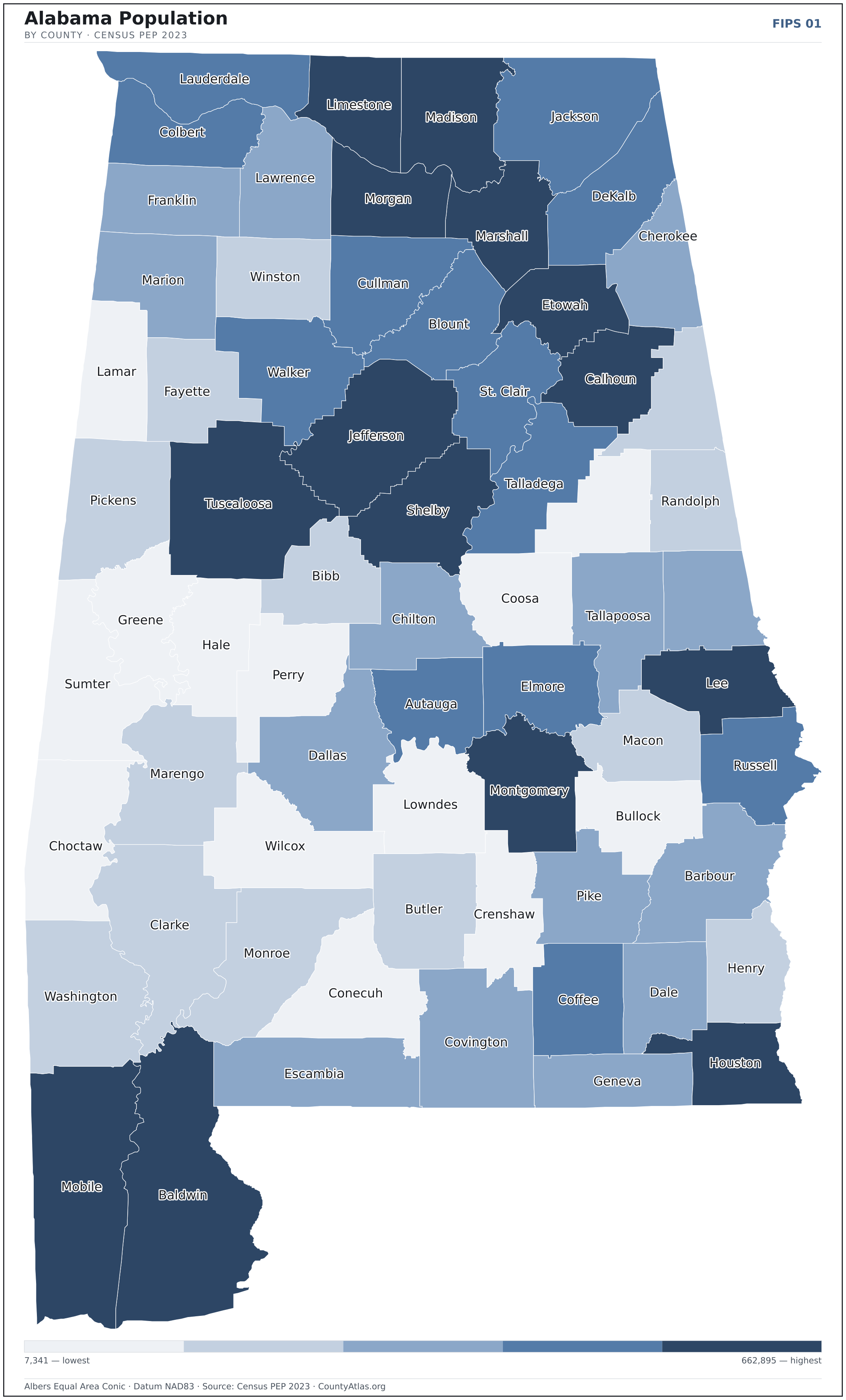
Cities in Alabama
Alabama has 464 incorporated cities and towns. The largest is Huntsville in Madison County with 218,814 residents. Use the search on the map above to find any city and highlight the county it sits in.
| Huntsville | Madison County | 218,814 |
| Birmingham | Jefferson County | 199,322 |
| Montgomery | Montgomery County | 198,440 |
| Mobile | Mobile County | 185,097 |
| Tuscaloosa | Tuscaloosa County | 107,699 |
| Hoover | Jefferson County | 92,401 |
| Auburn | Lee County | 78,738 |
| Dothan | Houston County | 71,118 |
| Madison | Madison County | 58,335 |
| Decatur | Morgan County | 57,760 |
| Florence | Lauderdale County | 41,231 |
| Prattville | Autauga County | 38,850 |
| Vestavia Hills | Jefferson County | 38,704 |
| Phenix City | Russell County | 38,477 |
| Alabaster | Shelby County | 33,633 |
| Gadsden | Etowah County | 33,617 |
| Opelika | Lee County | 31,944 |
| Northport | Tuscaloosa County | 30,991 |
| Enterprise | Coffee County | 28,990 |
| Daphne | Baldwin County | 28,673 |
| Homewood | Jefferson County | 27,697 |
| Athens | Limestone County | 27,474 |
| Trussville | Jefferson County | 26,182 |
| Bessemer | Jefferson County | 25,655 |
| Pelham | Shelby County | 24,510 |
| Fairhope | Baldwin County | 23,360 |
| Albertville | Marshall County | 22,584 |
| Foley | Baldwin County | 22,330 |
| Mountain Brook | Jefferson County | 22,160 |
| Oxford | Calhoun County | 22,063 |
| Helena | Shelby County | 21,452 |
| Anniston | Calhoun County | 21,377 |
| Prichard | Mobile County | 19,121 |
| Cullman | Cullman County | 18,894 |
| Troy | Pike County | 17,733 |
| Selma | Dallas County | 17,442 |
| Calera | Shelby County | 17,188 |
| Millbrook | Elmore County | 16,923 |
| Muscle Shoals | Colbert County | 16,670 |
| Hueytown | Jefferson County | 16,541 |
| Saraland | Mobile County | 16,304 |
| Center Point | Jefferson County | 16,125 |
| Gardendale | Jefferson County | 16,110 |
| Gulf Shores | Baldwin County | 15,785 |
| Chelsea | Shelby County | 15,731 |
| Scottsboro | Jackson County | 15,641 |
| Hartselle | Morgan County | 15,586 |
| Talladega | Talladega County | 15,041 |
| Fort Payne | DeKalb County | 14,886 |
| Alexander City | Tallapoosa County | 14,686 |
Showing the 50 most populous — and 414 more. Search the map above for any Alabama city or village.
A city can span more than one county; each is listed in its primary county — the one its center falls in.
Which Alabama county is the richest, largest, most crowded? The answers
- Alabama’s highest median household income is in Shelby County ($90,280); the lowest is in Perry County ($34,176). Census SAIPE 2023
- Alabama’s most populous county is Jefferson County (662,895); the least populous is Greene County (7,341) — a 90× spread. Census PEP 2023
- Alabama’s largest county by land area is Baldwin County (1,590 sq mi); the smallest is Etowah County (535 sq mi). Census TIGER
- Alabama’s highest population density is in Jefferson County (596/sq mi); the lowest is in Perry County (11/sq mi). Census PEP 2023 · TIGER
- Alabama’s highest poverty rate is in Perry County (33.8%); the lowest is in Shelby County (8.4%). Census SAIPE 2023
- In Alabama, unemployment is highest in Greene County (6.2%) and lowest in Shelby County (2.7%), for May 2026. BLS LAUS
- Alabama’s highest median age is in Coosa County (50.3); the lowest is in Pike County (31.7). Census ACS 2019–2023
- Alabama’s highest share of bachelor’s degrees is in Shelby County (46.2% of adults); the lowest is in Bullock County (9.0%). Census ACS 2019–2023
Every figure is a current official estimate from the source named — not a crowd-sourced or copied value. Suppressed estimates (coefficient of variation ≥ 0.30) are omitted, never guessed. See the full methodology.
Alabama counties: common questions
How many counties are in Alabama?
Alabama has 67 counties covering 50,652 sq mi and about 5.1M residents. Every one is on the map above and in the table below.
What is the largest county in Alabama?
It depends on the measure. By land area it’s Baldwin County (1,590 sq mi); by population it’s Jefferson County (662,895 residents).
What county is Huntsville in?
Huntsville (population 218,814) is in Madison County. Use the search on the map to find any Alabama city’s county.
What is the richest county in Alabama?
By median household income, Shelby County is the richest at $90,280; the poorest is Perry County at $34,176 (Census SAIPE 2023).
What is the most populous county in Alabama?
Jefferson County, with 662,895 residents — about 13.0% of Alabama’s people, and 90× the least populous, Greene County (7,341).
Sources & vintages
- Population — PEP Vintage 2023 (July 1, 2023) — pep/charv
- Median household income & poverty — SAIPE 2023
- Unemployment — BLS LAUS May 2026 (preliminary)
- Geometry & boundaries — Census TIGERweb
- Cities & city population — Census TIGERweb Incorporated Places + ACS 5-year 2019–2023
Data current through .