CountyAtlas Colorado
Colorado County Map with Cities — All 64 Counties
All 64 of Colorado's counties, mapped from official U.S. Census boundaries with population, income, and unemployment for every one. Colour the map by any measure, tap a county for its data, or download a print-ready copy.
Tap any county for its population, income, and more.
Colorado at a glance
- Scale. Colorado is divided into 64 counties across 103,637 sq mi of land — an average of 1,619 sq mi each. Census TIGER
- People. Its counties are home to 5,877,610 residents — an average of 91,838 each, or 57 per square mile statewide. Census PEP 2023
- Water. Another 458 sq mi is water — 0.4% of the state’s area, led by Larimer County. Census TIGER
Colorado’s 64 counties, by the numbers
Every county’s population, median household income, unemployment, density, and land area — sortable by any column, so you can find yours or rank by what matters to you. A few patterns run through the data:
- Concentrated. Half of Colorado’s 5,877,610 residents live in just 5 of 64 counties, and the five largest hold 54.9% of the total. Census PEP 2023
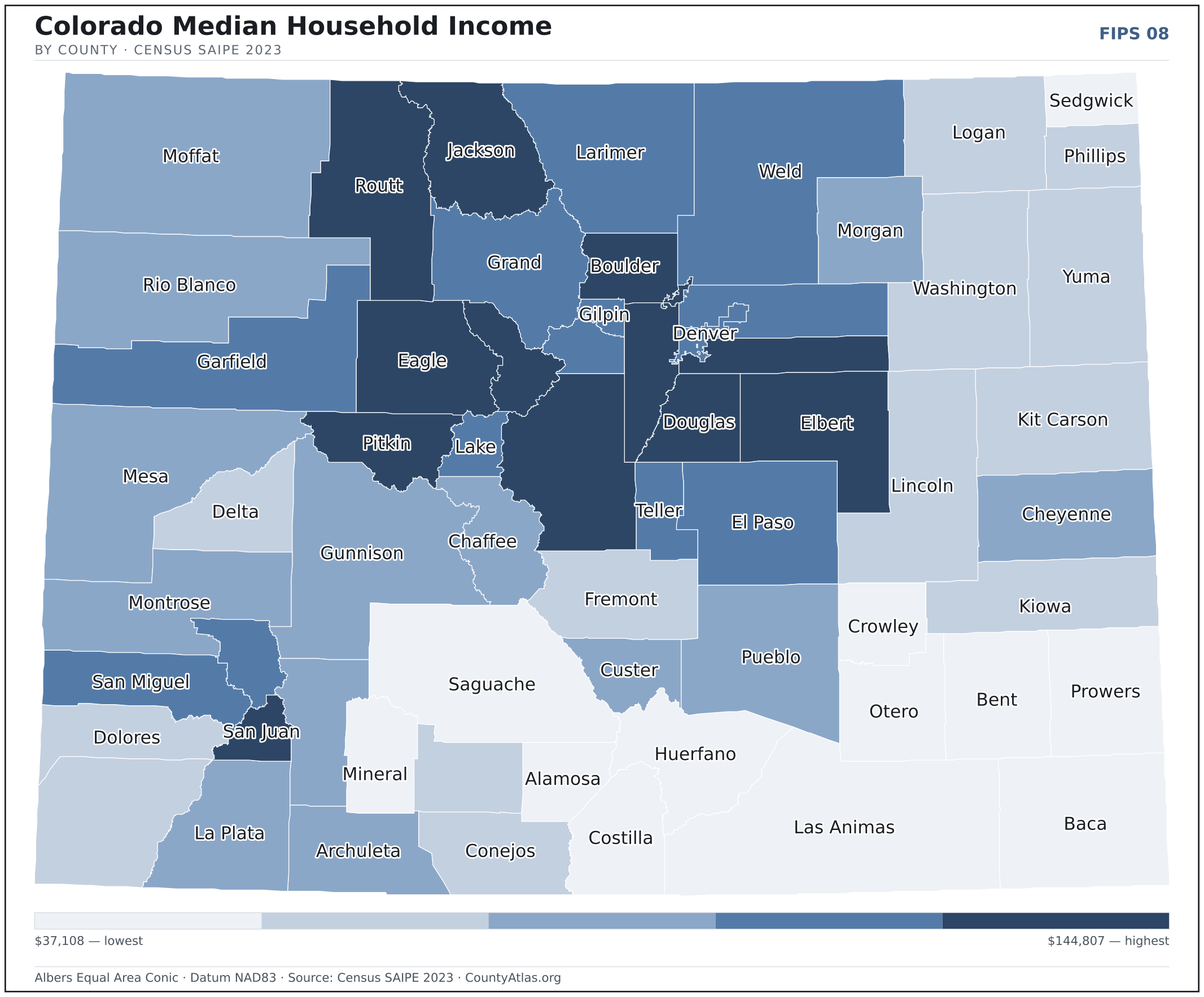
- Income tracks poverty. The gap from richest to poorest runs 3.9×, and the 10 highest-income counties average 6.8% in poverty against 21.4% for the 10 lowest. Census SAIPE 2023
- Mostly small. Half of Colorado’s counties have fewer than 15,142 residents, and half report a median household income below $72,982 — a few metros lift the statewide totals well above both. Census PEP 2023 · SAIPE 2023
- Lopsided density. Only 11 of 64 counties are denser than Colorado’s statewide average of 57 people per square mile — the rest are more rural. Census PEP 2023 · TIGER
| Adams County | 533,365 | $95,278 | 3.9% | 457/sq mi | 1,167 sq mi | Brighton |
| Alamosa County | 16,655 | $50,056 | 4.3% | 23/sq mi | 723 sq mi | Alamosa |
| Arapahoe County | 656,061 | $97,560 | 3.6% | 822/sq mi | 798 sq mi | Littleton |
| Archuleta County | 14,189 | $74,432 | 2.9% | 11/sq mi | 1,350 sq mi | Pagosa Springs |
| Baca County | 3,344 | $47,421 | 2.4% | 1/sq mi | 2,555 sq mi | Springfield |
| Bent County | 5,681 | $44,960 | 4.1% | 4/sq mi | 1,513 sq mi | Las Animas |
| Boulder County | 326,831 | $97,170 | 3.6% | 450/sq mi | 726 sq mi | Boulder |
| Broomfield County | 76,860 | $113,162 | 3.6% | 2,331/sq mi | 33 sq mi | — |
| Chaffee County | 20,617 | $75,298 | 3.1% | 20/sq mi | 1,013 sq mi | Salida |
| Cheyenne County | 1,727 | $63,177 | 2.2% | 1/sq mi | 1,778 sq mi | Cheyenne Wells |
| Clear Creek County | 9,147 | $94,093 | 3.3% | 23/sq mi | 395 sq mi | Georgetown |
| Conejos County | 7,521 | $53,174 | 3.5% | 6/sq mi | 1,287 sq mi | Conejos |
| Costilla County | 3,628 | $38,731 | 6.3% | 3/sq mi | 1,228 sq mi | San Luis |
| Crowley County | 5,636 | $46,979 | 3.6% | 7/sq mi | 787 sq mi | Ordway |
| Custer County | 5,534 | $77,137 | 2.7% | 7/sq mi | 739 sq mi | Westcliffe |
| Delta County | 31,746 | $57,075 | 4.7% | 28/sq mi | 1,142 sq mi | Delta |
| Denver County | 716,577 | $93,572 | 3.8% | 4,681/sq mi | 153 sq mi | Denver |
| Dolores County | 2,513 | $57,701 | 5.0% | 2/sq mi | 1,067 sq mi | Dove Creek |
| Douglas County | 383,906 | $144,807 | 3.3% | 457/sq mi | 840 sq mi | Castle Rock |
| Eagle County | 54,381 | $110,598 | 4.6% | 32/sq mi | 1,684 sq mi | Eagle |
| El Paso County | 744,215 | $88,794 | 3.8% | 350/sq mi | 2,126 sq mi | Colorado Springs |
| Elbert County | 28,806 | $123,083 | 3.2% | 16/sq mi | 1,851 sq mi | Kiowa |
| Fremont County | 50,318 | $61,015 | 4.6% | 33/sq mi | 1,534 sq mi | Cañon City |
| Garfield County | 62,707 | $94,696 | 3.2% | 21/sq mi | 2,947 sq mi | Glenwood Springs |
| Gilpin County | 5,926 | $88,589 | 3.0% | 40/sq mi | 150 sq mi | Central City |
| Grand County | 15,935 | $93,257 | 3.3% | 9/sq mi | 1,847 sq mi | Hot Sulphur Springs |
| Gunnison County | 17,321 | $79,658 | 3.9% | 5/sq mi | 3,239 sq mi | Gunnison |
| Hinsdale County | 765 | $71,541 | 2.8% | 1/sq mi | 1,117 sq mi | Lake City |
| Huerfano County | 7,055 | $47,855 | 5.7% | 4/sq mi | 1,591 sq mi | Walsenburg |
| Jackson County | 1,309 | $96,811 | 3.2% | 1/sq mi | 1,614 sq mi | Walden |
| Jefferson County | 576,366 | $102,146 | 3.4% | 754/sq mi | 764 sq mi | Golden |
| Kiowa County | 1,384 | $55,523 | 2.6% | 1/sq mi | 1,768 sq mi | Eads |
| Kit Carson County | 6,994 | $55,304 | 2.4% | 3/sq mi | 2,161 sq mi | Burlington |
| La Plata County | 56,407 | $83,542 | 3.2% | 33/sq mi | 1,690 sq mi | Durango |
| Lake County | 7,365 | $86,215 | 4.4% | 20/sq mi | 377 sq mi | Leadville |
| Larimer County | 370,771 | $88,519 | 3.4% | 143/sq mi | 2,596 sq mi | Fort Collins |
| Las Animas County | 14,348 | $52,067 | 5.5% | 3/sq mi | 4,773 sq mi | Trinidad |
| Lincoln County | 5,480 | $58,034 | 4.8% | 2/sq mi | 2,578 sq mi | Hugo |
| Logan County | 20,619 | $55,415 | 3.1% | 11/sq mi | 1,839 sq mi | Sterling |
| Mesa County | 159,681 | $66,339 | 3.6% | 48/sq mi | 3,329 sq mi | Grand Junction |
| Mineral County | 944 | $37,108 | 4.3% | 1/sq mi | 876 sq mi | City of Creede |
| Moffat County | 13,327 | $73,875 | 4.1% | 3/sq mi | 4,743 sq mi | Craig |
| Montezuma County | 26,531 | $60,809 | 4.3% | 13/sq mi | 2,029 sq mi | Cortez |
| Montrose County | 44,156 | $67,113 | 3.6% | 20/sq mi | 2,241 sq mi | Montrose |
| Morgan County | 29,524 | $68,541 | 3.9% | 23/sq mi | 1,280 sq mi | Fort Morgan |
| Otero County | 18,136 | $52,169 | 5.1% | 14/sq mi | 1,262 sq mi | La Junta |
| Ouray County | 5,176 | $92,760 | 3.6% | 10/sq mi | 541 sq mi | Ouray |
| Park County | 18,117 | $103,720 | 3.6% | 8/sq mi | 2,194 sq mi | Fairplay |
| Phillips County | 4,476 | $59,367 | 2.7% | 7/sq mi | 688 sq mi | Holyoke |
| Pitkin County | 16,640 | $109,268 | 6.6% | 17/sq mi | 971 sq mi | Aspen |
| Prowers County | 11,751 | $50,365 | 3.8% | 7/sq mi | 1,638 sq mi | Lamar |
| Pueblo County | 169,422 | $63,801 | 5.1% | 71/sq mi | 2,387 sq mi | Pueblo |
| Rio Blanco County | 6,569 | $72,088 | 3.4% | 2/sq mi | 3,221 sq mi | Meeker |
| Rio Grande County | 11,188 | $55,574 | 3.6% | 12/sq mi | 912 sq mi | Del Norte |
| Routt County | 25,064 | $112,377 | 4.0% | 11/sq mi | 2,362 sq mi | Steamboat Springs |
| Saguache County | 6,688 | $47,829 | 4.0% | 2/sq mi | 3,169 sq mi | Saguache |
| San Juan County | 802 | $102,689 | 3.1% | 2/sq mi | 388 sq mi | Silverton |
| San Miguel County | 7,868 | $94,927 | 7.1% | 6/sq mi | 1,287 sq mi | Telluride |
| Sedgwick County | 2,299 | $45,999 | 3.0% | 4/sq mi | 548 sq mi | Julesburg |
| Summit County | 30,465 | $105,135 | 4.0% | 50/sq mi | 608 sq mi | Breckenridge |
| Teller County | 24,617 | $88,089 | 3.4% | 44/sq mi | 557 sq mi | Cripple Creek |
| Washington County | 4,855 | $54,255 | 3.2% | 2/sq mi | 2,518 sq mi | Akron |
| Weld County | 359,442 | $90,675 | 4.0% | 90/sq mi | 3,985 sq mi | Greeley |
| Yuma County | 9,862 | $61,870 | 2.1% | 4/sq mi | 2,364 sq mi | Wray |
All 64 counties, sortable by any column — click a heading. A suppressed estimate (coefficient of variation ≥ 0.30) shows a marker, never a guess. County seats are from Wikidata (CC0), each validated to a Census place inside its county; a county with no validated seat is left blank. See the methodology.
Download & print this Colorado map
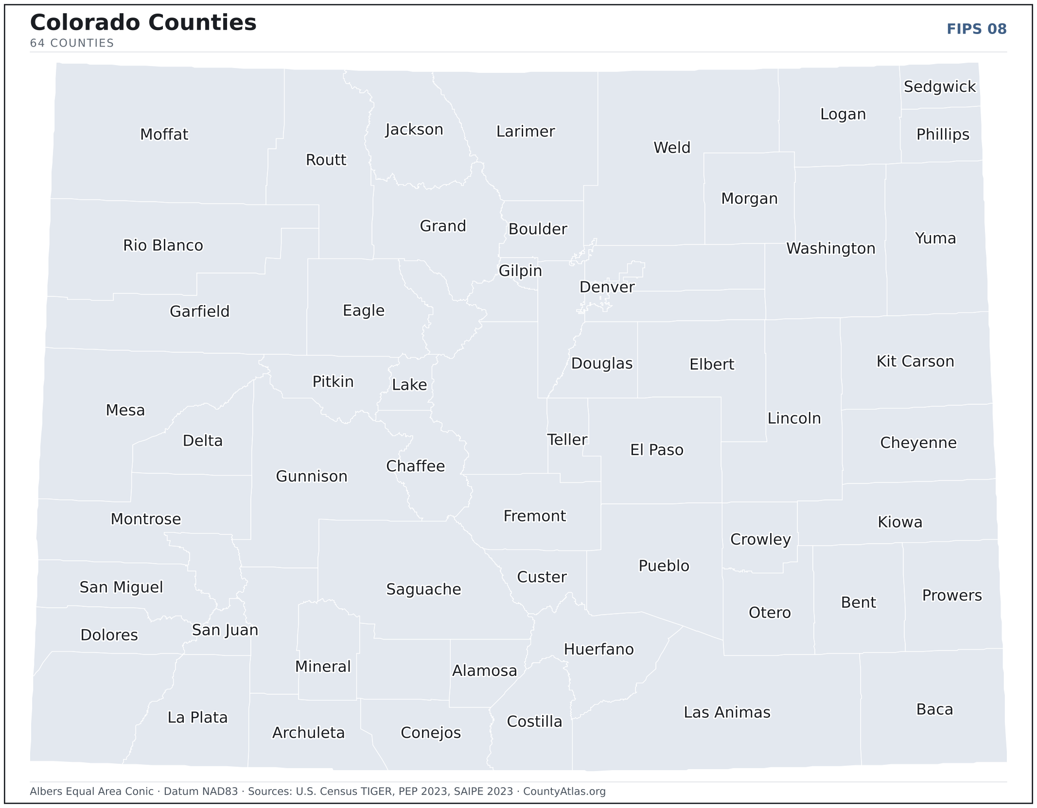
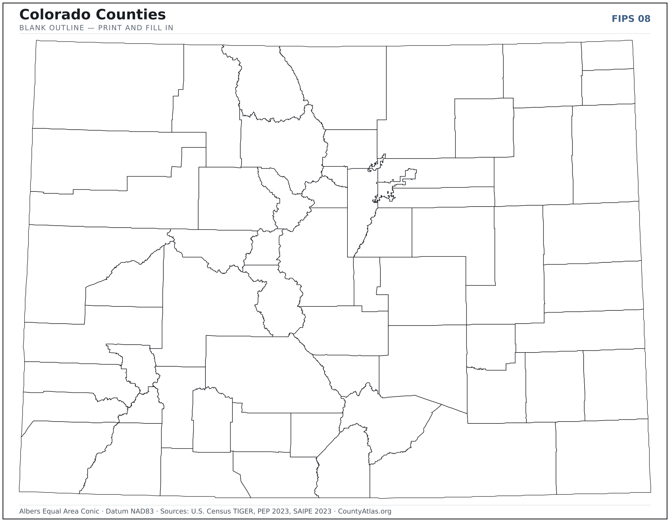
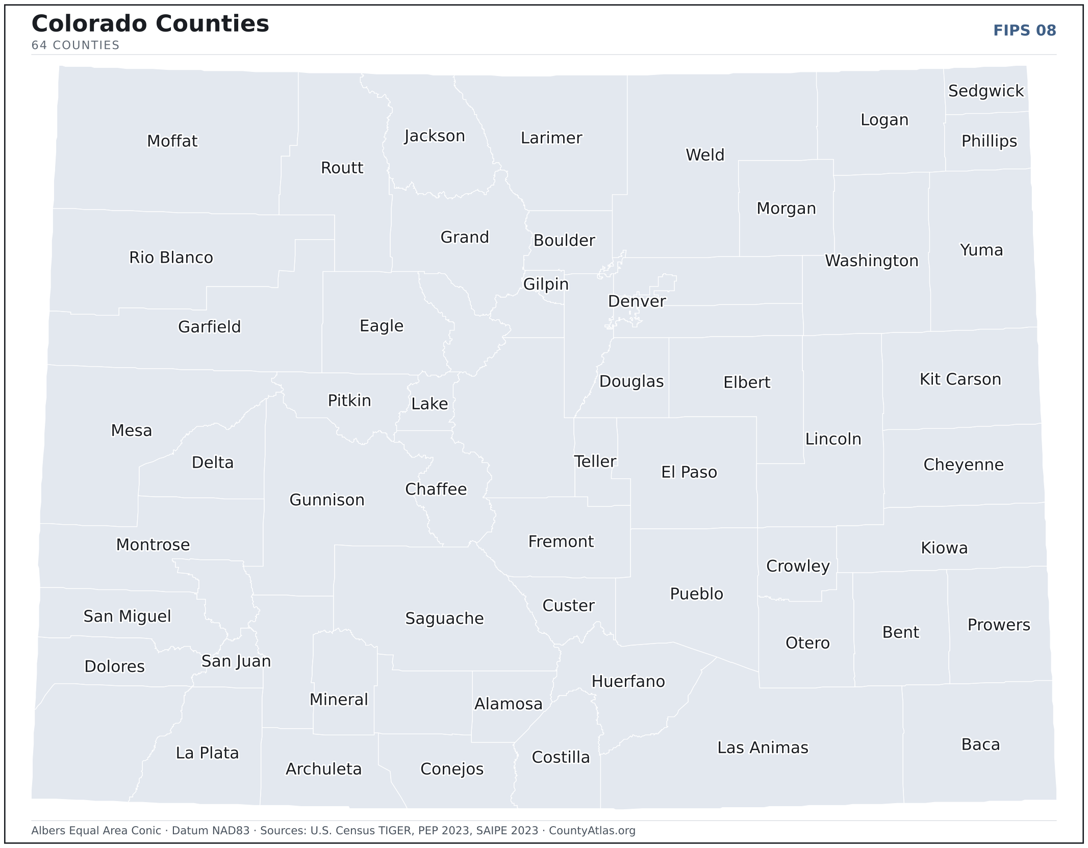
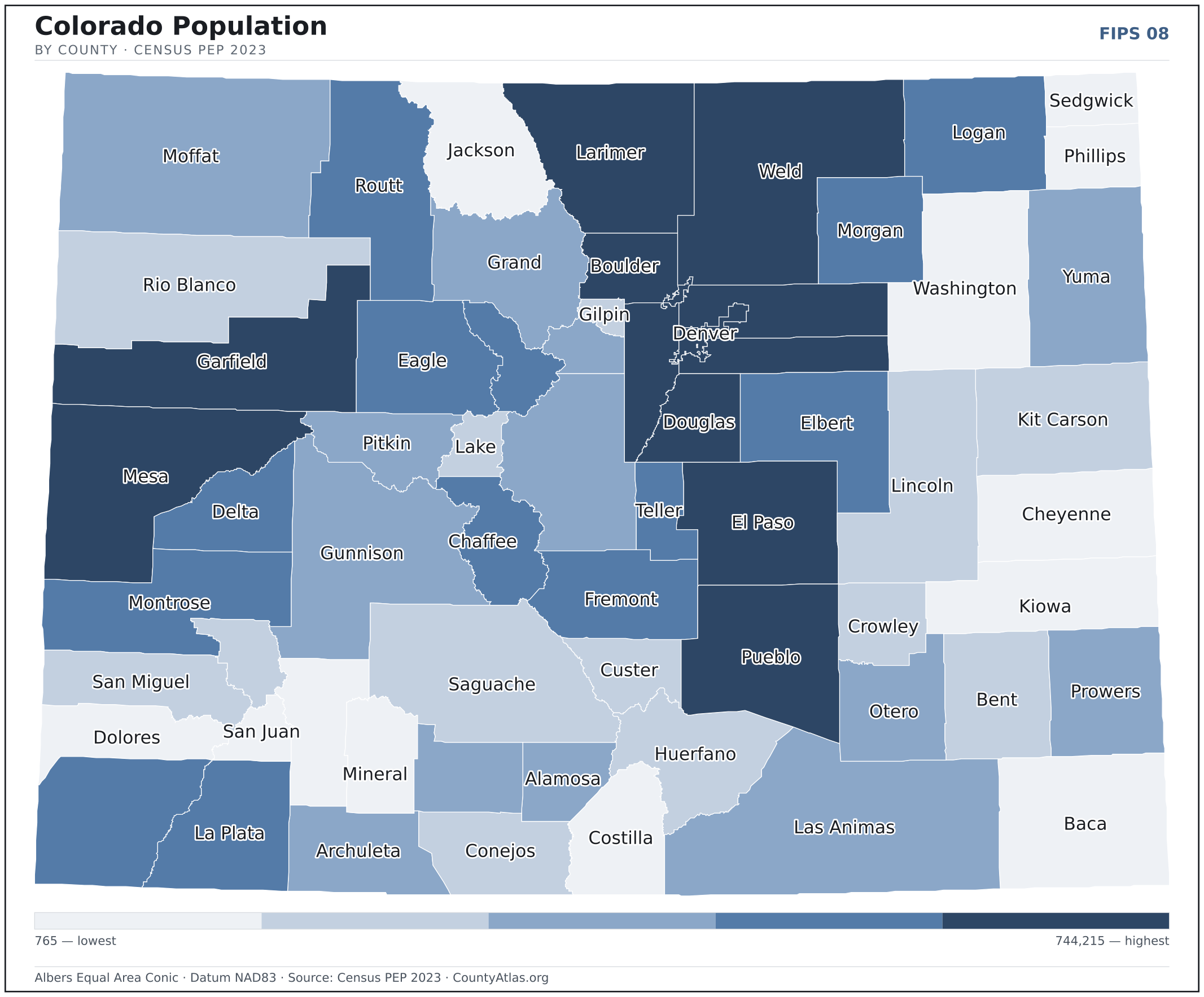
Colorado maps, coloured by the data
Cities in Colorado
Colorado has 273 incorporated cities and towns. The largest is Denver in Denver County with 713,734 residents. Use the search on the map above to find any city and highlight the county it sits in.
| Denver | Denver County | 713,734 |
| Colorado Springs | El Paso County | 483,099 |
| Aurora | Arapahoe County | 390,201 |
| Fort Collins | Larimer County | 169,705 |
| Lakewood | Jefferson County | 156,309 |
| Thornton | Adams County | 142,878 |
| Arvada | Jefferson County | 122,835 |
| Westminster | Jefferson County | 115,546 |
| Pueblo | Pueblo County | 111,514 |
| Greeley | Weld County | 109,421 |
| Centennial | Arapahoe County | 107,386 |
| Boulder | Boulder County | 106,274 |
| Longmont | Boulder County | 98,958 |
| Loveland | Larimer County | 77,350 |
| Castle Rock (town) | Douglas County | 76,614 |
| Broomfield | Broomfield County | 75,110 |
| Grand Junction | Mesa County | 67,027 |
| Commerce City | Adams County | 64,640 |
| Parker (town) | Douglas County | 60,115 |
| Littleton | Arapahoe County | 45,092 |
| Brighton | Adams County | 41,196 |
| Northglenn | Adams County | 37,953 |
| Windsor (town) | Weld County | 35,918 |
| Englewood | Arapahoe County | 33,774 |
| Wheat Ridge | Jefferson County | 32,158 |
| Erie (town) | Weld County | 31,927 |
| Lafayette | Boulder County | 30,471 |
| Fountain | El Paso County | 29,327 |
| Evans | Weld County | 22,265 |
| Louisville | Boulder County | 20,788 |
| Montrose | Montrose County | 20,703 |
| Golden | Jefferson County | 20,467 |
| Durango | La Plata County | 19,257 |
| Johnstown (town) | Weld County | 18,075 |
| Firestone (town) | Weld County | 17,353 |
| Cañon City | Fremont County | 17,098 |
| Frederick (town) | Weld County | 15,893 |
| Greenwood Village | Arapahoe County | 15,485 |
| Federal Heights | Adams County | 14,160 |
| Lone Tree | Douglas County | 14,136 |
| Fruita | Mesa County | 13,578 |
| Steamboat Springs | Routt County | 13,341 |
| Sterling | Logan County | 13,273 |
| Superior (town) | Boulder County | 13,136 |
| Castle Pines | Douglas County | 12,573 |
| Berthoud (town) | Weld County | 11,684 |
| Wellington (town) | Larimer County | 11,538 |
| Fort Morgan | Morgan County | 11,521 |
| Monument (town) | El Paso County | 11,035 |
| Rifle | Garfield County | 10,466 |
Showing the 50 most populous — and 223 more. Search the map above for any Colorado city or village.
A city can span more than one county; each is listed in its primary county — the one its center falls in.
Which Colorado county is the richest, largest, most crowded? The answers
- Colorado’s highest median household income is in Douglas County ($144,807); the lowest is in Mineral County ($37,108). Census SAIPE 2023
- Colorado’s most populous county is El Paso County (744,215); the least populous is Hinsdale County (765) — a 973× spread. Census PEP 2023
- Colorado’s largest county by land area is Las Animas County (4,773 sq mi); the smallest is Broomfield County (33 sq mi). Census TIGER
- Colorado’s highest population density is in Denver County (4,681/sq mi); the lowest is in Hinsdale County (1/sq mi). Census PEP 2023 · TIGER
- Colorado’s highest poverty rate is in Crowley County (37.5%); the lowest is in Douglas County (3.7%). Census SAIPE 2023
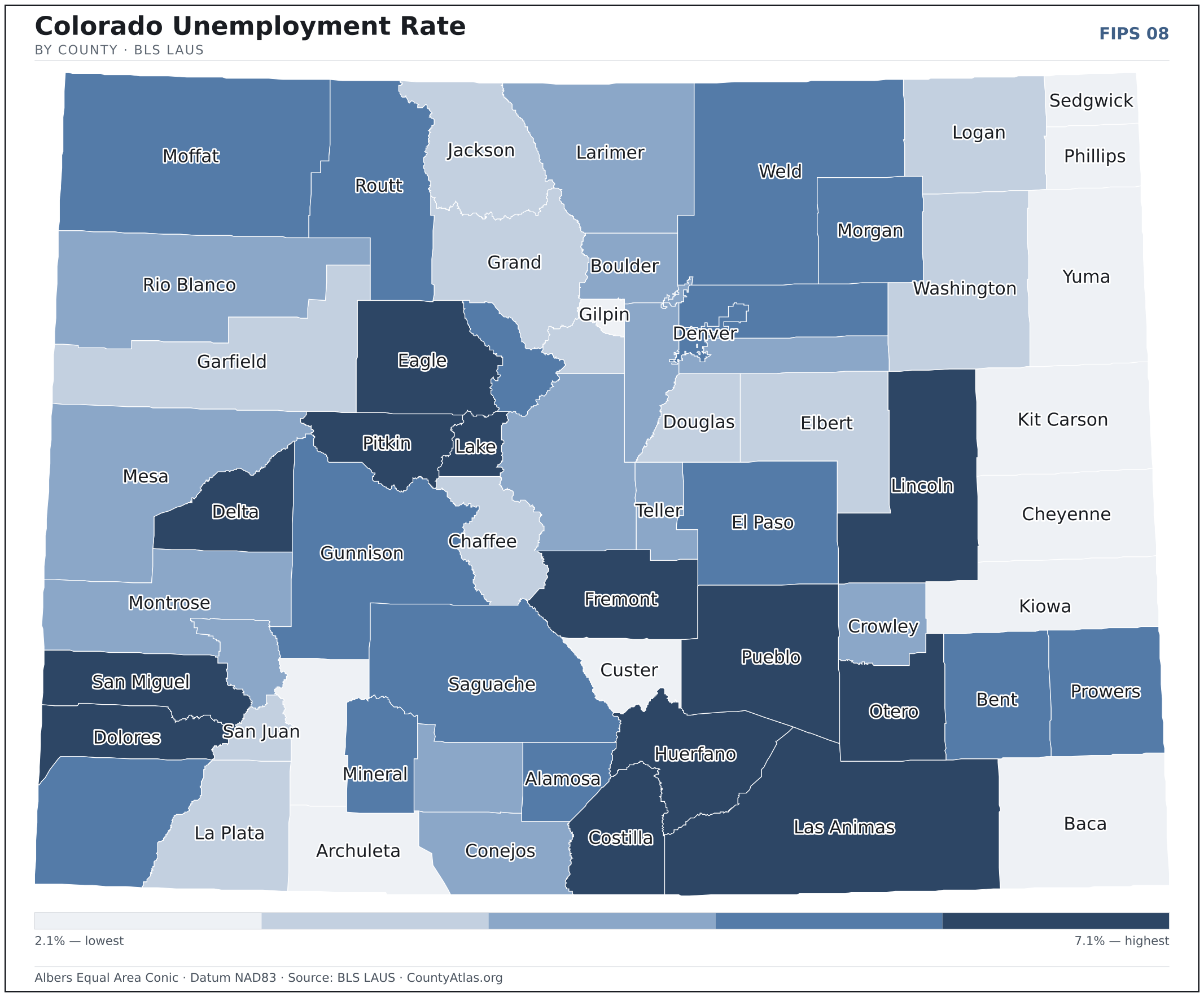
- In Colorado, unemployment is highest in San Miguel County (7.1%) and lowest in Yuma County (2.1%), for May 2026. BLS LAUS
- Colorado’s highest median age is in Custer County (58.6); the lowest is in Alamosa County (33.1). Census ACS 2019–2023
- Colorado’s highest share of bachelor’s degrees is in San Miguel County (65.2% of adults); the lowest is in Crowley County (12.7%). Census ACS 2019–2023
Every figure is a current official estimate from the source named — not a crowd-sourced or copied value. Suppressed estimates (coefficient of variation ≥ 0.30) are omitted, never guessed. See the full methodology.
Colorado counties: common questions
How many counties are in Colorado?
Colorado has 64 counties covering 103,637 sq mi and about 5.9M residents. Every one is on the map above and in the table below.
What is the largest county in Colorado?
It depends on the measure. By land area it’s Las Animas County (4,773 sq mi); by population it’s El Paso County (744,215 residents).
What county is Denver in?
Denver (population 713,734) is in Denver County. Use the search on the map to find any Colorado city’s county.
What is the richest county in Colorado?
By median household income, Douglas County is the richest at $144,807; the poorest is Mineral County at $37,108 (Census SAIPE 2023).
What is the most populous county in Colorado?
El Paso County, with 744,215 residents — about 12.7% of Colorado’s people, and 973× the least populous, Hinsdale County (765).
Sources & vintages
- Population — PEP Vintage 2023 (July 1, 2023) — pep/charv
- Median household income & poverty — SAIPE 2023
- Unemployment — BLS LAUS May 2026 (preliminary)
- Geometry & boundaries — Census TIGERweb
- Cities & city population — Census TIGERweb Incorporated Places + ACS 5-year 2019–2023
Data current through .