CountyAtlas Maryland
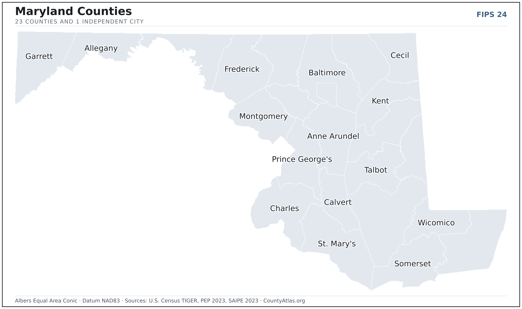
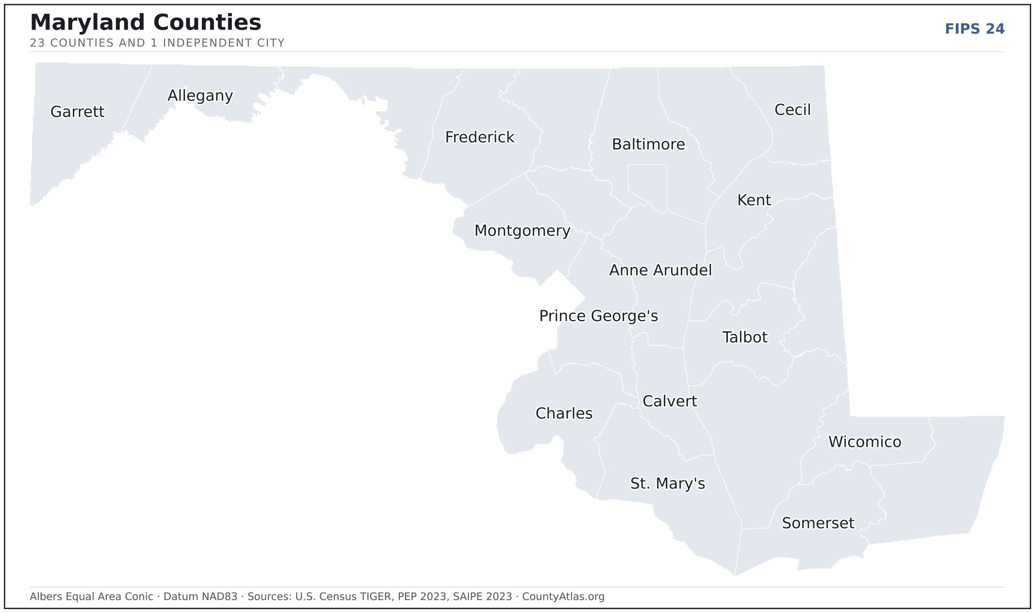
Maryland County Map — 23 Counties and 1 Independent City
All 24 of Maryland's counties, mapped from official U.S. Census boundaries with population, income, and unemployment for every one. Colour the map by any measure, tap a county for its data, or download a print-ready copy.
Tap any county for its population, income, and more.
Maryland at a glance
- Scale. Maryland is divided into 24 counties and independent cities across 9,711 sq mi of land — an average of 405 sq mi each. Census TIGER
- People. Its counties and independent cities are home to 6,180,253 residents — an average of 257,511 each, or 636 per square mile statewide. Census PEP 2023
- Water. Another 2,695 sq mi is water — 21.7% of the state’s area, led by Dorchester County. Census TIGER
Maryland’s 23 counties and 1 independent city, by the numbers
Every county or independent city’s population, median household income, unemployment, density, and land area — sortable by any column, so you can find yours or rank by what matters to you. A few patterns run through the data:
- Concentrated. Half of Maryland’s 6,180,253 residents live in just 4 of 24 counties and independent cities, and the five largest hold 64.9% of the total. Census PEP 2023
- Income tracks poverty. The gap from richest to poorest runs 2.7×, and the 10 highest-income counties and independent cities average 6.7% in poverty against 15.2% for the 10 lowest. Census SAIPE 2023
- Mostly small. Half of Maryland’s counties and independent cities have fewer than 110,477 residents, and half report a median household income below $87,200 — a few metros lift the statewide totals well above both. Census PEP 2023 · SAIPE 2023
- Lopsided density. Only 6 of 24 counties and independent cities are denser than Maryland’s statewide average of 636 people per square mile — the rest are more rural. Census PEP 2023 · TIGER
| Allegany County | 67,273 | $54,759 | 4.9% | 159/sq mi | 422 sq mi | Cumberland |
| Anne Arundel County | 594,582 | $116,956 | 3.3% | 1,433/sq mi | 415 sq mi | Annapolis |
| Baltimore city | 565,239 | $58,616 | 5.4% | 6,983/sq mi | 81 sq mi | — |
| Baltimore County | 844,703 | $86,807 | 3.9% | 1,412/sq mi | 598 sq mi | Towson |
| Calvert County | 94,728 | $124,486 | 3.3% | 444/sq mi | 213 sq mi | Prince Frederick |
| Caroline County | 33,593 | $63,491 | 3.6% | 105/sq mi | 319 sq mi | Denton |
| Carroll County | 176,639 | $113,885 | 2.8% | 395/sq mi | 448 sq mi | Westminster |
| Cecil County | 105,672 | $87,592 | 3.8% | 305/sq mi | 346 sq mi | Elkton |
| Charles County | 171,973 | $105,141 | 4.3% | 376/sq mi | 458 sq mi | La Plata |
| Dorchester County | 32,879 | $63,087 | 4.5% | 61/sq mi | 541 sq mi | Cambridge |
| Frederick County | 293,391 | $114,089 | 3.4% | 444/sq mi | 661 sq mi | Frederick |
| Garrett County | 28,423 | $65,991 | 3.6% | 44/sq mi | 649 sq mi | Oakland |
| Harford County | 264,644 | $104,553 | 3.4% | 605/sq mi | 437 sq mi | Bel Air |
| Howard County | 336,001 | $140,113 | 3.4% | 1,339/sq mi | 251 sq mi | Ellicott City |
| Kent County | 19,303 | $69,781 | 3.5% | 70/sq mi | 277 sq mi | Chestertown |
| Montgomery County | 1,058,474 | $125,076 | 3.6% | 2,146/sq mi | 493 sq mi | Rockville |
| Prince George's County | 947,430 | $97,171 | 4.6% | 1,963/sq mi | 483 sq mi | Upper Marlboro |
| Queen Anne's County | 52,508 | $112,527 | 2.9% | 141/sq mi | 372 sq mi | Centreville |
| Somerset County | 24,910 | $51,841 | 4.2% | 78/sq mi | 320 sq mi | Princess Anne |
| St. Mary's County | 115,281 | $102,345 | 3.2% | 321/sq mi | 359 sq mi | Leonardtown |
| Talbot County | 37,823 | $80,371 | 3.5% | 141/sq mi | 269 sq mi | Easton |
| Washington County | 155,813 | $71,685 | 4.1% | 340/sq mi | 458 sq mi | Hagerstown |
| Wicomico County | 104,800 | $70,975 | 4.0% | 280/sq mi | 374 sq mi | Salisbury |
| Worcester County | 54,171 | $75,459 | 4.2% | 116/sq mi | 468 sq mi | Snow Hill |
All 24 counties and independent cities, sortable by any column — click a heading. A suppressed estimate (coefficient of variation ≥ 0.30) shows a marker, never a guess. County seats are from Wikidata (CC0), each validated to a Census place inside its county; a county with no validated seat is left blank. See the methodology.
Download & print this Maryland map
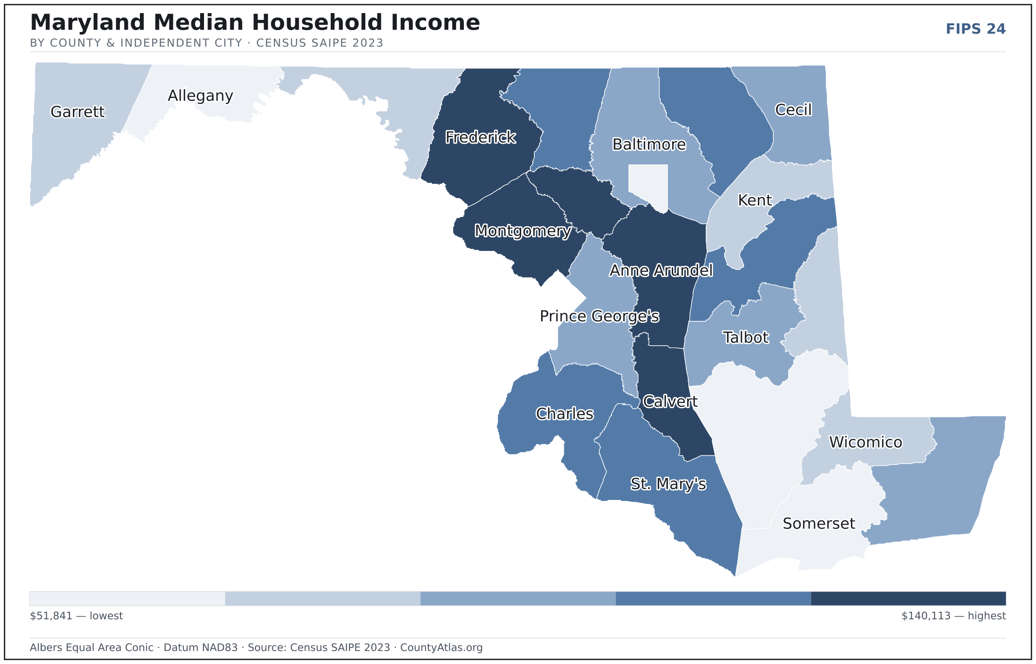
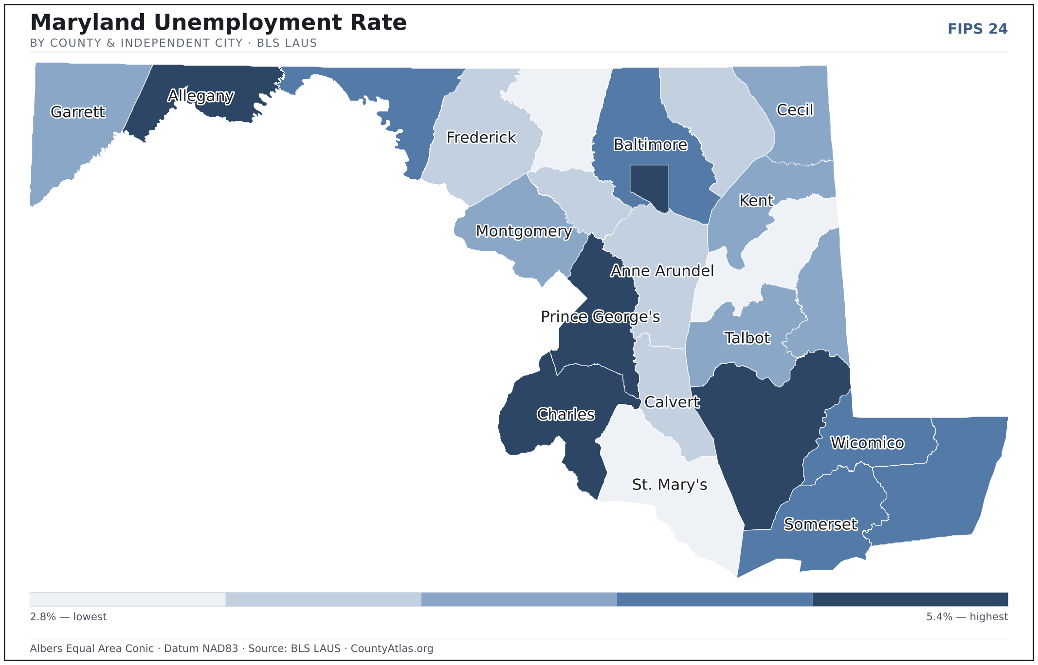
Maryland maps, coloured by the data
Cities in Maryland
Maryland has 156 incorporated cities, towns, and villages. The largest is Baltimore, an independent city, with 577,193 residents. Use the search on the map above to find any city and highlight the county it sits in.
| Baltimore | independent city | 577,193 |
| Frederick | Frederick County | 80,617 |
| Gaithersburg | Montgomery County | 69,225 |
| Rockville | Montgomery County | 67,218 |
| Bowie | Prince George's County | 57,771 |
| Hagerstown | Washington County | 43,490 |
| Annapolis | Anne Arundel County | 40,744 |
| College Park | Prince George's County | 34,397 |
| Salisbury | Wicomico County | 33,080 |
| Laurel | Prince George's County | 29,594 |
| Greenbelt | Prince George's County | 24,572 |
| Hyattsville | Prince George's County | 20,861 |
| Westminster | Carroll County | 20,257 |
| Cumberland | Allegany County | 18,938 |
| Takoma Park | Montgomery County | 17,522 |
| Easton (town) | Talbot County | 17,202 |
| Aberdeen | Harford County | 16,831 |
| Elkton (town) | Cecil County | 15,867 |
| Havre de Grace | Harford County | 14,857 |
| New Carrollton | Prince George's County | 13,544 |
| Cambridge | Dorchester County | 13,094 |
| Bel Air (town) | Harford County | 10,616 |
| La Plata (town) | Charles County | 10,470 |
| Mount Airy (town) | Carroll County | 9,746 |
| Bladensburg (town) | Prince George's County | 9,552 |
| Mount Rainier | Prince George's County | 8,235 |
| Brunswick | Frederick County | 7,994 |
| Taneytown | Carroll County | 7,295 |
| Riverdale Park (town) | Prince George's County | 7,249 |
| Frostburg | Allegany County | 7,025 |
| Ocean City (town) | Worcester County | 6,887 |
| Thurmont (town) | Frederick County | 6,439 |
| Chesapeake Beach (town) | Calvert County | 6,428 |
| Walkersville (town) | Frederick County | 6,352 |
| Glenarden | Prince George's County | 6,320 |
| Hampstead (town) | Carroll County | 6,311 |
| Cheverly (town) | Prince George's County | 6,107 |
| District Heights | Prince George's County | 5,888 |
| Poolesville (town) | Montgomery County | 5,704 |
| Fruitland | Wicomico County | 5,698 |
| Chestertown (town) | Kent County | 5,548 |
| Manchester (town) | Carroll County | 5,446 |
| Berlin (town) | Worcester County | 5,161 |
| Middletown (town) | Frederick County | 5,108 |
| Denton (town) | Caroline County | 4,879 |
| Centreville (town) | Queen Anne's County | 4,725 |
| Leonardtown (town) | St. Mary's County | 4,712 |
| Seat Pleasant | Prince George's County | 4,515 |
| Perryville (town) | Cecil County | 4,425 |
| Pocomoke City | Worcester County | 4,360 |
Showing the 50 most populous — and 106 more. Search the map above for any Maryland city or village.
A city can span more than one county; each is listed in its primary county — the one its center falls in. Some Maryland cities are independent cities — each is its own county-equivalent, not part of a surrounding county — and are marked as such.
Which Maryland county is the richest, largest, most crowded? The answers
- Maryland’s highest median household income is in Howard County ($140,113); the lowest is in Somerset County ($51,841). Census SAIPE 2023
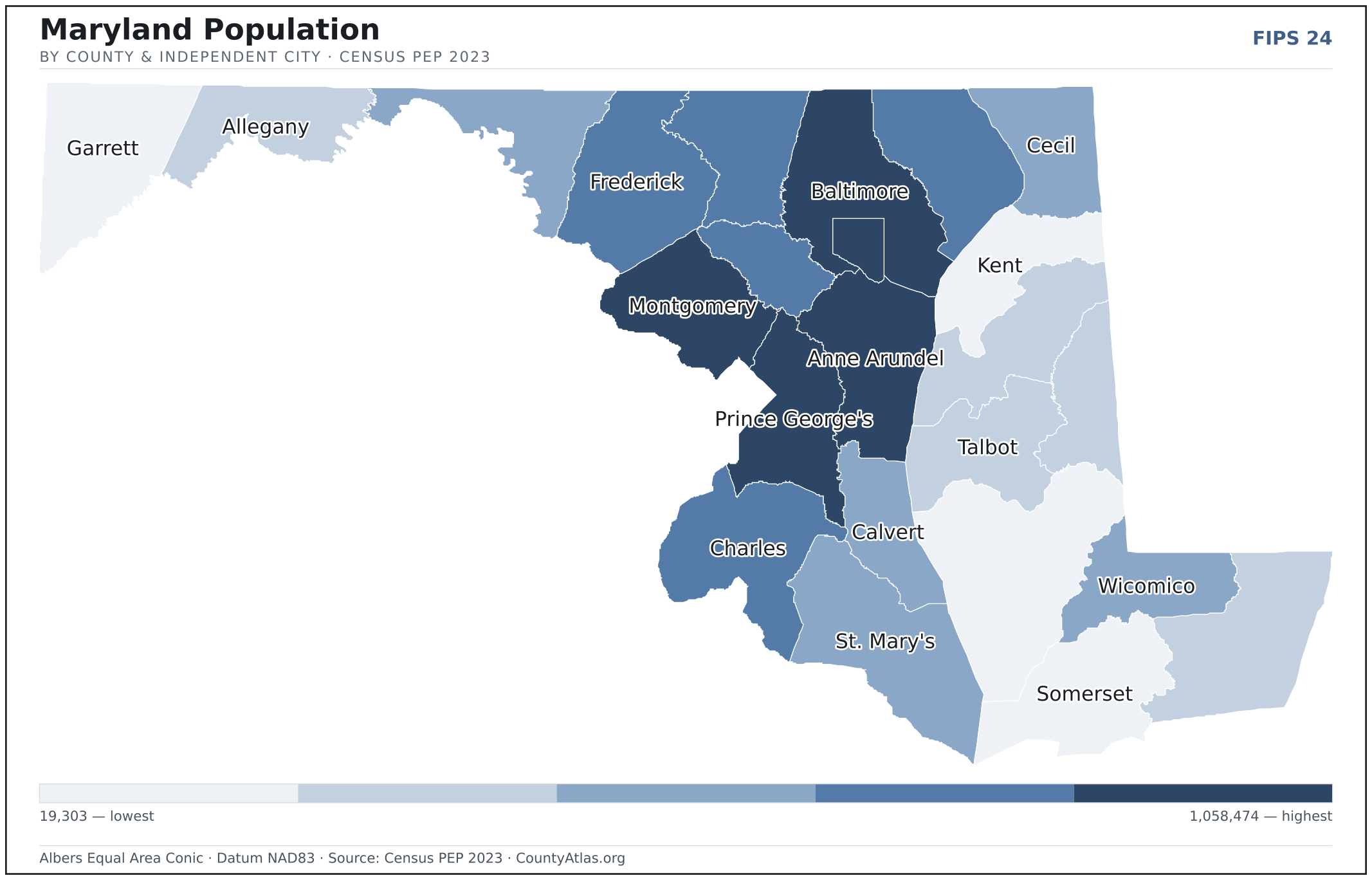
- Maryland’s most populous county is Montgomery County (1,058,474); the least populous is Kent County (19,303) — a 55× spread. Census PEP 2023
- Maryland’s largest county by land area is Frederick County (661 sq mi); the smallest is Baltimore city (81 sq mi). Census TIGER
- Maryland’s highest population density is in Baltimore city (6,983/sq mi); the lowest is in Garrett County (44/sq mi). Census PEP 2023 · TIGER
- Maryland’s highest poverty rate is in Somerset County (22.9%); the lowest is in Calvert County (4.9%). Census SAIPE 2023
- In Maryland, unemployment is highest in Baltimore city (5.4%) and lowest in Carroll County (2.8%), for May 2026. BLS LAUS
- Maryland’s highest median age is in Talbot County (51.1); the lowest is in Baltimore city (36.1). Census ACS 2019–2023
- Maryland’s highest share of bachelor’s degrees is in Howard County (64.5% of adults); the lowest is in Somerset County (17.1%). Census ACS 2019–2023
Every figure is a current official estimate from the source named — not a crowd-sourced or copied value. Suppressed estimates (coefficient of variation ≥ 0.30) are omitted, never guessed. See the full methodology.
Maryland counties: common questions
How many counties are in Maryland?
Maryland has 23 counties and 1 independent city covering 9,711 sq mi and about 6.2M residents. Every one is on the map above and in the table below.
What is the largest county in Maryland?
It depends on the measure. By land area it’s Frederick County (661 sq mi); by population it’s Montgomery County (1,058,474 residents).
What county is Baltimore in?
Baltimore (population 577,193) is an independent city — its own county-equivalent. Use the search on the map to find any Maryland city’s county.
What is the richest county in Maryland?
By median household income, Howard County is the richest at $140,113; the poorest is Somerset County at $51,841 (Census SAIPE 2023).
What is the most populous county in Maryland?
Montgomery County, with 1,058,474 residents — about 17.1% of Maryland’s people, and 55× the least populous, Kent County (19,303).
Sources & vintages
- Population — PEP Vintage 2023 (July 1, 2023) — pep/charv
- Median household income & poverty — SAIPE 2023
- Unemployment — BLS LAUS May 2026 (preliminary)
- Geometry & boundaries — Census TIGERweb
- Cities & city population — Census TIGERweb Incorporated Places + ACS 5-year 2019–2023
Data current through .