CountyAtlas Missouri
Missouri County Map — 114 Counties and 1 Independent City
All 115 of Missouri's counties, mapped from official U.S. Census boundaries with population, income, and unemployment for every one. Colour the map by any measure, tap a county for its data, or download a print-ready copy.
Tap any county for its population, income, and more.
Missouri at a glance
- Scale. Missouri is divided into 115 counties and independent cities across 68,747 sq mi of land — an average of 598 sq mi each. Census TIGER
- People. Its counties and independent cities are home to 6,196,156 residents — an average of 53,880 each, or 90 per square mile statewide. Census PEP 2023
- Water. Another 960 sq mi is water — 1.4% of the state’s area, led by Camden County. Census TIGER
Missouri’s 114 counties and 1 independent city, by the numbers
Every county or independent city’s population, median household income, unemployment, density, and land area — sortable by any column, so you can find yours or rank by what matters to you. A few patterns run through the data:
- Concentrated. Half of Missouri’s 6,196,156 residents live in just 7 of 115 counties and independent cities, and the five largest hold 43.7% of the total. Census PEP 2023
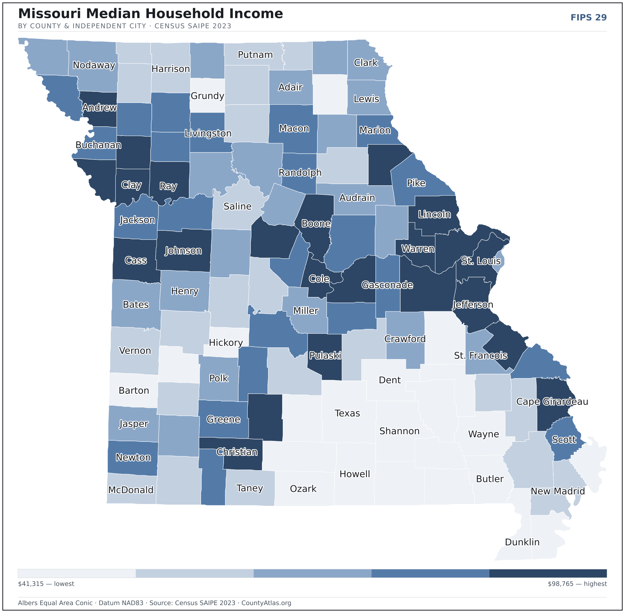
- Income tracks poverty. The gap from richest to poorest runs 2.4×, and the 10 highest-income counties and independent cities average 7.9% in poverty against 21.1% for the 10 lowest. Census SAIPE 2023
- Mostly small. Half of Missouri’s counties and independent cities have fewer than 18,950 residents, and half report a median household income below $56,121 — a few metros lift the statewide totals well above both. Census PEP 2023 · SAIPE 2023
- Lopsided density. Only 21 of 115 counties and independent cities are denser than Missouri’s statewide average of 90 people per square mile — the rest are more rural. Census PEP 2023 · TIGER
| Adair County | 25,122 | $56,954 | 4.4% | 44/sq mi | 567 sq mi | Kirksville |
| Andrew County | 18,127 | $75,926 | 3.1% | 42/sq mi | 433 sq mi | Savannah |
| Atchison County | 5,107 | $56,797 | 2.4% | 9/sq mi | 547 sq mi | Rock Port |
| Audrain County | 24,394 | $55,957 | 3.5% | 35/sq mi | 692 sq mi | Mexico |
| Barry County | 35,265 | $53,303 | 3.9% | 45/sq mi | 778 sq mi | Cassville |
| Barton County | 11,731 | $50,185 | 3.2% | 20/sq mi | 592 sq mi | Lamar |
| Bates County | 16,242 | $56,178 | 3.6% | 19/sq mi | 837 sq mi | Butler |
| Benton County | 20,552 | $50,946 | 4.4% | 29/sq mi | 704 sq mi | Warsaw |
| Bollinger County | 10,544 | $53,134 | 3.2% | 17/sq mi | 618 sq mi | Marble Hill |
| Boone County | 189,463 | $70,153 | 3.1% | 276/sq mi | 686 sq mi | Columbia |
| Buchanan County | 82,956 | $60,575 | 3.7% | 203/sq mi | 408 sq mi | St. Joseph |
| Butler County | 41,948 | $48,059 | 4.3% | 60/sq mi | 695 sq mi | Poplar Bluff |
| Caldwell County | 8,955 | $62,916 | 3.2% | 21/sq mi | 426 sq mi | Kingston |
| Callaway County | 44,731 | $64,214 | 3.0% | 54/sq mi | 835 sq mi | Fulton |
| Camden County | 44,044 | $63,903 | 3.5% | 67/sq mi | 656 sq mi | Camdenton |
| Cape Girardeau County | 82,984 | $67,445 | 3.2% | 143/sq mi | 579 sq mi | Jackson |
| Carroll County | 8,391 | $56,690 | 3.7% | 12/sq mi | 695 sq mi | Carrollton |
| Carter County | 5,303 | $43,801 | 3.8% | 10/sq mi | 507 sq mi | Van Buren |
| Cass County | 111,732 | $85,283 | 3.0% | 160/sq mi | 697 sq mi | Harrisonville |
| Cedar County | 14,672 | $48,789 | 3.6% | 31/sq mi | 474 sq mi | Stockton |
| Chariton County | 7,399 | $56,070 | 3.0% | 10/sq mi | 751 sq mi | Keytesville |
| Christian County | 94,422 | $79,714 | 3.0% | 168/sq mi | 563 sq mi | Ozark |
| Clark County | 6,641 | $56,191 | 3.4% | 13/sq mi | 505 sq mi | Kahoka |
| Clay County | 259,772 | $84,816 | 3.0% | 653/sq mi | 398 sq mi | Liberty |
| Clinton County | 21,548 | $76,875 | 3.2% | 51/sq mi | 419 sq mi | Plattsburg |
| Cole County | 77,278 | $74,002 | 2.9% | 197/sq mi | 392 sq mi | Jefferson City |
| Cooper County | 16,947 | $70,769 | 3.2% | 30/sq mi | 565 sq mi | Boonville |
| Crawford County | 22,719 | $55,253 | 3.8% | 31/sq mi | 742 sq mi | Steelville |
| Dade County | 7,716 | $53,959 | 3.6% | 16/sq mi | 490 sq mi | Greenfield |
| Dallas County | 17,768 | $63,112 | 4.1% | 33/sq mi | 541 sq mi | Buffalo |
| Daviess County | 8,551 | $59,385 | 2.8% | 15/sq mi | 563 sq mi | Gallatin |
| DeKalb County | 9,899 | $63,946 | 3.3% | 23/sq mi | 421 sq mi | Maysville |
| Dent County | 14,647 | $49,324 | 3.3% | 19/sq mi | 753 sq mi | Salem |
| Douglas County | 12,228 | $43,336 | 3.9% | 15/sq mi | 814 sq mi | Ava |
| Dunklin County | 27,032 | $45,570 | 5.0% | 50/sq mi | 542 sq mi | Kennett |
| Franklin County | 106,404 | $70,389 | 3.2% | 115/sq mi | 922 sq mi | Union |
| Gasconade County | 14,705 | $62,203 | 3.0% | 28/sq mi | 519 sq mi | Hermann |
| Gentry County | 6,287 | $54,610 | 2.8% | 13/sq mi | 491 sq mi | Albany |
| Greene County | 304,611 | $59,740 | 3.3% | 451/sq mi | 675 sq mi | Springfield |
| Grundy County | 9,815 | $48,491 | 3.7% | 23/sq mi | 435 sq mi | Trenton |
| Harrison County | 8,220 | $50,489 | 3.6% | 11/sq mi | 723 sq mi | Bethany |
| Henry County | 22,485 | $55,216 | 3.3% | 32/sq mi | 697 sq mi | Clinton |
| Hickory County | 8,718 | $48,213 | 5.0% | 22/sq mi | 399 sq mi | Hermitage |
| Holt County | 4,248 | $61,260 | 3.1% | 9/sq mi | 463 sq mi | Oregon |
| Howard County | 10,101 | $57,674 | 3.5% | 22/sq mi | 464 sq mi | Fayette |
| Howell County | 40,735 | $48,727 | 4.1% | 44/sq mi | 927 sq mi | West Plains |
| Iron County | 9,440 | $48,241 | 4.1% | 17/sq mi | 550 sq mi | Ironton |
| Jackson County | 718,560 | $66,102 | 3.5% | 1,188/sq mi | 605 sq mi | Independence; Kansas City |
| Jasper County | 125,056 | $55,152 | 3.4% | 196/sq mi | 639 sq mi | Carthage |
| Jefferson County | 231,230 | $81,517 | 3.2% | 352/sq mi | 656 sq mi | Hillsboro |
| Johnson County | 54,962 | $68,326 | 3.5% | 66/sq mi | 829 sq mi | Warrensburg |
| Knox County | 3,723 | $50,083 | 4.1% | 7/sq mi | 504 sq mi | Edina |
| Laclede County | 36,680 | $52,211 | 4.5% | 48/sq mi | 765 sq mi | Lebanon |
| Lafayette County | 33,196 | $67,178 | 3.3% | 53/sq mi | 628 sq mi | Lexington |
| Lawrence County | 38,872 | $58,128 | 3.4% | 64/sq mi | 612 sq mi | Mount Vernon |
| Lewis County | 9,818 | $57,912 | 4.0% | 19/sq mi | 505 sq mi | Monticello |
| Lincoln County | 64,699 | $79,954 | 3.3% | 103/sq mi | 627 sq mi | Troy |
| Linn County | 11,791 | $53,836 | 2.9% | 19/sq mi | 616 sq mi | Linneus |
| Livingston County | 14,557 | $59,389 | 2.9% | 27/sq mi | 532 sq mi | Chillicothe |
| Macon County | 15,161 | $58,887 | 3.6% | 19/sq mi | 801 sq mi | Macon |
| Madison County | 12,698 | $52,339 | 3.9% | 26/sq mi | 494 sq mi | Fredericktown |
| Maries County | 8,430 | $58,983 | 3.0% | 16/sq mi | 527 sq mi | Vienna |
| Marion County | 28,336 | $60,780 | 3.5% | 65/sq mi | 437 sq mi | Palmyra |
| McDonald County | 23,903 | $54,452 | 4.0% | 44/sq mi | 539 sq mi | Pineville |
| Mercer County | 3,469 | $55,282 | 3.2% | 8/sq mi | 454 sq mi | Princeton |
| Miller County | 25,590 | $55,031 | 3.1% | 43/sq mi | 593 sq mi | Tuscumbia |
| Mississippi County | 11,822 | $48,342 | 5.2% | 29/sq mi | 412 sq mi | Charleston |
| Moniteau County | 15,256 | $63,971 | 2.9% | 37/sq mi | 415 sq mi | California |
| Monroe County | 8,698 | $54,624 | 3.3% | 13/sq mi | 648 sq mi | Paris |
| Montgomery County | 11,459 | $57,686 | 3.0% | 21/sq mi | 535 sq mi | Montgomery City |
| Morgan County | 21,970 | $52,072 | 4.1% | 37/sq mi | 598 sq mi | Versailles |
| New Madrid County | 15,424 | $53,843 | 4.3% | 23/sq mi | 675 sq mi | New Madrid |
| Newton County | 60,677 | $63,292 | 3.4% | 97/sq mi | 625 sq mi | Neosho |
| Nodaway County | 20,695 | $55,749 | 2.9% | 24/sq mi | 877 sq mi | Maryville |
| Oregon County | 8,720 | $41,462 | 3.6% | 11/sq mi | 790 sq mi | Alton |
| Osage County | 13,468 | $73,660 | 2.6% | 22/sq mi | 607 sq mi | Linn |
| Ozark County | 8,970 | $45,234 | 5.1% | 12/sq mi | 745 sq mi | Gainesville |
| Pemiscot County | 14,613 | $42,080 | 5.4% | 30/sq mi | 493 sq mi | Caruthersville |
| Perry County | 18,950 | $64,302 | 2.7% | 40/sq mi | 474 sq mi | Perryville |
| Pettis County | 43,530 | $55,021 | 3.7% | 64/sq mi | 682 sq mi | Sedalia |
| Phelps County | 45,284 | $53,151 | 3.4% | 67/sq mi | 672 sq mi | Rolla |
| Pike County | 17,935 | $59,147 | 3.9% | 27/sq mi | 670 sq mi | Bowling Green |
| Platte County | 111,940 | $96,353 | 2.9% | 267/sq mi | 420 sq mi | Platte City |
| Polk County | 32,780 | $56,628 | 3.7% | 52/sq mi | 636 sq mi | Bolivar |
| Pulaski County | 53,812 | $71,856 | 3.8% | 98/sq mi | 547 sq mi | Waynesville |
| Putnam County | 4,638 | $51,967 | 2.9% | 9/sq mi | 517 sq mi | Unionville |
| Ralls County | 10,489 | $68,550 | 3.2% | 22/sq mi | 470 sq mi | New London |
| Randolph County | 24,109 | $59,692 | 3.2% | 50/sq mi | 483 sq mi | Huntsville |
| Ray County | 23,182 | $70,993 | 3.1% | 41/sq mi | 569 sq mi | Richmond |
| Reynolds County | 5,950 | $43,674 | 4.1% | 7/sq mi | 808 sq mi | Centerville |
| Ripley County | 10,806 | $43,485 | 3.8% | 17/sq mi | 630 sq mi | Doniphan |
| Saline County | 23,049 | $53,943 | 3.1% | 31/sq mi | 756 sq mi | Marshall |
| Schuyler County | 4,053 | $52,078 | 2.8% | 13/sq mi | 307 sq mi | Lancaster |
| Scotland County | 4,676 | $57,063 | 2.9% | 11/sq mi | 437 sq mi | Memphis |
| Scott County | 37,889 | $60,088 | 3.5% | 90/sq mi | 420 sq mi | Benton |
| Shannon County | 7,238 | $44,439 | 4.6% | 7/sq mi | 1,004 sq mi | Eminence |
| Shelby County | 5,931 | $56,121 | 2.7% | 12/sq mi | 501 sq mi | Shelbyville |
| St. Charles County | 416,659 | $98,765 | 3.0% | 744/sq mi | 560 sq mi | St. Charles |
| St. Clair County | 9,752 | $50,578 | 3.6% | 14/sq mi | 675 sq mi | Osceola |
| St. Francois County | 67,058 | $55,578 | 3.9% | 148/sq mi | 452 sq mi | Farmington |
| St. Louis city | 281,754 | $55,231 | 4.0% | 4,565/sq mi | 62 sq mi | — |
| St. Louis County | 987,059 | $81,631 | 3.7% | 1,941/sq mi | 509 sq mi | Clayton |
| Ste. Genevieve County | 18,642 | $71,557 | 2.8% | 37/sq mi | 499 sq mi | Ste. Genevieve |
| Stoddard County | 28,397 | $51,741 | 3.6% | 34/sq mi | 823 sq mi | Bloomfield |
| Stone County | 32,658 | $62,394 | 4.1% | 70/sq mi | 464 sq mi | Galena |
| Sullivan County | 5,797 | $51,492 | 3.8% | 9/sq mi | 648 sq mi | Milan |
| Taney County | 56,775 | $54,514 | 4.2% | 90/sq mi | 632 sq mi | Forsyth |
| Texas County | 25,619 | $47,273 | 3.8% | 22/sq mi | 1,177 sq mi | Houston |
| Vernon County | 19,710 | $53,602 | 3.3% | 24/sq mi | 826 sq mi | Nevada |
| Warren County | 37,806 | $77,075 | 3.3% | 88/sq mi | 429 sq mi | Warrenton |
| Washington County | 23,534 | $49,510 | 3.9% | 31/sq mi | 760 sq mi | Potosi |
| Wayne County | 10,811 | $41,315 | 4.6% | 14/sq mi | 759 sq mi | Greenville |
| Webster County | 41,472 | $69,841 | 3.5% | 70/sq mi | 593 sq mi | Marshfield |
| Worth County | 1,907 | $50,765 | 2.7% | 7/sq mi | 267 sq mi | Grant City |
| Wright County | 19,403 | $47,612 | 4.2% | 28/sq mi | 682 sq mi | Hartville |
All 115 counties and independent cities, sortable by any column — click a heading. A suppressed estimate (coefficient of variation ≥ 0.30) shows a marker, never a guess. County seats are from Wikidata (CC0), each validated to a Census place inside its county; a county with no validated seat is left blank. See the methodology.
Download & print this Missouri map
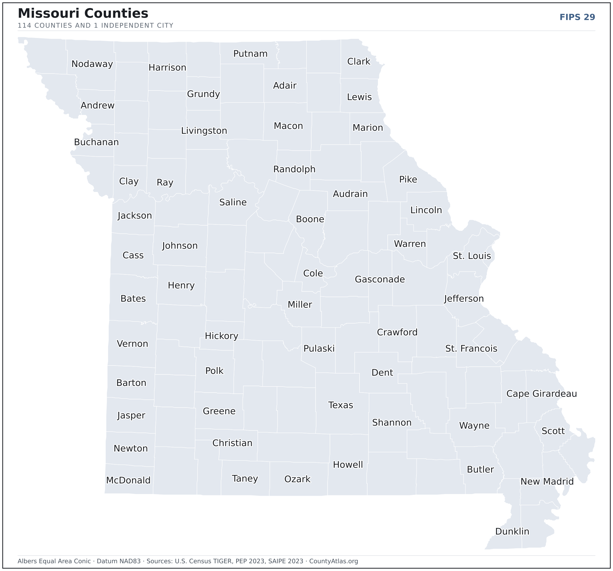
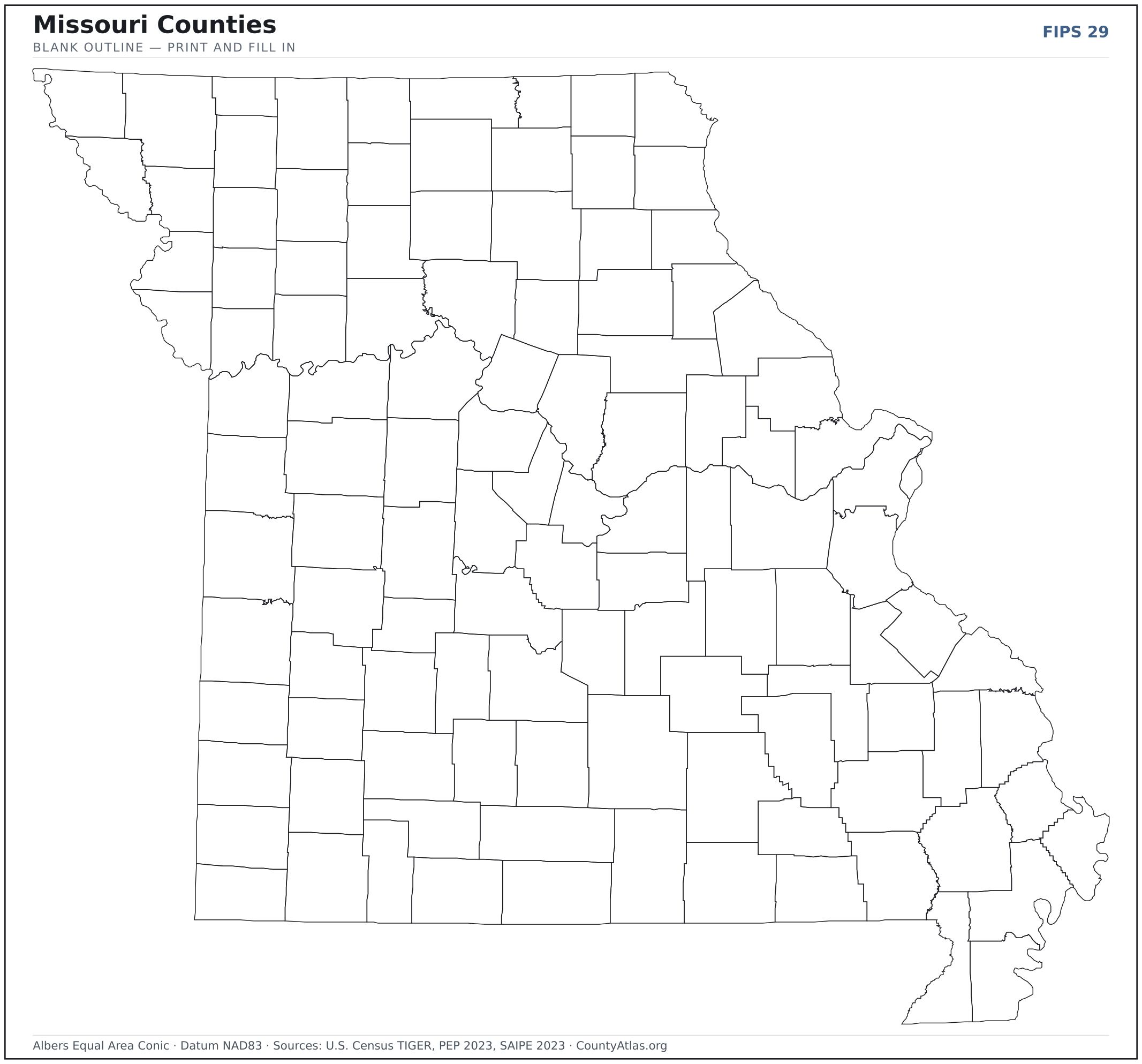
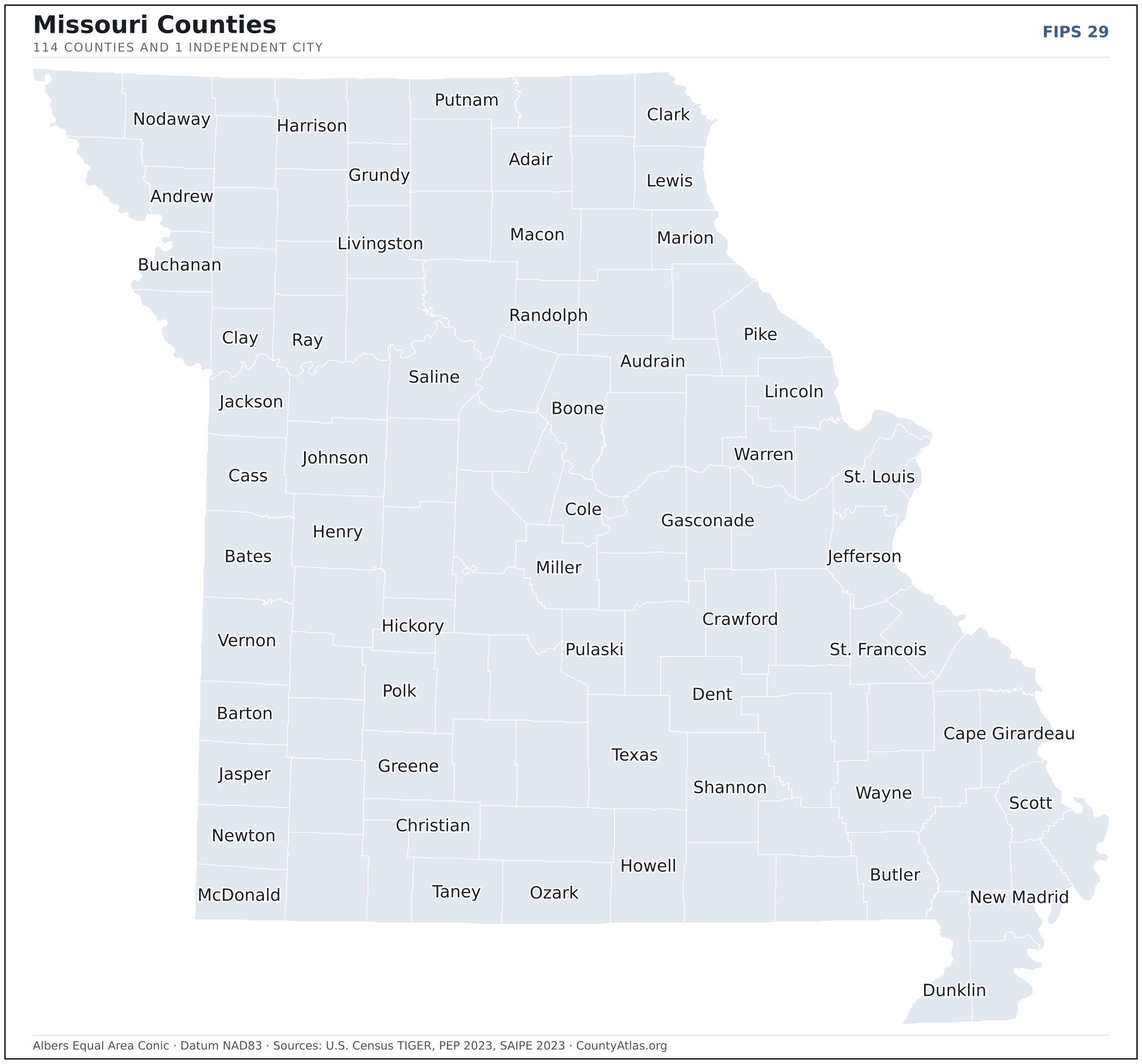
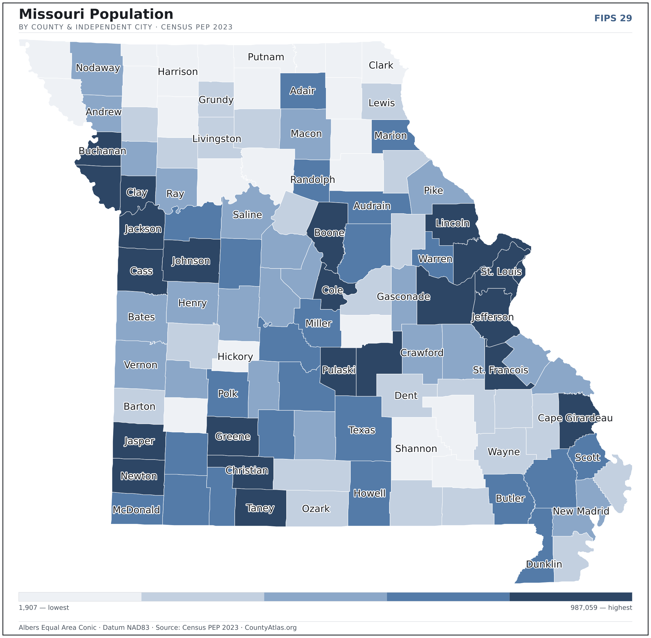
Missouri maps, coloured by the data
Cities in Missouri
Missouri has 947 incorporated cities, villages, and towns. The largest is Kansas City in Jackson County with 508,233 residents. Use the search on the map above to find any city and highlight the county it sits in.
| Kansas City | Jackson County | 508,233 |
| St. Louis | independent city | 293,109 |
| Springfield | Greene County | 169,432 |
| Columbia | Boone County | 127,200 |
| Independence | Jackson County | 121,944 |
| Lee's Summit | Jackson County | 102,583 |
| O'Fallon | St. Charles County | 92,697 |
| St. Joseph | Buchanan County | 71,542 |
| St. Charles | St. Charles County | 71,048 |
| Blue Springs | Jackson County | 59,416 |
| St. Peters | St. Charles County | 58,200 |
| Joplin | Jasper County | 52,218 |
| Florissant | St. Louis County | 51,915 |
| Chesterfield | St. Louis County | 49,591 |
| Wentzville | St. Charles County | 45,734 |
| Jefferson City | Cole County | 42,565 |
| Cape Girardeau | Cape Girardeau County | 40,047 |
| Wildwood | St. Louis County | 35,168 |
| University City | St. Louis County | 34,655 |
| Ballwin | St. Louis County | 30,835 |
| Liberty | Clay County | 30,446 |
| Raytown | Jackson County | 29,593 |
| Kirkwood | St. Louis County | 29,302 |
| Maryland Heights | St. Louis County | 27,981 |
| Gladstone | Clay County | 27,069 |
| Grandview | Jackson County | 25,821 |
| Hazelwood | St. Louis County | 25,214 |
| Belton | Cass County | 24,618 |
| Nixa | Christian County | 24,131 |
| Raymore | Cass County | 23,849 |
| Webster Groves | St. Louis County | 23,771 |
| Ozark | Christian County | 21,953 |
| Sedalia | Pettis County | 21,869 |
| Arnold | Jefferson County | 20,884 |
| Rolla | Phelps County | 20,144 |
| Warrensburg | Johnson County | 19,437 |
| Republic | Greene County | 19,233 |
| Creve Coeur | St. Louis County | 18,643 |
| Ferguson | St. Louis County | 18,350 |
| Manchester | St. Louis County | 18,189 |
| Farmington | St. Francois County | 17,999 |
| Lake St. Louis | St. Charles County | 17,538 |
| Kirksville | Adair County | 17,493 |
| Clayton | St. Louis County | 17,282 |
| Hannibal | Marion County | 16,825 |
| Poplar Bluff | Butler County | 16,243 |
| Sikeston | Scott County | 16,231 |
| Grain Valley | Jackson County | 15,967 |
| Overland | St. Louis County | 15,762 |
| Jackson | Cape Girardeau County | 15,532 |
Showing the 50 most populous — and 897 more. Search the map above for any Missouri city or village.
A city can span more than one county; each is listed in its primary county — the one its center falls in. Some Missouri cities are independent cities — each is its own county-equivalent, not part of a surrounding county — and are marked as such.
Which Missouri county is the richest, largest, most crowded? The answers
- Missouri’s highest median household income is in St. Charles County ($98,765); the lowest is in Wayne County ($41,315). Census SAIPE 2023
- Missouri’s most populous county is St. Louis County (987,059); the least populous is Worth County (1,907) — a 518× spread. Census PEP 2023
- Missouri’s largest county by land area is Texas County (1,177 sq mi); the smallest is St. Louis city (62 sq mi). Census TIGER
- Missouri’s highest population density is in St. Louis city (4,565/sq mi); the lowest is in Worth County (7/sq mi). Census PEP 2023 · TIGER
- Missouri’s highest poverty rate is in Pemiscot County (27.4%); the lowest is in St. Charles County (5.5%). Census SAIPE 2023
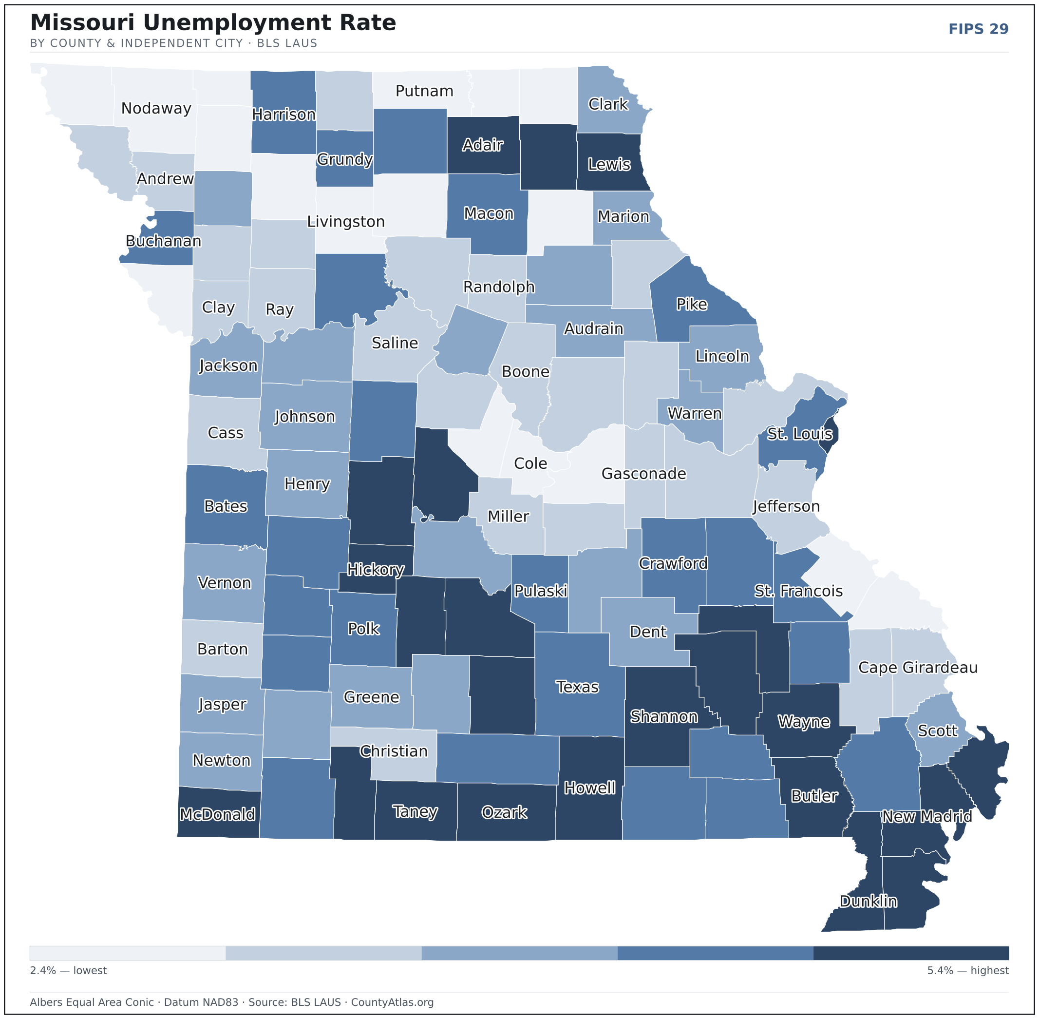
- In Missouri, unemployment is highest in Pemiscot County (5.4%) and lowest in Atchison County (2.4%), for May 2026. BLS LAUS
- Missouri’s highest median age is in Hickory County (55.2); the lowest is in Pulaski County (27.5). Census ACS 2019–2023
- Missouri’s highest share of bachelor’s degrees is in Boone County (51.0% of adults); the lowest is in Schuyler County (10.6%). Census ACS 2019–2023
Every figure is a current official estimate from the source named — not a crowd-sourced or copied value. Suppressed estimates (coefficient of variation ≥ 0.30) are omitted, never guessed. See the full methodology.
Missouri counties: common questions
How many counties are in Missouri?
Missouri has 114 counties and 1 independent city covering 68,747 sq mi and about 6.2M residents. Every one is on the map above and in the table below.
What is the largest county in Missouri?
It depends on the measure. By land area it’s Texas County (1,177 sq mi); by population it’s St. Louis County (987,059 residents).
What county is Kansas City in?
Kansas City (population 508,233) is in Jackson County. Use the search on the map to find any Missouri city’s county.
What is the richest county in Missouri?
By median household income, St. Charles County is the richest at $98,765; the poorest is Wayne County at $41,315 (Census SAIPE 2023).
What is the most populous county in Missouri?
St. Louis County, with 987,059 residents — about 15.9% of Missouri’s people, and 518× the least populous, Worth County (1,907).
Sources & vintages
- Population — PEP Vintage 2023 (July 1, 2023) — pep/charv
- Median household income & poverty — SAIPE 2023
- Unemployment — BLS LAUS May 2026 (preliminary)
- Geometry & boundaries — Census TIGERweb
- Cities & city population — Census TIGERweb Incorporated Places + ACS 5-year 2019–2023
Data current through .