CountyAtlas New York
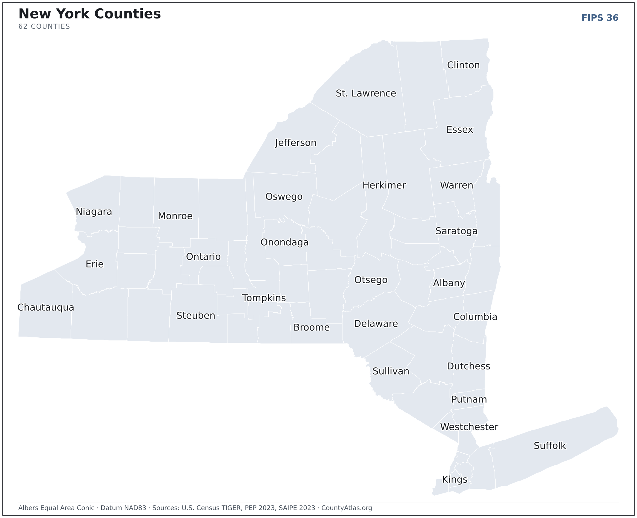
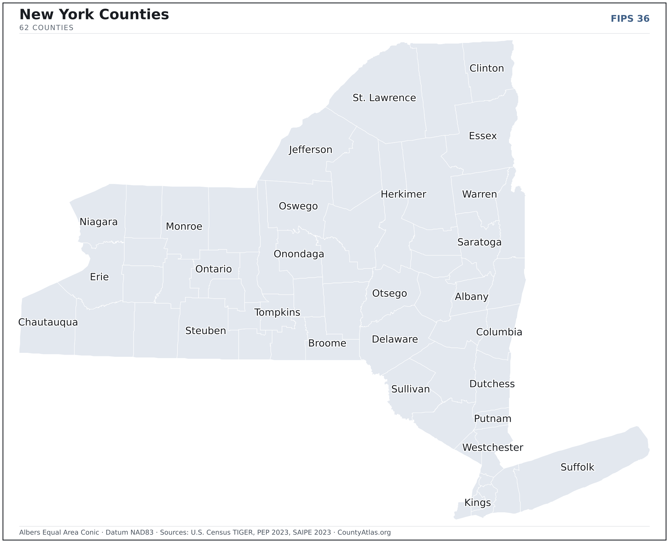
New York County Map with Cities — All 62 Counties
All 62 of New York's counties, mapped from official U.S. Census boundaries with population, income, and unemployment for every one. Colour the map by any measure, tap a county for its data, or download a print-ready copy.
Tap any county for its population, income, and more.
New York at a glance
- Scale. New York is divided into 62 counties across 47,123 sq mi of land — an average of 760 sq mi each. Census TIGER
- People. Its counties are home to 19,571,216 residents — an average of 315,665 each, or 415 per square mile statewide. Census PEP 2023
- Water. Another 7,435 sq mi is water — 13.6% of the state’s area, led by Suffolk County. Census TIGER
New York’s 62 counties, by the numbers
Every county’s population, median household income, unemployment, density, and land area — sortable by any column, so you can find yours or rank by what matters to you. A few patterns run through the data:
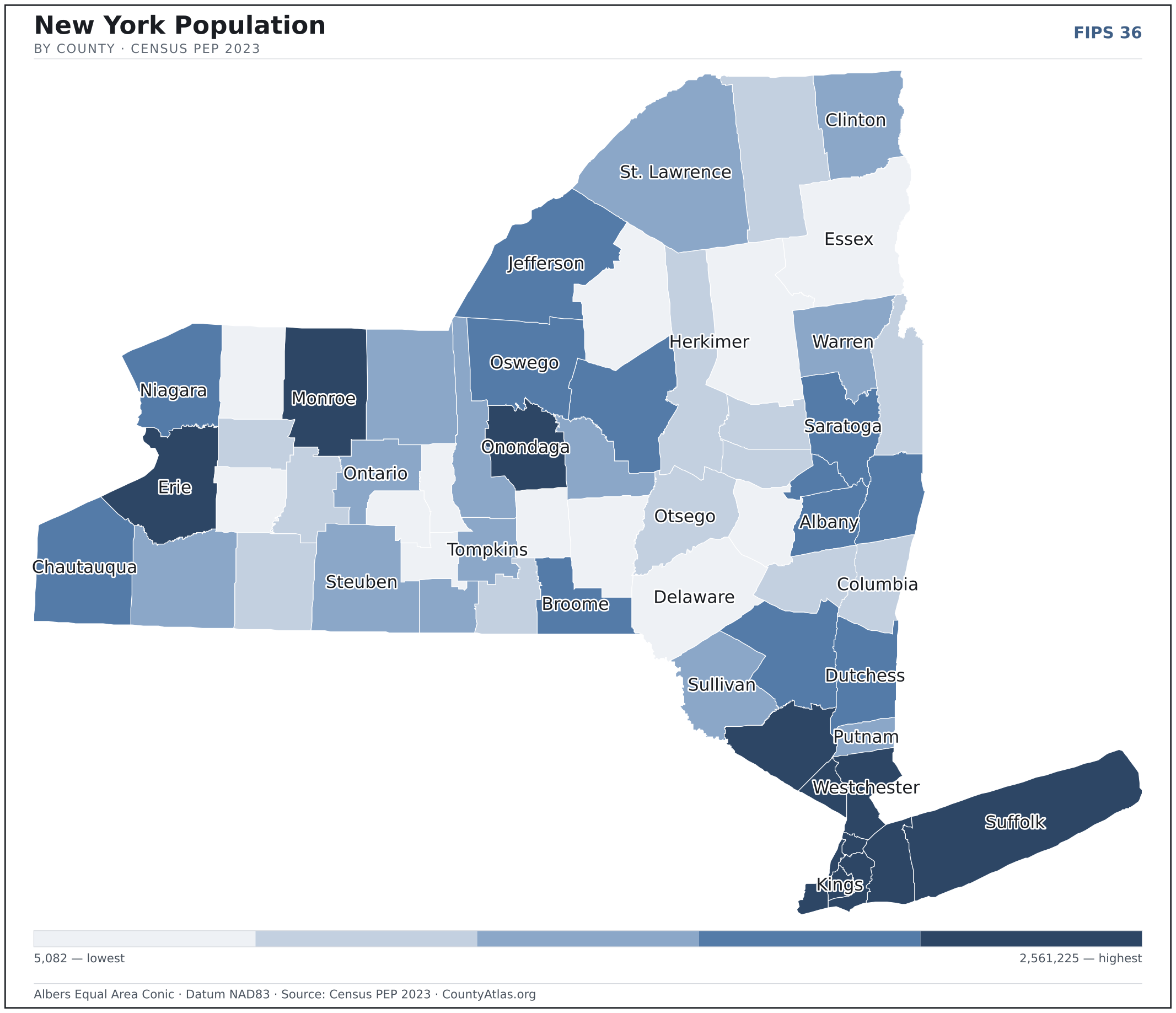
- Concentrated. Half of New York’s 19,571,216 residents live in just 6 of 62 counties, and the five largest hold 47.6% of the total. Census PEP 2023
- Income tracks poverty. The gap from richest to poorest runs 3.0×, and the 10 highest-income counties average 10.2% in poverty against 17.4% for the 10 lowest. Census SAIPE 2023
- Mostly small. Half of New York’s counties have fewer than 86,077 residents, and half report a median household income below $68,571 — a few metros lift the statewide totals well above both. Census PEP 2023 · SAIPE 2023
- Lopsided density. Only 16 of 62 counties are denser than New York’s statewide average of 415 people per square mile — the rest are more rural. Census PEP 2023 · TIGER
| Albany County | 316,659 | $81,193 | 3.6% | 606/sq mi | 523 sq mi | Albany |
| Allegany County | 46,651 | $57,488 | 4.7% | 45/sq mi | 1,030 sq mi | Belmont |
| Bronx County | 1,356,476 | $46,894 | 6.5% | 32,144/sq mi | 42 sq mi | — |
| Broome County | 196,077 | $63,590 | 4.2% | 278/sq mi | 706 sq mi | Binghamton |
| Cattaraugus County | 75,600 | $55,944 | 4.1% | 58/sq mi | 1,308 sq mi | Little Valley |
| Cayuga County | 74,485 | $66,431 | 3.6% | 108/sq mi | 692 sq mi | Auburn |
| Chautauqua County | 124,891 | $56,040 | 4.5% | 118/sq mi | 1,060 sq mi | Mayville |
| Chemung County | 81,325 | $60,456 | 4.0% | 200/sq mi | 407 sq mi | Elmira |
| Chenango County | 45,920 | $57,407 | 3.4% | 51/sq mi | 893 sq mi | Norwich |
| Clinton County | 78,115 | $64,282 | 3.9% | 75/sq mi | 1,038 sq mi | Plattsburgh |
| Columbia County | 60,470 | $73,112 | 3.3% | 95/sq mi | 635 sq mi | Hudson |
| Cortland County | 45,752 | $63,890 | 4.1% | 92/sq mi | 499 sq mi | Cortland |
| Delaware County | 44,410 | $56,163 | 4.3% | 31/sq mi | 1,443 sq mi | Delhi |
| Dutchess County | 297,150 | $96,374 | 3.5% | 373/sq mi | 796 sq mi | Poughkeepsie |
| Erie County | 946,147 | $70,443 | 4.1% | 907/sq mi | 1,043 sq mi | Buffalo |
| Essex County | 36,775 | $70,902 | 3.5% | 20/sq mi | 1,794 sq mi | Elizabethtown |
| Franklin County | 46,502 | $63,624 | 4.0% | 29/sq mi | 1,629 sq mi | Malone |
| Fulton County | 52,234 | $63,409 | 4.1% | 105/sq mi | 495 sq mi | Johnstown |
| Genesee County | 57,529 | $71,749 | 3.4% | 117/sq mi | 493 sq mi | Batavia |
| Greene County | 47,062 | $70,789 | 4.0% | 73/sq mi | 647 sq mi | Catskill |
| Hamilton County | 5,082 | $68,529 | 5.8% | 3/sq mi | 1,717 sq mi | — |
| Herkimer County | 59,484 | $63,771 | 4.1% | 42/sq mi | 1,411 sq mi | Herkimer |
| Jefferson County | 114,787 | $61,664 | 4.4% | 91/sq mi | 1,268 sq mi | Watertown |
| Kings County | 2,561,225 | $76,353 | 4.9% | 36,916/sq mi | 69 sq mi | — |
| Lewis County | 26,548 | $64,941 | 3.8% | 21/sq mi | 1,276 sq mi | Lowville |
| Livingston County | 61,158 | $70,185 | 4.3% | 97/sq mi | 632 sq mi | Geneseo |
| Madison County | 66,921 | $73,680 | 3.8% | 102/sq mi | 655 sq mi | Wampsville |
| Monroe County | 748,482 | $73,263 | 4.1% | 1,139/sq mi | 657 sq mi | Rochester |
| Montgomery County | 49,368 | $61,463 | 4.2% | 122/sq mi | 403 sq mi | Fonda |
| Nassau County | 1,381,715 | $140,466 | 3.5% | 4,856/sq mi | 285 sq mi | Mineola |
| New York County | 1,597,451 | $100,869 | 4.3% | 70,497/sq mi | 23 sq mi | — |
| Niagara County | 209,457 | $65,932 | 4.4% | 401/sq mi | 522 sq mi | Lockport |
| Oneida County | 227,555 | $61,566 | 3.9% | 188/sq mi | 1,212 sq mi | Utica |
| Onondaga County | 467,873 | $74,388 | 3.8% | 601/sq mi | 778 sq mi | Syracuse |
| Ontario County | 112,494 | $79,364 | 3.5% | 175/sq mi | 644 sq mi | Canandaigua |
| Orange County | 407,470 | $93,492 | 4.0% | 502/sq mi | 812 sq mi | Goshen |
| Orleans County | 39,124 | $65,156 | 3.8% | 100/sq mi | 391 sq mi | Albion |
| Oswego County | 118,162 | $68,613 | 4.3% | 124/sq mi | 952 sq mi | Oswego |
| Otsego County | 60,126 | $63,863 | 4.1% | 60/sq mi | 1,002 sq mi | Cooperstown |
| Putnam County | 98,060 | $120,930 | 3.3% | 426/sq mi | 230 sq mi | Carmel |
| Queens County | 2,252,196 | $81,399 | 4.3% | 20,716/sq mi | 109 sq mi | — |
| Rensselaer County | 159,305 | $82,846 | 3.7% | 244/sq mi | 652 sq mi | Troy |
| Richmond County | 490,687 | $93,337 | 4.2% | 8,531/sq mi | 58 sq mi | — |
| Rockland County | 340,807 | $105,923 | 3.4% | 1,962/sq mi | 174 sq mi | New City |
| Saratoga County | 238,711 | $94,394 | 3.0% | 295/sq mi | 810 sq mi | Ballston Spa |
| Schenectady County | 159,902 | $74,791 | 4.0% | 781/sq mi | 205 sq mi | Schenectady |
| Schoharie County | 30,105 | $63,768 | 3.9% | 48/sq mi | 622 sq mi | Schoharie |
| Schuyler County | 17,507 | $65,210 | 3.9% | 53/sq mi | 328 sq mi | Watkins Glen |
| Seneca County | 32,349 | $58,581 | 3.7% | 100/sq mi | 324 sq mi | Waterloo |
| St. Lawrence County | 106,940 | $57,832 | 4.7% | 40/sq mi | 2,680 sq mi | Canton |
| Steuben County | 92,162 | $64,261 | 4.0% | 66/sq mi | 1,391 sq mi | Bath |
| Suffolk County | 1,523,170 | $123,219 | 3.6% | 1,672/sq mi | 911 sq mi | Riverhead |
| Sullivan County | 79,920 | $68,063 | 3.8% | 83/sq mi | 968 sq mi | Monticello |
| Tioga County | 47,715 | $67,616 | 3.6% | 92/sq mi | 519 sq mi | Owego |
| Tompkins County | 103,558 | $68,222 | 3.8% | 218/sq mi | 475 sq mi | Ithaca |
| Ulster County | 182,333 | $84,593 | 3.6% | 162/sq mi | 1,124 sq mi | Kingston |
| Warren County | 65,380 | $73,115 | 3.7% | 75/sq mi | 867 sq mi | Queensbury |
| Washington County | 60,047 | $71,396 | 3.6% | 72/sq mi | 831 sq mi | Fort Edward |
| Wayne County | 90,829 | $73,028 | 3.7% | 150/sq mi | 604 sq mi | Lyons |
| Westchester County | 990,817 | $114,020 | 3.6% | 2,300/sq mi | 431 sq mi | White Plains |
| Wyoming County | 39,532 | $70,775 | 3.4% | 67/sq mi | 593 sq mi | Warsaw |
| Yates County | 24,472 | $66,155 | 2.9% | 72/sq mi | 338 sq mi | Penn Yan |
All 62 counties, sortable by any column — click a heading. A suppressed estimate (coefficient of variation ≥ 0.30) shows a marker, never a guess. County seats are from Wikidata (CC0), each validated to a Census place inside its county; a county with no validated seat is left blank. See the methodology.
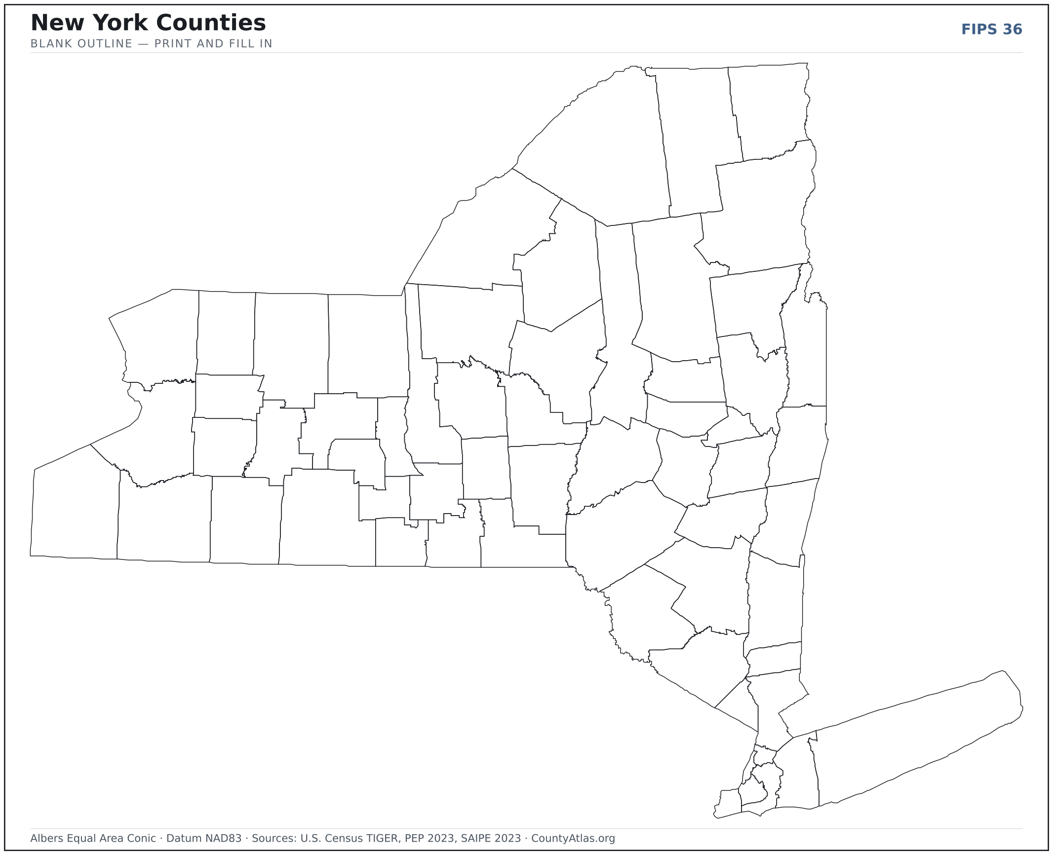
Download & print this New York map
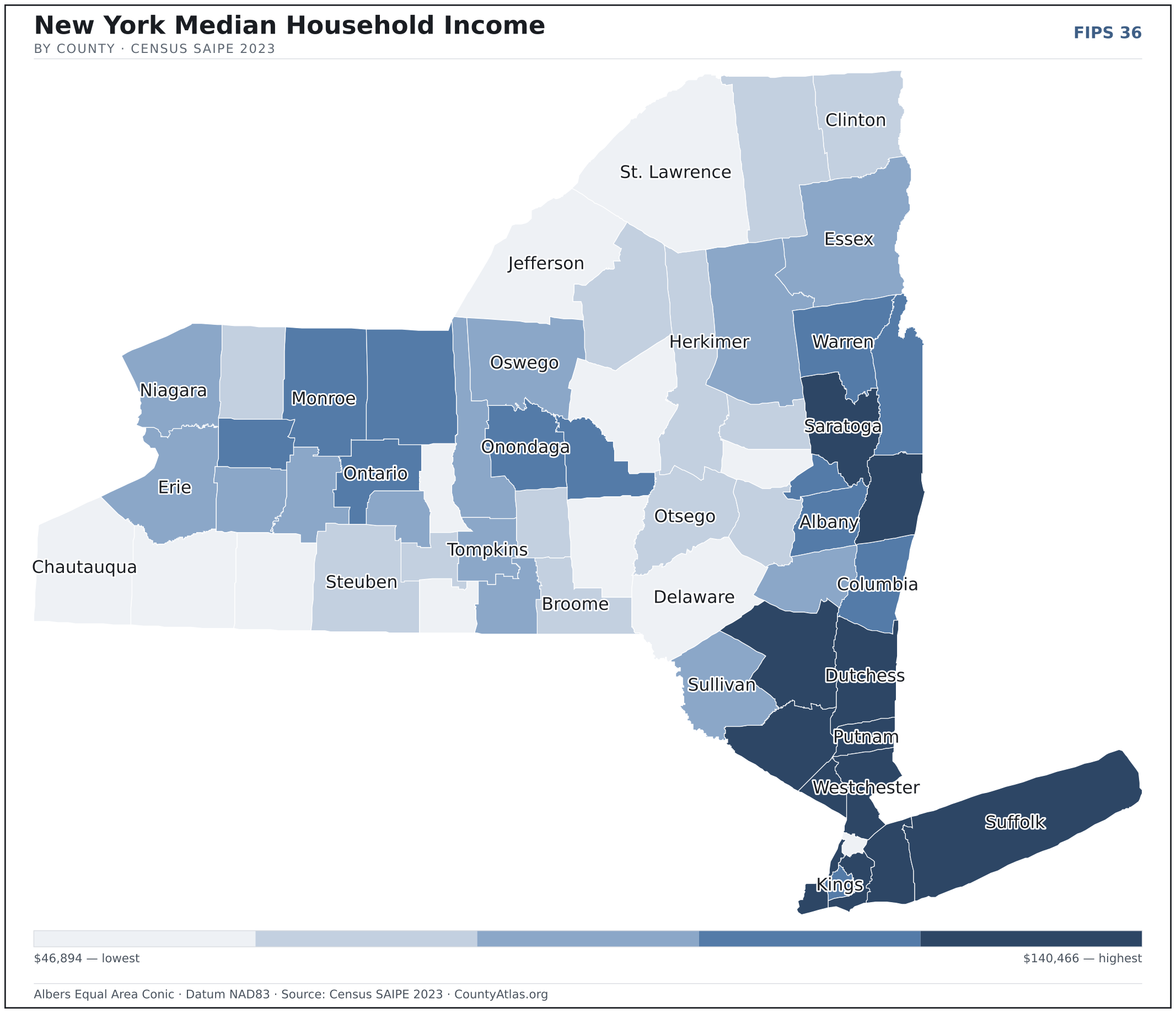
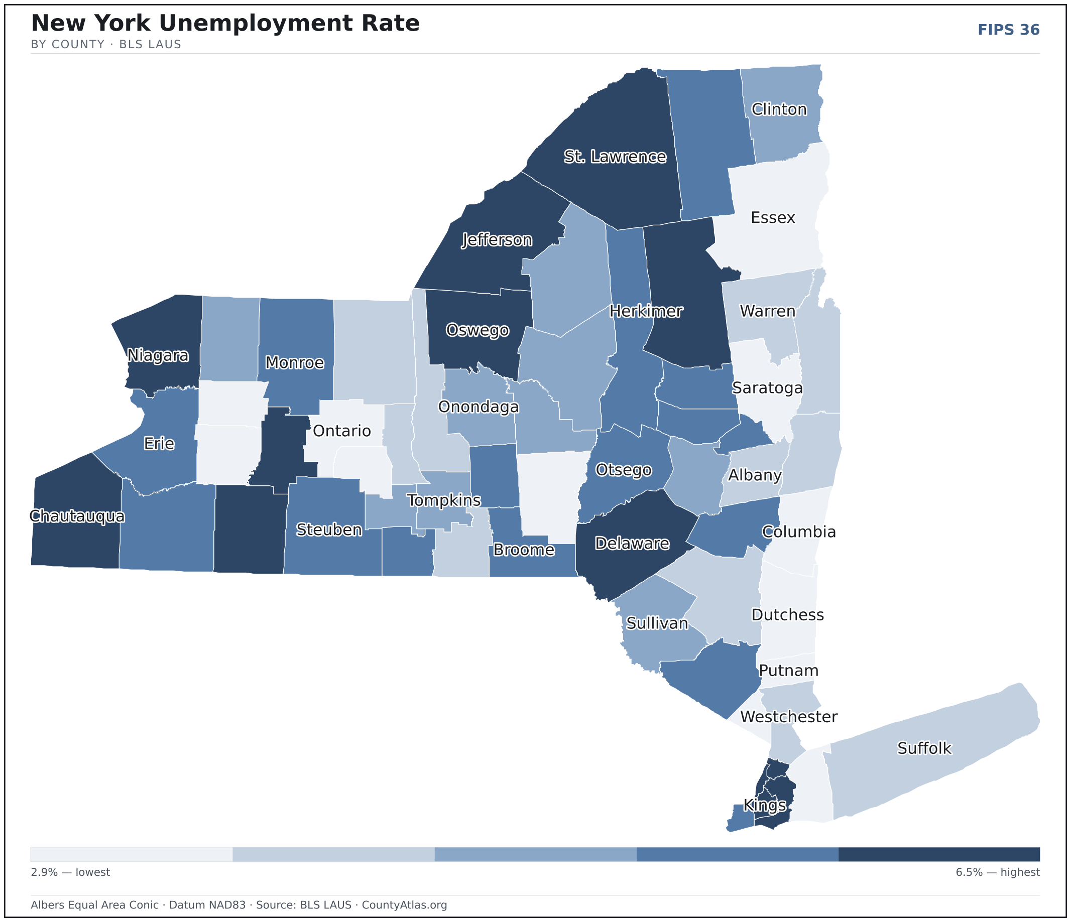
New York maps, coloured by the data
Cities in New York
New York has 593 incorporated cities and villages. The largest is New York in Kings County with 8,516,202 residents. Use the search on the map above to find any city and highlight the county it sits in.
| New York | Kings County | 8,516,202 |
| Buffalo | Erie County | 276,397 |
| Rochester | Monroe County | 209,720 |
| Yonkers | Westchester County | 209,529 |
| Syracuse | Onondaga County | 146,211 |
| Albany | Albany County | 100,081 |
| New Rochelle | Westchester County | 81,591 |
| Mount Vernon | Westchester County | 72,528 |
| Schenectady | Schenectady County | 68,521 |
| Utica | Oneida County | 64,440 |
| White Plains | Westchester County | 59,818 |
| Hempstead (village) | Nassau County | 58,569 |
| Troy | Rensselaer County | 51,054 |
| Niagara Falls | Niagara County | 48,198 |
| Binghamton | Broome County | 47,357 |
| Freeport (village) | Nassau County | 44,102 |
| Valley Stream (village) | Nassau County | 40,278 |
| Kiryas Joel (village) | Orange County | 36,572 |
| Long Beach | Nassau County | 34,741 |
| Spring Valley (village) | Rockland County | 32,995 |
| Rome | Oneida County | 31,795 |
| Ithaca | Tompkins County | 31,792 |
| Poughkeepsie | Dutchess County | 31,778 |
| Port Chester (village) | Westchester County | 31,162 |
| North Tonawanda | Niagara County | 30,338 |
| Middletown | Orange County | 30,227 |
| Harrison (village) | Westchester County | 29,279 |
| Newburgh | Orange County | 28,649 |
| Saratoga Springs | Saratoga County | 28,542 |
| Jamestown | Chautauqua County | 28,401 |
| Glen Cove | Nassau County | 28,101 |
| Lindenhurst (village) | Suffolk County | 27,106 |
| Ossining (village) | Westchester County | 26,979 |
| Auburn | Cayuga County | 26,475 |
| Elmira | Chemung County | 26,349 |
| Rockville Centre (village) | Nassau County | 25,770 |
| Peekskill | Westchester County | 25,484 |
| Watertown | Jefferson County | 24,574 |
| Kingston | Ulster County | 23,942 |
| Garden City (village) | Nassau County | 22,866 |
| Mineola (village) | Nassau County | 21,082 |
| Lockport | Niagara County | 20,699 |
| Lynbrook (village) | Nassau County | 20,251 |
| Plattsburgh | Clinton County | 19,878 |
| Mamaroneck (village) | Westchester County | 19,840 |
| Lackawanna | Erie County | 19,779 |
| Amsterdam | Montgomery County | 18,162 |
| Cohoes | Albany County | 18,043 |
| Scarsdale (village) | Westchester County | 18,005 |
| Cortland | Cortland County | 17,465 |
Showing the 50 most populous — and 543 more. Search the map above for any New York city or village.
A city can span more than one county; each is listed in its primary county — the one its center falls in.
Which New York county is the richest, largest, most crowded? The answers
- New York’s highest median household income is in Nassau County ($140,466); the lowest is in Bronx County ($46,894). Census SAIPE 2023
- New York’s most populous county is Kings County (2,561,225); the least populous is Hamilton County (5,082) — a 504× spread. Census PEP 2023
- New York’s largest county by land area is St. Lawrence County (2,680 sq mi); the smallest is New York County (23 sq mi). Census TIGER
- New York’s highest population density is in New York County (70,497/sq mi); the lowest is in Hamilton County (3/sq mi). Census PEP 2023 · TIGER
- New York’s highest poverty rate is in Bronx County (27.7%); the lowest is in Nassau County (5.8%). Census SAIPE 2023
- In New York, unemployment is highest in Bronx County (6.5%) and lowest in Yates County (2.9%), for May 2026. BLS LAUS
- New York’s highest median age is in Hamilton County (57.2); the lowest is in Tompkins County (32.8). Census ACS 2019–2023
- New York’s highest share of bachelor’s degrees is in New York County (64.0% of adults); the lowest is in Orleans County (17.5%). Census ACS 2019–2023
Every figure is a current official estimate from the source named — not a crowd-sourced or copied value. Suppressed estimates (coefficient of variation ≥ 0.30) are omitted, never guessed. See the full methodology.
New York counties: common questions
How many counties are in New York?
New York has 62 counties covering 47,123 sq mi and about 19.6M residents. Every one is on the map above and in the table below.
What is the largest county in New York?
It depends on the measure. By land area it’s St. Lawrence County (2,680 sq mi); by population it’s Kings County (2,561,225 residents).
What county is New York in?
New York (population 8,516,202) is in Kings County. Use the search on the map to find any New York city’s county.
What is the richest county in New York?
By median household income, Nassau County is the richest at $140,466; the poorest is Bronx County at $46,894 (Census SAIPE 2023).
What is the most populous county in New York?
Kings County, with 2,561,225 residents — about 13.1% of New York’s people, and 504× the least populous, Hamilton County (5,082).
Sources & vintages
- Population — PEP Vintage 2023 (July 1, 2023) — pep/charv
- Median household income & poverty — SAIPE 2023
- Unemployment — BLS LAUS May 2026 (preliminary)
- Geometry & boundaries — Census TIGERweb
- Cities & city population — Census TIGERweb Incorporated Places + ACS 5-year 2019–2023
Data current through .