CountyAtlas North Carolina
North Carolina County Map with Cities — All 100 Counties
All 100 of North Carolina's counties, mapped from official U.S. Census boundaries with population, income, and unemployment for every one. Colour the map by any measure, tap a county for its data, or download a print-ready copy.
Tap any county for its population, income, and more.
North Carolina at a glance
- Scale. North Carolina is divided into 100 counties across 48,624 sq mi of land — an average of 486 sq mi each. Census TIGER
- People. Its counties are home to 10,835,491 residents — an average of 108,355 each, or 223 per square mile statewide. Census PEP 2023
- Water. Another 5,195 sq mi is water — 9.7% of the state’s area, led by Dare County. Census TIGER
North Carolina’s 100 counties, by the numbers
Every county’s population, median household income, unemployment, density, and land area — sortable by any column, so you can find yours or rank by what matters to you. A few patterns run through the data:
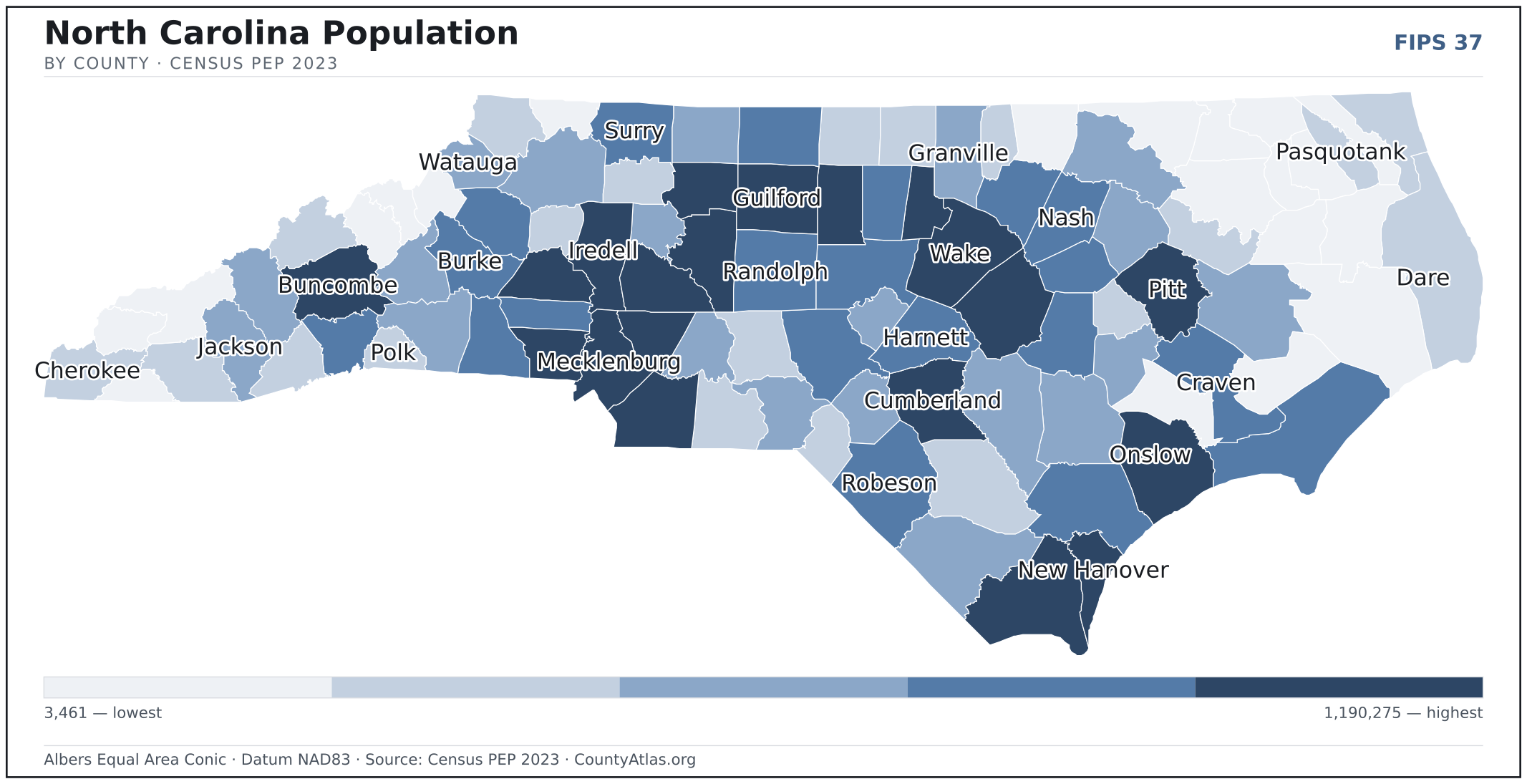
- Concentrated. Half of North Carolina’s 10,835,491 residents live in just 12 of 100 counties, and the five largest hold 33.5% of the total. Census PEP 2023
- Income tracks poverty. The gap from richest to poorest runs 2.4×, and the 10 highest-income counties average 9.1% in poverty against 23.1% for the 10 lowest. Census SAIPE 2023
- Mostly small. Half of North Carolina’s counties have fewer than 52,284 residents, and half report a median household income below $60,263 — a few metros lift the statewide totals well above both. Census PEP 2023 · SAIPE 2023
- Lopsided density. Only 24 of 100 counties are denser than North Carolina’s statewide average of 223 people per square mile — the rest are more rural. Census PEP 2023 · TIGER
| Alamance County | 179,165 | $66,395 | 3.6% | 423/sq mi | 423 sq mi | Graham |
| Alexander County | 36,473 | $62,976 | 3.4% | 140/sq mi | 260 sq mi | Taylorsville |
| Alleghany County | 11,342 | $46,571 | 3.6% | 48/sq mi | 235 sq mi | Sparta |
| Anson County | 21,897 | $50,503 | 4.1% | 41/sq mi | 531 sq mi | Wadesboro |
| Ashe County | 27,063 | $54,589 | 2.9% | 63/sq mi | 426 sq mi | Jefferson |
| Avery County | 17,561 | $55,922 | 3.1% | 71/sq mi | 247 sq mi | Newland |
| Beaufort County | 44,481 | $55,960 | 3.5% | 53/sq mi | 833 sq mi | Washington |
| Bertie County | 16,922 | $44,371 | 4.6% | 24/sq mi | 699 sq mi | Windsor |
| Bladen County | 29,484 | $49,661 | 4.9% | 34/sq mi | 875 sq mi | Elizabethtown |
| Brunswick County | 159,964 | $76,797 | 4.0% | 188/sq mi | 849 sq mi | Bolivia |
| Buncombe County | 275,901 | $71,218 | 3.3% | 420/sq mi | 656 sq mi | Asheville |
| Burke County | 88,338 | $55,616 | 3.4% | 174/sq mi | 506 sq mi | Morganton |
| Cabarrus County | 240,016 | $85,540 | 3.4% | 664/sq mi | 361 sq mi | Concord |
| Caldwell County | 80,574 | $56,239 | 3.6% | 171/sq mi | 472 sq mi | Lenoir |
| Camden County | 11,137 | $84,656 | 2.9% | 46/sq mi | 240 sq mi | Camden |
| Carteret County | 69,615 | $76,397 | 3.2% | 137/sq mi | 508 sq mi | Beaufort |
| Caswell County | 22,807 | $57,865 | 3.4% | 54/sq mi | 426 sq mi | Yanceyville |
| Catawba County | 164,645 | $65,898 | 3.5% | 410/sq mi | 401 sq mi | Newton |
| Chatham County | 81,624 | $95,716 | 3.1% | 120/sq mi | 681 sq mi | Pittsboro |
| Cherokee County | 29,959 | $53,926 | 3.9% | 66/sq mi | 456 sq mi | Murphy |
| Chowan County | 13,891 | $60,808 | 3.4% | 80/sq mi | 173 sq mi | Edenton |
| Clay County | 11,864 | $53,229 | 3.5% | 55/sq mi | 215 sq mi | Hayesville |
| Cleveland County | 101,378 | $61,411 | 4.2% | 218/sq mi | 464 sq mi | Shelby |
| Columbus County | 50,121 | $50,837 | 4.0% | 53/sq mi | 938 sq mi | Whiteville |
| Craven County | 102,391 | $61,761 | 3.7% | 145/sq mi | 707 sq mi | New Bern |
| Cumberland County | 337,890 | $61,511 | 4.3% | 518/sq mi | 653 sq mi | Fayetteville |
| Currituck County | 31,593 | $86,047 | 2.7% | 121/sq mi | 262 sq mi | — |
| Dare County | 38,110 | $79,646 | 3.3% | 99/sq mi | 383 sq mi | Manteo |
| Davidson County | 174,804 | $63,551 | 3.5% | 316/sq mi | 553 sq mi | Lexington |
| Davie County | 44,599 | $76,153 | 3.4% | 169/sq mi | 264 sq mi | Mocksville |
| Duplin County | 49,520 | $52,947 | 3.1% | 61/sq mi | 815 sq mi | Kenansville |
| Durham County | 336,892 | $81,413 | 3.2% | 1,172/sq mi | 288 sq mi | Durham |
| Edgecombe County | 48,832 | $49,972 | 5.2% | 97/sq mi | 505 sq mi | Tarboro |
| Forsyth County | 392,921 | $65,556 | 3.7% | 963/sq mi | 408 sq mi | Winston-Salem |
| Franklin County | 77,001 | $70,898 | 3.3% | 157/sq mi | 492 sq mi | Louisburg |
| Gaston County | 237,242 | $67,076 | 3.6% | 667/sq mi | 356 sq mi | Gastonia |
| Gates County | 10,343 | $64,047 | 3.2% | 30/sq mi | 341 sq mi | Gatesville |
| Graham County | 8,052 | $51,841 | 3.3% | 28/sq mi | 292 sq mi | Robbinsville |
| Granville County | 62,192 | $72,896 | 3.3% | 117/sq mi | 532 sq mi | Oxford |
| Greene County | 20,530 | $52,145 | 3.3% | 77/sq mi | 267 sq mi | Snow Hill |
| Guilford County | 549,866 | $65,890 | 3.9% | 851/sq mi | 646 sq mi | Greensboro |
| Halifax County | 47,298 | $48,520 | 5.1% | 65/sq mi | 724 sq mi | Halifax |
| Harnett County | 141,477 | $70,074 | 3.8% | 238/sq mi | 595 sq mi | Lillington |
| Haywood County | 62,969 | $64,553 | 3.2% | 114/sq mi | 554 sq mi | Waynesville |
| Henderson County | 119,230 | $63,765 | 3.0% | 320/sq mi | 373 sq mi | Hendersonville |
| Hertford County | 19,453 | $48,964 | 4.0% | 55/sq mi | 353 sq mi | Winton |
| Hoke County | 54,446 | $60,257 | 4.4% | 140/sq mi | 390 sq mi | Raeford |
| Hyde County | 4,607 | $49,781 | 5.2% | 8/sq mi | 612 sq mi | Swan Quarter |
| Iredell County | 199,710 | $84,335 | 3.3% | 348/sq mi | 574 sq mi | Statesville |
| Jackson County | 44,574 | $55,462 | 3.1% | 91/sq mi | 491 sq mi | Sylva |
| Johnston County | 241,955 | $79,666 | 3.0% | 305/sq mi | 792 sq mi | Smithfield |
| Jones County | 9,401 | $53,001 | 3.5% | 20/sq mi | 471 sq mi | Trenton |
| Lee County | 67,059 | $62,680 | 3.4% | 263/sq mi | 255 sq mi | Sanford |
| Lenoir County | 54,895 | $51,601 | 3.8% | 138/sq mi | 399 sq mi | Kinston |
| Lincoln County | 95,675 | $79,109 | 3.2% | 323/sq mi | 296 sq mi | Lincolnton |
| Macon County | 38,412 | $58,765 | 3.4% | 75/sq mi | 516 sq mi | Franklin |
| Madison County | 22,071 | $59,505 | 3.4% | 49/sq mi | 450 sq mi | Marshall |
| Martin County | 21,447 | $49,033 | 3.8% | 47/sq mi | 456 sq mi | Williamston |
| McDowell County | 44,893 | $53,697 | 3.7% | 102/sq mi | 440 sq mi | Marion |
| Mecklenburg County | 1,163,701 | $84,796 | 3.6% | 2,222/sq mi | 524 sq mi | Charlotte |
| Mitchell County | 14,999 | $56,746 | 3.6% | 68/sq mi | 221 sq mi | Bakersville |
| Montgomery County | 26,085 | $55,005 | 3.7% | 53/sq mi | 492 sq mi | Troy |
| Moore County | 106,898 | $78,955 | 3.2% | 153/sq mi | 698 sq mi | Carthage |
| Nash County | 96,551 | $65,457 | 4.4% | 179/sq mi | 540 sq mi | Nashville |
| New Hanover County | 238,852 | $79,106 | 3.2% | 1,242/sq mi | 192 sq mi | Wilmington |
| Northampton County | 16,715 | $44,182 | 4.4% | 31/sq mi | 537 sq mi | Jackson |
| Onslow County | 213,676 | $66,982 | 3.8% | 280/sq mi | 762 sq mi | Jacksonville |
| Orange County | 150,626 | $86,736 | 3.2% | 379/sq mi | 398 sq mi | Hillsborough |
| Pamlico County | 12,423 | $61,996 | 3.4% | 37/sq mi | 337 sq mi | Bayboro |
| Pasquotank County | 41,444 | $59,463 | 3.6% | 183/sq mi | 227 sq mi | Elizabeth City |
| Pender County | 68,521 | $72,161 | 3.3% | 79/sq mi | 871 sq mi | Burgaw |
| Perquimans County | 13,377 | $61,157 | 3.9% | 54/sq mi | 247 sq mi | Hertford |
| Person County | 39,737 | $64,466 | 3.1% | 101/sq mi | 392 sq mi | Roxboro |
| Pitt County | 175,119 | $60,268 | 3.9% | 268/sq mi | 652 sq mi | Greenville |
| Polk County | 20,060 | $59,012 | 3.2% | 84/sq mi | 238 sq mi | Columbus |
| Randolph County | 147,458 | $59,336 | 3.5% | 188/sq mi | 782 sq mi | Asheboro |
| Richmond County | 42,324 | $50,242 | 3.7% | 89/sq mi | 474 sq mi | Rockingham |
| Robeson County | 117,365 | $42,180 | 4.8% | 124/sq mi | 947 sq mi | Lumberton |
| Rockingham County | 92,518 | $58,508 | 3.8% | 164/sq mi | 566 sq mi | Wentworth |
| Rowan County | 151,661 | $65,139 | 3.4% | 296/sq mi | 512 sq mi | Salisbury |
| Rutherford County | 65,507 | $50,714 | 4.1% | 116/sq mi | 565 sq mi | Rutherfordton |
| Sampson County | 59,601 | $53,637 | 3.6% | 63/sq mi | 946 sq mi | Clinton |
| Scotland County | 34,376 | $45,604 | 4.6% | 108/sq mi | 319 sq mi | Laurinburg |
| Stanly County | 65,699 | $65,784 | 2.9% | 166/sq mi | 395 sq mi | Albemarle |
| Stokes County | 45,532 | $61,374 | 3.4% | 101/sq mi | 449 sq mi | Danbury |
| Surry County | 71,462 | $58,211 | 3.2% | 134/sq mi | 533 sq mi | Dobson |
| Swain County | 13,916 | $54,357 | 3.0% | 26/sq mi | 528 sq mi | Bryson City |
| Transylvania County | 33,549 | $62,002 | 3.3% | 89/sq mi | 378 sq mi | Brevard |
| Tyrrell County | 3,461 | $46,072 | 4.7% | 9/sq mi | 391 sq mi | Columbia |
| Union County | 256,452 | $98,776 | 3.2% | 405/sq mi | 633 sq mi | Monroe |
| Vance County | 42,301 | $45,408 | 4.5% | 168/sq mi | 252 sq mi | Henderson |
| Wake County | 1,190,275 | $103,084 | 3.0% | 1,426/sq mi | 835 sq mi | Raleigh |
| Warren County | 18,836 | $47,866 | 4.5% | 44/sq mi | 429 sq mi | Warrenton |
| Washington County | 10,713 | $47,239 | 4.4% | 31/sq mi | 347 sq mi | Plymouth |
| Watauga County | 54,748 | $62,045 | 3.2% | 175/sq mi | 312 sq mi | Boone |
| Wayne County | 118,686 | $56,313 | 3.7% | 214/sq mi | 554 sq mi | Goldsboro |
| Wilkes County | 66,013 | $50,848 | 3.6% | 88/sq mi | 754 sq mi | Wilkesboro |
| Wilson County | 78,970 | $52,620 | 4.7% | 215/sq mi | 368 sq mi | Wilson |
| Yadkin County | 37,774 | $61,626 | 3.2% | 113/sq mi | 335 sq mi | Yadkinville |
| Yancey County | 18,938 | $54,913 | 3.1% | 61/sq mi | 313 sq mi | Burnsville |
All 100 counties, sortable by any column — click a heading. A suppressed estimate (coefficient of variation ≥ 0.30) shows a marker, never a guess. County seats are from Wikidata (CC0), each validated to a Census place inside its county; a county with no validated seat is left blank. See the methodology.
Download & print this North Carolina map
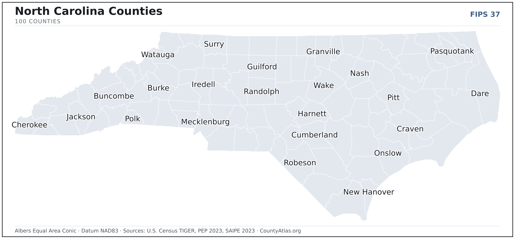
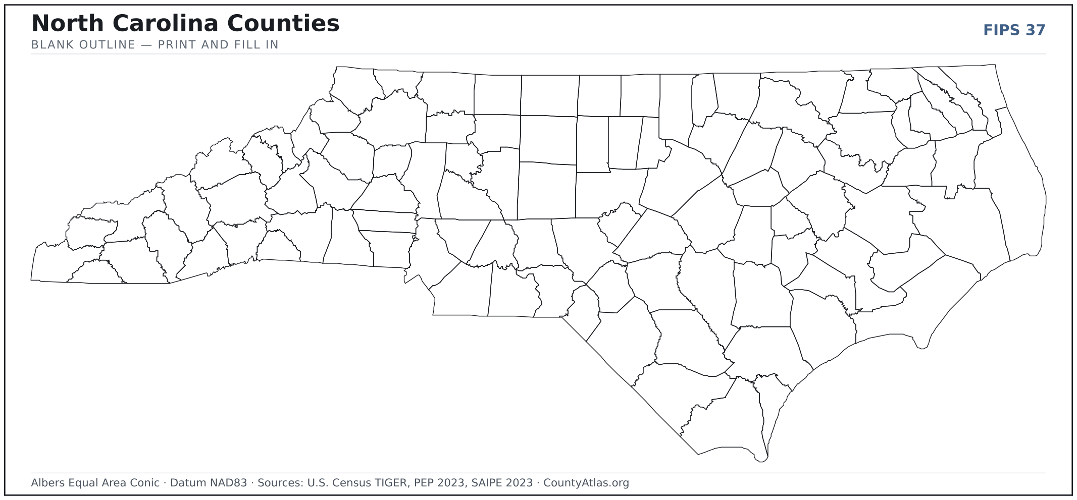
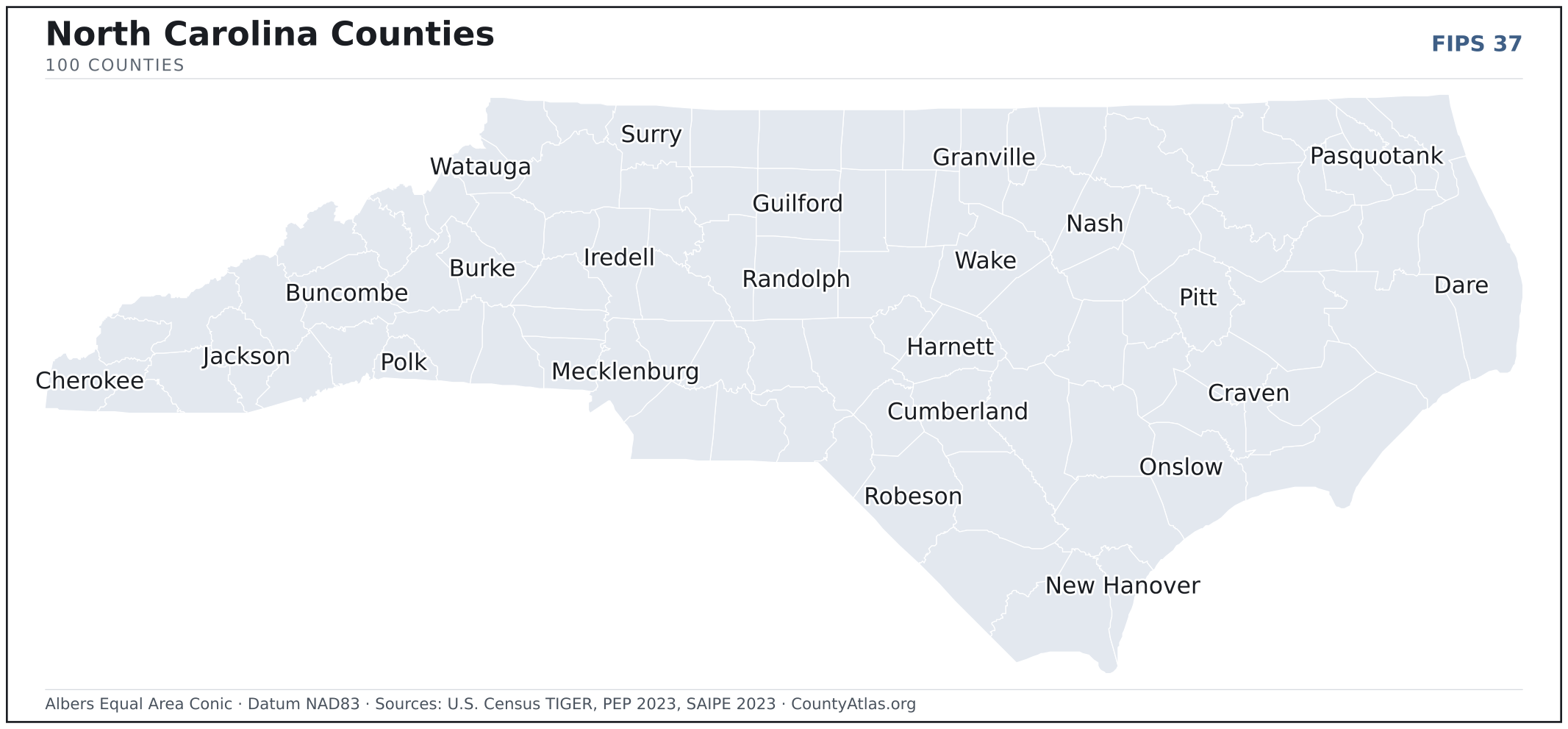
North Carolina maps, coloured by the data
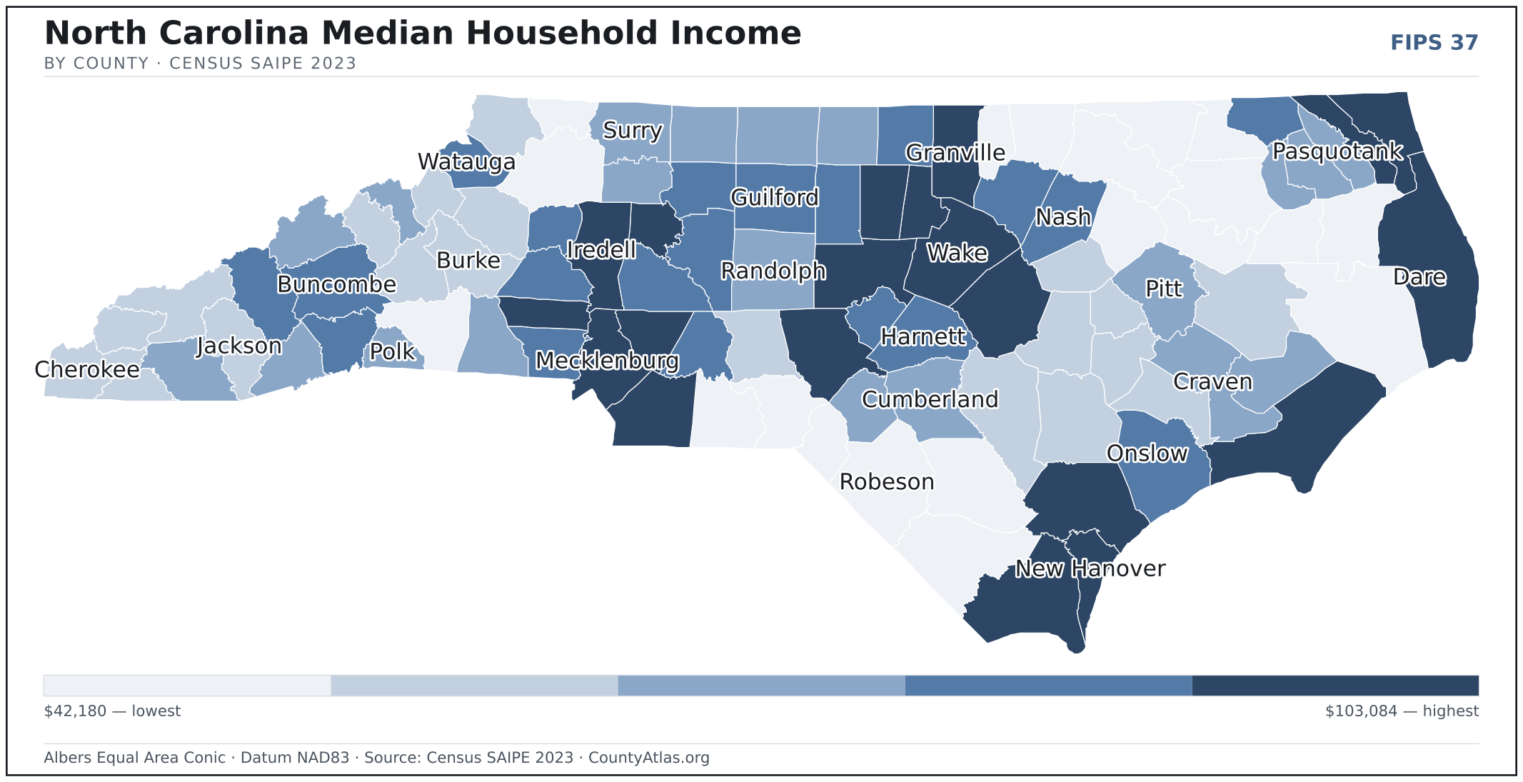
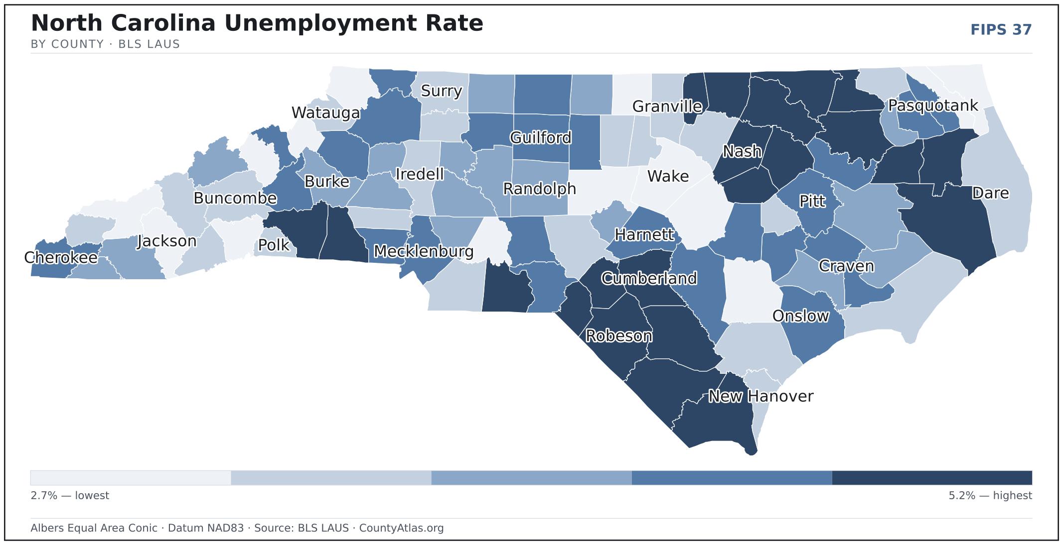
Cities in North Carolina
North Carolina has 552 incorporated cities, towns, and villages. The largest is Charlotte in Mecklenburg County with 886,283 residents. Use the search on the map above to find any city and highlight the county it sits in.
| Charlotte | Mecklenburg County | 886,283 |
| Raleigh | Wake County | 470,763 |
| Greensboro | Guilford County | 298,564 |
| Durham | Durham County | 288,465 |
| Winston-Salem | Forsyth County | 250,887 |
| Fayetteville | Cumberland County | 209,692 |
| Cary (town) | Wake County | 176,686 |
| Wilmington | New Hanover County | 118,578 |
| High Point | Guilford County | 115,263 |
| Concord | Cabarrus County | 106,518 |
| Asheville | Buncombe County | 94,369 |
| Greenville | Pitt County | 88,540 |
| Gastonia | Gaston County | 81,632 |
| Jacksonville | Onslow County | 73,507 |
| Apex (town) | Wake County | 67,765 |
| Huntersville (town) | Mecklenburg County | 62,458 |
| Chapel Hill (town) | Orange County | 59,889 |
| Burlington | Alamance County | 58,599 |
| Kannapolis | Cabarrus County | 56,470 |
| Rocky Mount | Nash County | 54,175 |
| Mooresville (town) | Iredell County | 51,447 |
| Wake Forest (town) | Wake County | 51,199 |
| Wilson | Wilson County | 47,740 |
| Hickory | Catawba County | 43,747 |
| Holly Springs (town) | Wake County | 43,429 |
| Indian Trail (town) | Union County | 41,146 |
| Fuquay-Varina (town) | Wake County | 37,749 |
| Salisbury | Rowan County | 35,730 |
| Monroe | Union County | 35,596 |
| Goldsboro | Wayne County | 33,448 |
| Garner (town) | Wake County | 32,543 |
| Cornelius (town) | Mecklenburg County | 32,009 |
| New Bern | Craven County | 31,563 |
| Sanford | Lee County | 30,833 |
| Morrisville (town) | Wake County | 30,471 |
| Matthews (town) | Mecklenburg County | 29,959 |
| Statesville | Iredell County | 29,161 |
| Clayton (town) | Johnston County | 28,043 |
| Kernersville (town) | Forsyth County | 27,439 |
| Asheboro | Randolph County | 27,353 |
| Thomasville | Davidson County | 27,261 |
| Mint Hill (town) | Mecklenburg County | 26,954 |
| Leland (town) | Brunswick County | 26,307 |
| Shelby | Cleveland County | 21,868 |
| Clemmons (village) | Forsyth County | 21,574 |
| Waxhaw (town) | Union County | 21,565 |
| Carrboro (town) | Orange County | 21,170 |
| Lexington | Davidson County | 19,691 |
| Kinston | Lenoir County | 19,576 |
| Boone (town) | Watauga County | 19,534 |
Showing the 50 most populous — and 502 more. Search the map above for any North Carolina city or village.
A city can span more than one county; each is listed in its primary county — the one its center falls in.
Which North Carolina county is the richest, largest, most crowded? The answers
- North Carolina’s highest median household income is in Wake County ($103,084); the lowest is in Robeson County ($42,180). Census SAIPE 2023
- North Carolina’s most populous county is Wake County (1,190,275); the least populous is Tyrrell County (3,461) — a 344× spread. Census PEP 2023
- North Carolina’s largest county by land area is Robeson County (947 sq mi); the smallest is Chowan County (173 sq mi). Census TIGER
- North Carolina’s highest population density is in Mecklenburg County (2,222/sq mi); the lowest is in Hyde County (8/sq mi). Census PEP 2023 · TIGER
- North Carolina’s highest poverty rate is in Scotland County (28.6%); the lowest is in Wake County (7.2%). Census SAIPE 2023
- In North Carolina, unemployment is highest in Edgecombe County (5.2%) and lowest in Currituck County (2.7%), for May 2026. BLS LAUS
- North Carolina’s highest median age is in Brunswick County (56.1); the lowest is in Onslow County (27.1). Census ACS 2019–2023
- North Carolina’s highest share of bachelor’s degrees is in Orange County (61.8% of adults); the lowest is in Gates County (10.8%). Census ACS 2019–2023
Every figure is a current official estimate from the source named — not a crowd-sourced or copied value. Suppressed estimates (coefficient of variation ≥ 0.30) are omitted, never guessed. See the full methodology.
North Carolina counties: common questions
How many counties are in North Carolina?
North Carolina has 100 counties covering 48,624 sq mi and about 10.8M residents. Every one is on the map above and in the table below.
What is the largest county in North Carolina?
It depends on the measure. By land area it’s Robeson County (947 sq mi); by population it’s Wake County (1,190,275 residents).
What county is Charlotte in?
Charlotte (population 886,283) is in Mecklenburg County. Use the search on the map to find any North Carolina city’s county.
What is the richest county in North Carolina?
By median household income, Wake County is the richest at $103,084; the poorest is Robeson County at $42,180 (Census SAIPE 2023).
What is the most populous county in North Carolina?
Wake County, with 1,190,275 residents — about 11.0% of North Carolina’s people, and 344× the least populous, Tyrrell County (3,461).
Sources & vintages
- Population — PEP Vintage 2023 (July 1, 2023) — pep/charv
- Median household income & poverty — SAIPE 2023
- Unemployment — BLS LAUS May 2026 (preliminary)
- Geometry & boundaries — Census TIGERweb
- Cities & city population — Census TIGERweb Incorporated Places + ACS 5-year 2019–2023
Data current through .