CountyAtlas Pennsylvania
Pennsylvania County Map with Cities — All 67 Counties
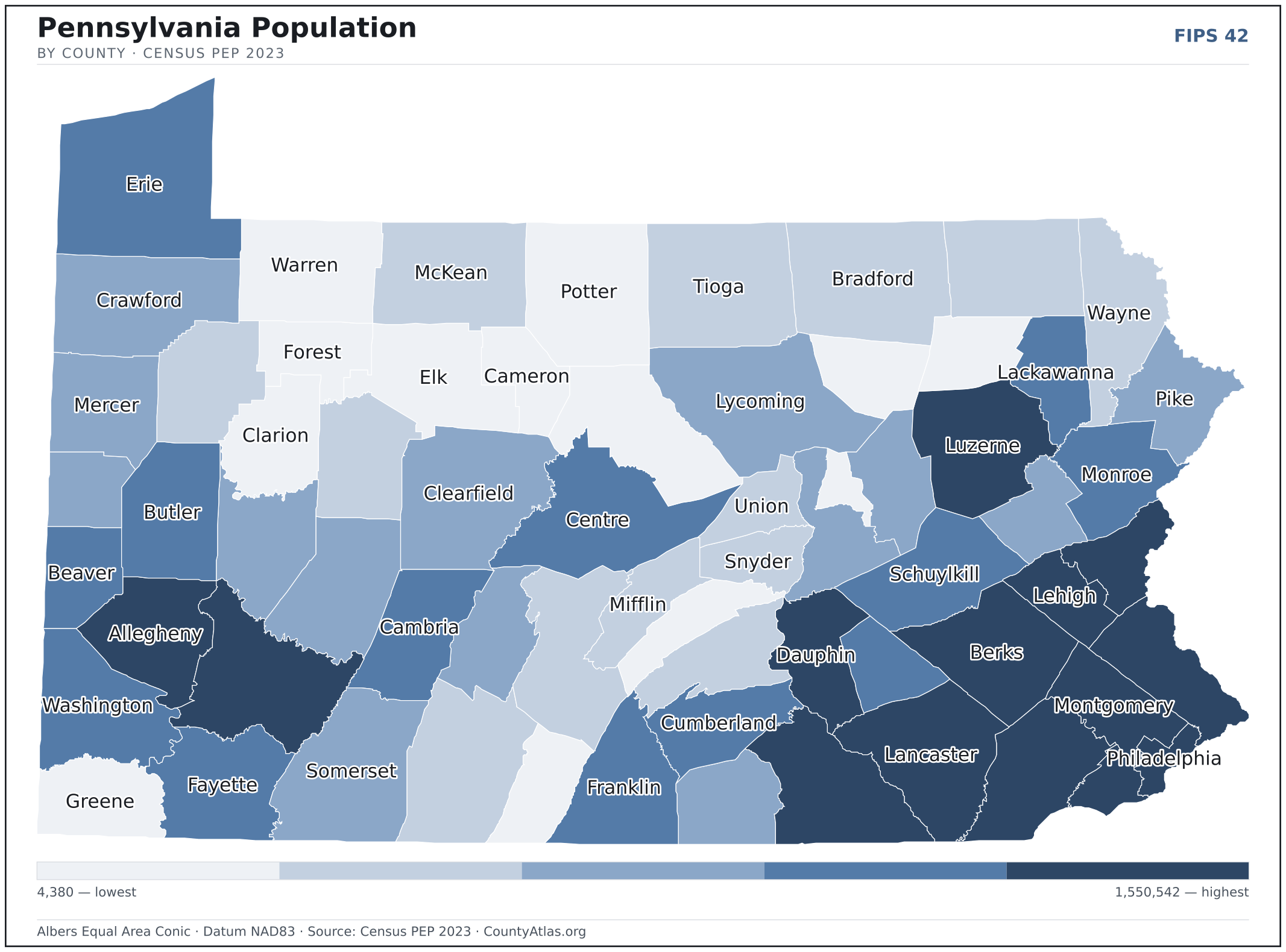
All 67 of Pennsylvania's counties, mapped from official U.S. Census boundaries with population, income, and unemployment for every one. Colour the map by any measure, tap a county for its data, or download a print-ready copy.
Tap any county for its population, income, and more.
Pennsylvania at a glance
- Scale. Pennsylvania is divided into 67 counties across 44,742 sq mi of land — an average of 668 sq mi each. Census TIGER
- People. Its counties are home to 12,961,683 residents — an average of 193,458 each, or 290 per square mile statewide. Census PEP 2023
- Water. Another 1,312 sq mi is water — 2.8% of the state’s area, led by Erie County. Census TIGER
Pennsylvania’s 67 counties, by the numbers
Every county’s population, median household income, unemployment, density, and land area — sortable by any column, so you can find yours or rank by what matters to you. A few patterns run through the data:
- Concentrated. Half of Pennsylvania’s 12,961,683 residents live in just 9 of 67 counties, and the five largest hold 37.5% of the total. Census PEP 2023
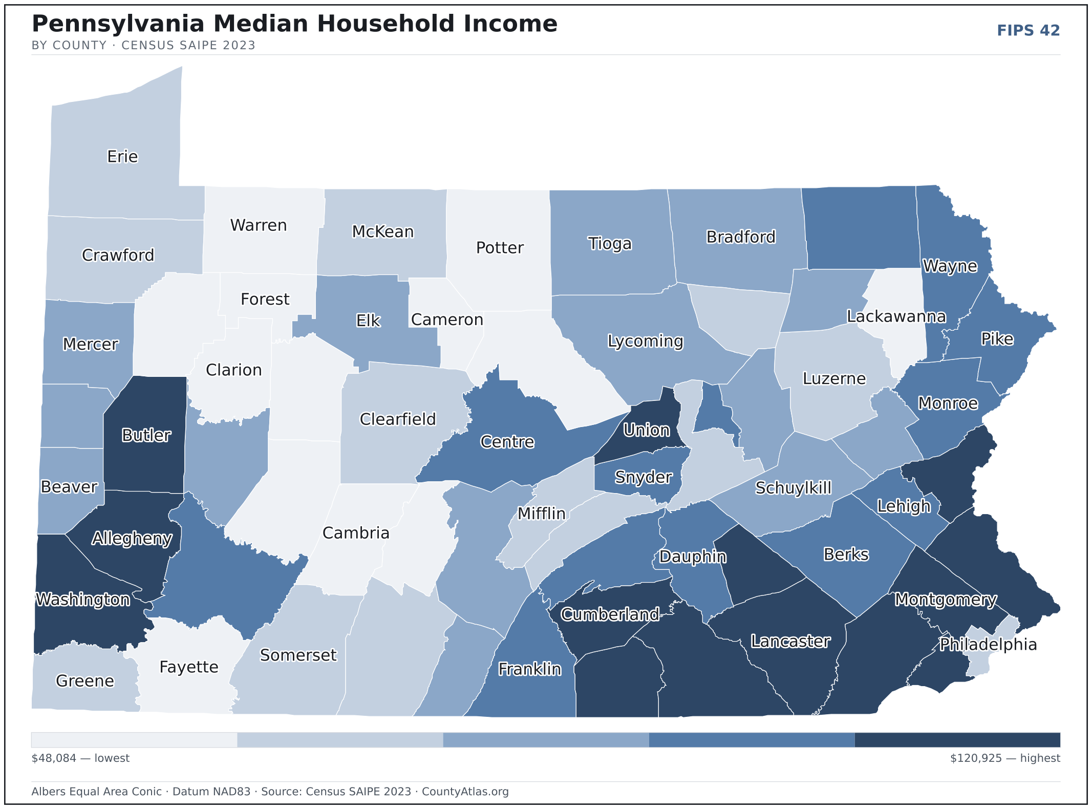
- Income tracks poverty. The gap from richest to poorest runs 2.5×, and the 10 highest-income counties average 8.6% in poverty against 16.5% for the 10 lowest. Census SAIPE 2023
- Mostly small. Half of Pennsylvania’s counties have fewer than 83,094 residents, and half report a median household income below $62,918 — a few metros lift the statewide totals well above both. Census PEP 2023 · SAIPE 2023
- Lopsided density. Only 19 of 67 counties are denser than Pennsylvania’s statewide average of 290 people per square mile — the rest are more rural. Census PEP 2023 · TIGER
| Adams County | 106,748 | $77,041 | 3.4% | 206/sq mi | 519 sq mi | Gettysburg |
| Allegheny County | 1,224,825 | $76,488 | 3.7% | 1,678/sq mi | 730 sq mi | Pittsburgh |
| Armstrong County | 64,074 | $61,521 | 3.8% | 98/sq mi | 653 sq mi | Kittanning |
| Beaver County | 165,631 | $66,846 | 4.0% | 381/sq mi | 435 sq mi | Beaver |
| Bedford County | 47,350 | $58,319 | 3.5% | 47/sq mi | 1,012 sq mi | Bedford |
| Berks County | 432,821 | $75,655 | 4.2% | 505/sq mi | 856 sq mi | Reading |
| Blair County | 120,273 | $54,909 | 3.6% | 229/sq mi | 525 sq mi | Hollidaysburg |
| Bradford County | 59,695 | $61,270 | 3.8% | 52/sq mi | 1,147 sq mi | Towanda |
| Bucks County | 645,984 | $107,006 | 3.6% | 1,069/sq mi | 604 sq mi | Doylestown |
| Butler County | 198,413 | $80,978 | 3.4% | 251/sq mi | 789 sq mi | Butler |
| Cambria County | 130,668 | $55,592 | 4.3% | 190/sq mi | 688 sq mi | Ebensburg |
| Cameron County | 4,380 | $51,035 | 5.1% | 11/sq mi | 396 sq mi | Emporium |
| Carbon County | 65,458 | $64,894 | 4.4% | 172/sq mi | 381 sq mi | Jim Thorpe |
| Centre County | 157,795 | $69,999 | 3.2% | 143/sq mi | 1,107 sq mi | Bellefonte |
| Chester County | 549,784 | $120,925 | 3.1% | 733/sq mi | 751 sq mi | West Chester |
| Clarion County | 36,970 | $56,911 | 4.1% | 62/sq mi | 601 sq mi | Clarion |
| Clearfield County | 77,090 | $60,213 | 3.8% | 67/sq mi | 1,145 sq mi | Clearfield |
| Clinton County | 37,607 | $55,946 | 4.0% | 42/sq mi | 890 sq mi | Lock Haven |
| Columbia County | 65,439 | $63,605 | 4.4% | 135/sq mi | 483 sq mi | Bloomsburg |
| Crawford County | 82,001 | $60,545 | 3.8% | 81/sq mi | 1,012 sq mi | Meadville |
| Cumberland County | 270,738 | $82,507 | 3.3% | 496/sq mi | 545 sq mi | Carlisle |
| Dauphin County | 289,234 | $73,929 | 4.0% | 551/sq mi | 525 sq mi | Harrisburg |
| Delaware County | 576,720 | $84,180 | 4.0% | 3,138/sq mi | 184 sq mi | Media |
| Elk County | 30,198 | $66,378 | 3.6% | 37/sq mi | 827 sq mi | Ridgway |
| Erie County | 267,571 | $60,721 | 4.0% | 335/sq mi | 799 sq mi | Erie |
| Fayette County | 123,915 | $54,030 | 4.6% | 157/sq mi | 791 sq mi | Uniontown |
| Forest County | 6,449 | $48,084 | 4.6% | 15/sq mi | 427 sq mi | Tionesta |
| Franklin County | 157,854 | $75,532 | 3.6% | 204/sq mi | 772 sq mi | Chambersburg |
| Fulton County | 14,468 | $62,044 | 3.6% | 33/sq mi | 438 sq mi | McConnellsburg |
| Greene County | 34,357 | $60,627 | 4.3% | 60/sq mi | 576 sq mi | Waynesburg |
| Huntingdon County | 43,514 | $61,812 | 3.8% | 50/sq mi | 875 sq mi | Huntingdon |
| Indiana County | 83,094 | $57,110 | 4.1% | 100/sq mi | 827 sq mi | Indiana |
| Jefferson County | 43,612 | $49,430 | 3.9% | 67/sq mi | 652 sq mi | Brookville |
| Juniata County | 23,243 | $59,755 | 3.6% | 59/sq mi | 391 sq mi | Mifflintown |
| Lackawanna County | 216,123 | $57,570 | 4.3% | 471/sq mi | 459 sq mi | Scranton |
| Lancaster County | 558,589 | $80,210 | 3.1% | 592/sq mi | 944 sq mi | Lancaster |
| Lawrence County | 84,472 | $61,686 | 4.0% | 236/sq mi | 357 sq mi | New Castle |
| Lebanon County | 144,252 | $78,284 | 3.6% | 399/sq mi | 362 sq mi | Lebanon |
| Lehigh County | 377,754 | $76,270 | 4.5% | 1,094/sq mi | 345 sq mi | Allentown |
| Luzerne County | 327,388 | $60,165 | 5.0% | 368/sq mi | 890 sq mi | Wilkes-Barre |
| Lycoming County | 112,724 | $62,063 | 3.9% | 92/sq mi | 1,229 sq mi | Williamsport |
| McKean County | 39,519 | $59,522 | 4.3% | 40/sq mi | 980 sq mi | Smethport |
| Mercer County | 108,503 | $61,530 | 4.2% | 161/sq mi | 673 sq mi | Mercer |
| Mifflin County | 45,922 | $58,758 | 3.1% | 112/sq mi | 411 sq mi | Lewistown |
| Monroe County | 166,053 | $73,408 | 4.8% | 273/sq mi | 608 sq mi | Stroudsburg |
| Montgomery County | 868,742 | $106,780 | 3.3% | 1,799/sq mi | 483 sq mi | Norristown |
| Montour County | 17,860 | $73,087 | 3.1% | 137/sq mi | 130 sq mi | Danville |
| Northampton County | 319,091 | $84,051 | 4.1% | 863/sq mi | 370 sq mi | Easton |
| Northumberland County | 90,120 | $58,834 | 3.8% | 197/sq mi | 458 sq mi | Sunbury |
| Perry County | 46,083 | $71,392 | 3.3% | 84/sq mi | 551 sq mi | Bloomfield |
| Philadelphia County | 1,550,542 | $60,196 | 5.0% | 11,543/sq mi | 134 sq mi | Philadelphia |
| Pike County | 61,247 | $71,698 | 4.6% | 112/sq mi | 545 sq mi | Milford |
| Potter County | 15,999 | $57,850 | 4.9% | 15/sq mi | 1,081 sq mi | Coudersport |
| Schuylkill County | 143,786 | $63,479 | 4.6% | 185/sq mi | 779 sq mi | Pottsville |
| Snyder County | 39,717 | $68,089 | 3.4% | 121/sq mi | 329 sq mi | Middleburg |
| Somerset County | 72,197 | $59,562 | 3.9% | 67/sq mi | 1,075 sq mi | Somerset |
| Sullivan County | 5,834 | $59,604 | 3.3% | 13/sq mi | 450 sq mi | Laporte |
| Susquehanna County | 38,109 | $70,021 | 3.8% | 46/sq mi | 823 sq mi | Montrose |
| Tioga County | 40,840 | $62,918 | 4.2% | 36/sq mi | 1,134 sq mi | Wellsboro |
| Union County | 42,042 | $82,708 | 3.8% | 133/sq mi | 316 sq mi | Lewisburg |
| Venango County | 49,431 | $57,256 | 4.2% | 73/sq mi | 674 sq mi | Franklin |
| Warren County | 37,572 | $57,469 | 3.8% | 42/sq mi | 884 sq mi | Warren |
| Washington County | 210,232 | $76,957 | 3.7% | 245/sq mi | 857 sq mi | Washington |
| Wayne County | 51,262 | $68,429 | 3.8% | 71/sq mi | 726 sq mi | Honesdale |
| Westmoreland County | 351,163 | $70,985 | 3.6% | 342/sq mi | 1,028 sq mi | Greensburg |
| Wyoming County | 25,902 | $66,855 | 3.9% | 65/sq mi | 397 sq mi | Tunkhannock |
| York County | 464,640 | $81,213 | 3.7% | 514/sq mi | 904 sq mi | York |
All 67 counties, sortable by any column — click a heading. A suppressed estimate (coefficient of variation ≥ 0.30) shows a marker, never a guess. County seats are from Wikidata (CC0), each validated to a Census place inside its county; a county with no validated seat is left blank. See the methodology.
Download & print this Pennsylvania map
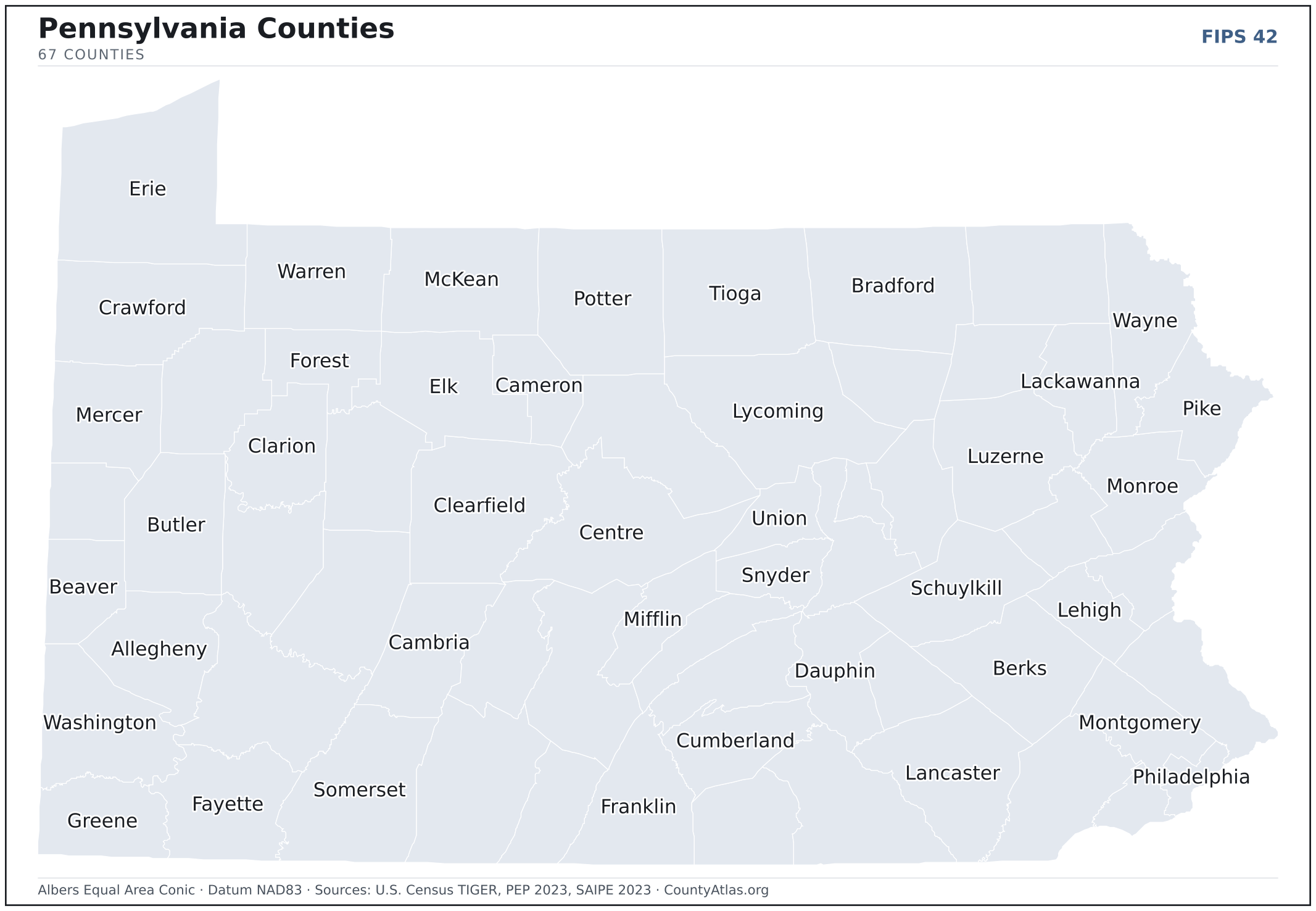
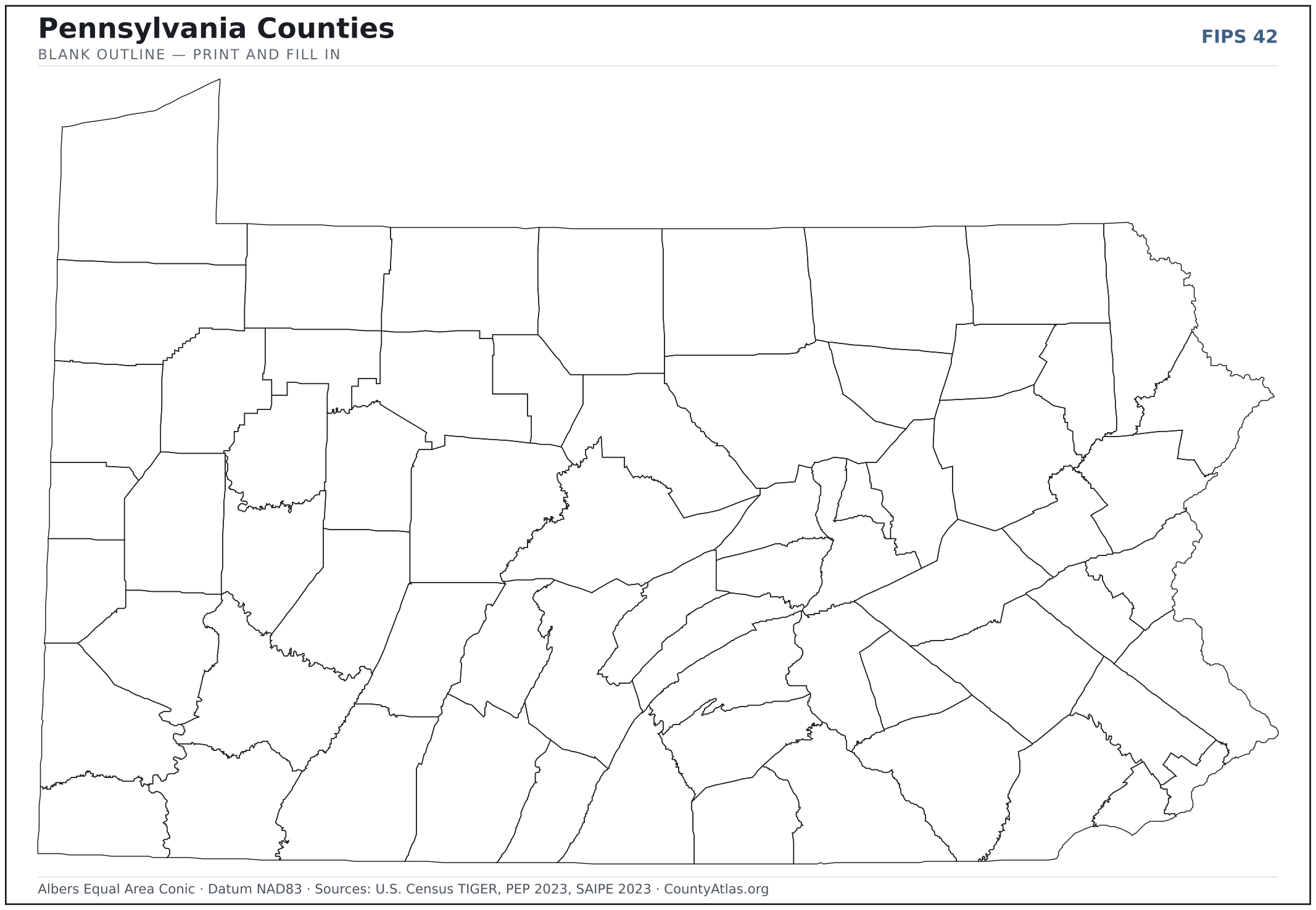
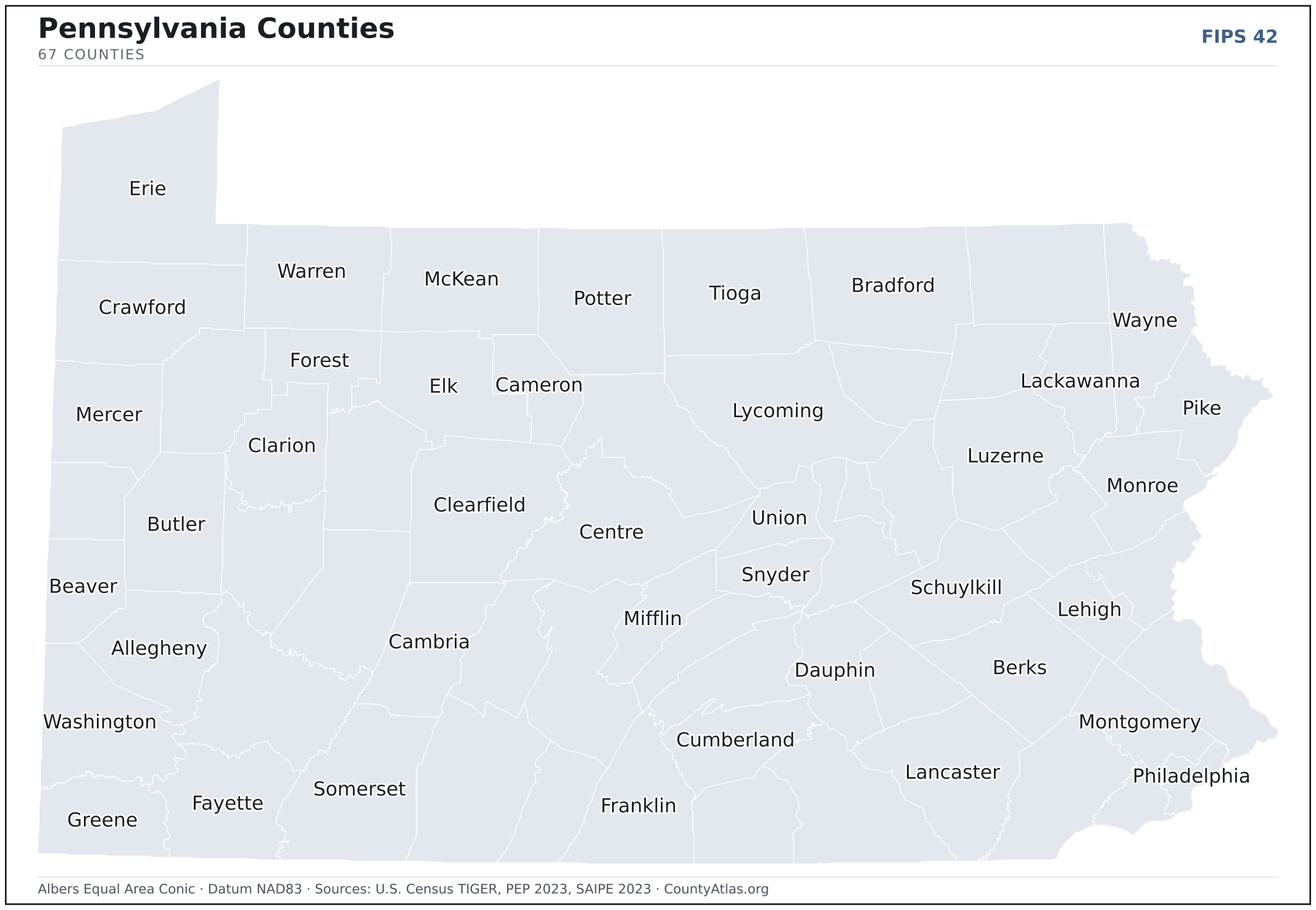
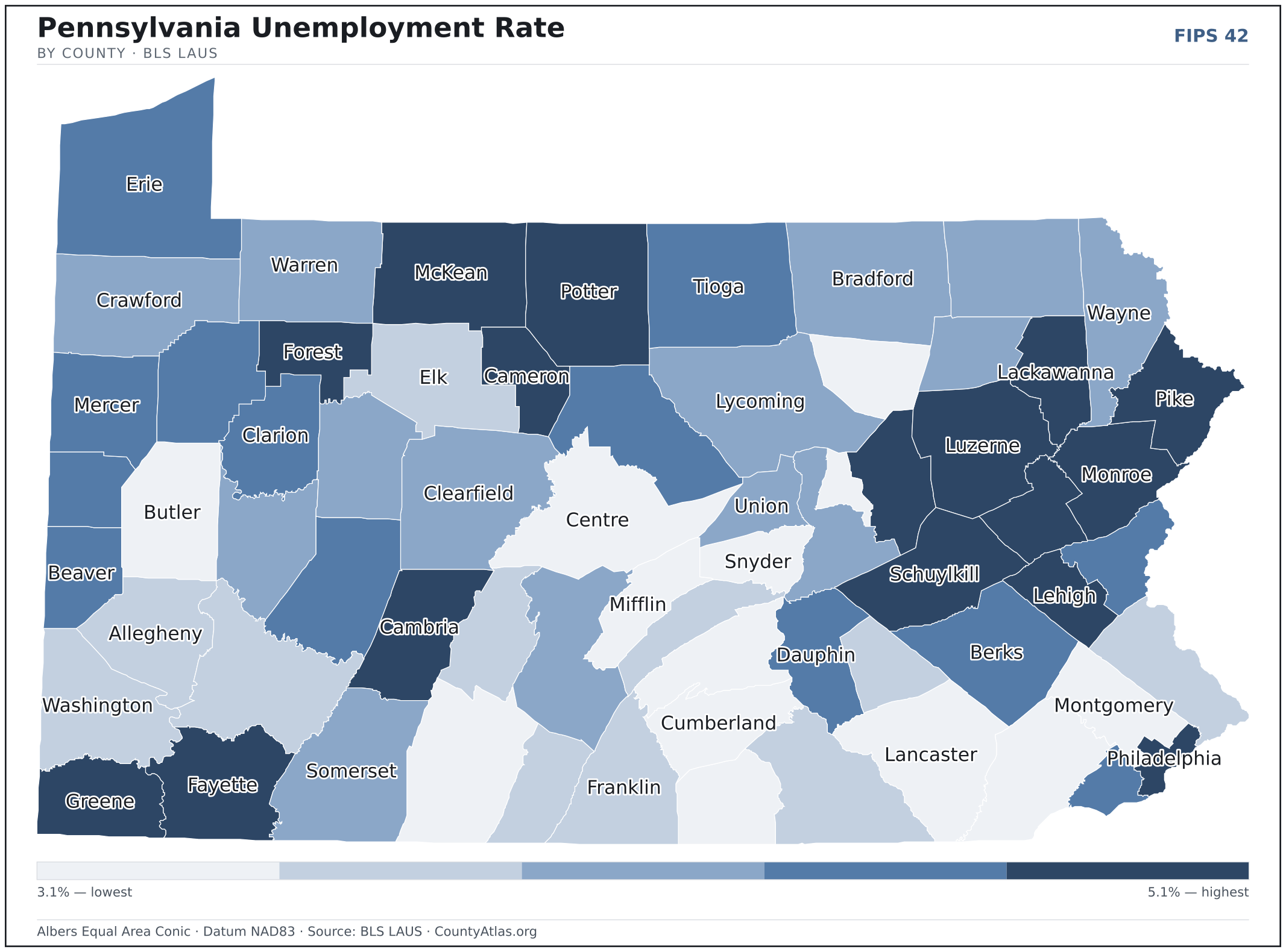
Pennsylvania maps, coloured by the data
Cities in Pennsylvania
Pennsylvania has 1,014 incorporated cities, boroughs, municipalities, and towns. The largest is Philadelphia in Philadelphia County with 1,582,432 residents. Use the search on the map above to find any city and highlight the county it sits in.
| Philadelphia | Philadelphia County | 1,582,432 |
| Pittsburgh | Allegheny County | 303,620 |
| Allentown | Lehigh County | 125,320 |
| Reading | Berks County | 94,836 |
| Erie | Erie County | 94,156 |
| Bethlehem | Northampton County | 77,069 |
| Scranton | Lackawanna County | 76,074 |
| Lancaster | Lancaster County | 57,683 |
| Harrisburg | Dauphin County | 50,092 |
| York | York County | 44,830 |
| Wilkes-Barre | Luzerne County | 44,217 |
| Altoona | Blair County | 43,508 |
| State College (borough) | Centre County | 40,669 |
| Norristown (borough) | Montgomery County | 35,782 |
| Chester | Delaware County | 33,209 |
| Bethel Park (municipality) | Allegheny County | 33,070 |
| Hazleton | Luzerne County | 29,886 |
| Easton | Northampton County | 29,079 |
| Monroeville (municipality) | Allegheny County | 28,383 |
| Williamsport | Lycoming County | 27,629 |
| Plum (borough) | Allegheny County | 26,873 |
| Lebanon | Lebanon County | 26,600 |
| Pottstown (borough) | Montgomery County | 23,392 |
| Chambersburg (borough) | Franklin County | 22,051 |
| New Castle | Lawrence County | 21,727 |
| Carlisle (borough) | Cumberland County | 21,335 |
| Baldwin (borough) | Allegheny County | 21,159 |
| Murrysville (municipality) | Westmoreland County | 20,839 |
| West Mifflin (borough) | Allegheny County | 19,338 |
| West Chester (borough) | Chester County | 19,235 |
| Phoenixville (borough) | Chester County | 19,062 |
| Lansdale (borough) | Montgomery County | 18,865 |
| Johnstown | Cambria County | 18,245 |
| McKeesport | Allegheny County | 17,520 |
| Hanover (borough) | York County | 16,483 |
| Hermitage | Mercer County | 16,132 |
| Franklin Park (borough) | Allegheny County | 15,273 |
| Whitehall (borough) | Allegheny County | 14,863 |
| Greensburg | Westmoreland County | 14,777 |
| Indiana (borough) | Indiana County | 14,170 |
| Wilkinsburg (borough) | Allegheny County | 14,165 |
| Dunmore (borough) | Lackawanna County | 14,123 |
| Ephrata (borough) | Lancaster County | 13,729 |
| Pottsville | Schuylkill County | 13,374 |
| Washington | Washington County | 13,361 |
| Kingston (borough) | Luzerne County | 13,333 |
| Coatesville | Chester County | 13,323 |
| Butler | Butler County | 13,306 |
| Sharon | Mercer County | 13,019 |
| Bloomsburg (town) | Columbia County | 12,906 |
Showing the 50 most populous — and 964 more. Search the map above for any Pennsylvania city or village.
A city can span more than one county; each is listed in its primary county — the one its center falls in.
Which Pennsylvania county is the richest, largest, most crowded? The answers
- Pennsylvania’s highest median household income is in Chester County ($120,925); the lowest is in Forest County ($48,084). Census SAIPE 2023
- Pennsylvania’s most populous county is Philadelphia County (1,550,542); the least populous is Cameron County (4,380) — a 354× spread. Census PEP 2023
- Pennsylvania’s largest county by land area is Lycoming County (1,229 sq mi); the smallest is Montour County (130 sq mi). Census TIGER
- Pennsylvania’s highest population density is in Philadelphia County (11,543/sq mi); the lowest is in Cameron County (11/sq mi). Census PEP 2023 · TIGER
- Pennsylvania’s highest poverty rate is in Forest County (24.8%); the lowest is in Chester County (6.2%). Census SAIPE 2023
- In Pennsylvania, unemployment is highest in Cameron County (5.1%) and lowest in Chester County (3.1%), for May 2026. BLS LAUS
- Pennsylvania’s highest median age is in Sullivan County (56.1); the lowest is in Centre County (33.8). Census ACS 2019–2023
- Pennsylvania’s highest share of bachelor’s degrees is in Chester County (56.6% of adults); the lowest is in Cameron County (11.3%). Census ACS 2019–2023
Every figure is a current official estimate from the source named — not a crowd-sourced or copied value. Suppressed estimates (coefficient of variation ≥ 0.30) are omitted, never guessed. See the full methodology.
Pennsylvania counties: common questions
How many counties are in Pennsylvania?
Pennsylvania has 67 counties covering 44,742 sq mi and about 13.0M residents. Every one is on the map above and in the table below.
What is the largest county in Pennsylvania?
It depends on the measure. By land area it’s Lycoming County (1,229 sq mi); by population it’s Philadelphia County (1,550,542 residents).
What county is Philadelphia in?
Philadelphia (population 1,582,432) is in Philadelphia County. Use the search on the map to find any Pennsylvania city’s county.
What is the richest county in Pennsylvania?
By median household income, Chester County is the richest at $120,925; the poorest is Forest County at $48,084 (Census SAIPE 2023).
What is the most populous county in Pennsylvania?
Philadelphia County, with 1,550,542 residents — about 12.0% of Pennsylvania’s people, and 354× the least populous, Cameron County (4,380).
Sources & vintages
- Population — PEP Vintage 2023 (July 1, 2023) — pep/charv
- Median household income & poverty — SAIPE 2023
- Unemployment — BLS LAUS May 2026 (preliminary)
- Geometry & boundaries — Census TIGERweb
- Cities & city population — Census TIGERweb Incorporated Places + ACS 5-year 2019–2023
Data current through .