CountyAtlas Virginia
Virginia County Map — 95 Counties and 38 Independent Cities
All 133 of Virginia's counties, mapped from official U.S. Census boundaries with population, income, and unemployment for every one. Colour the map by any measure, tap a county for its data, or download a print-ready copy.
Tap any county for its population, income, and more.
Virginia at a glance
- Scale. Virginia is divided into 133 counties and independent cities across 39,481 sq mi of land — an average of 297 sq mi each. Census TIGER
- People. Its counties and independent cities are home to 8,715,698 residents — an average of 65,532 each, or 221 per square mile statewide. Census PEP 2023
- Water. Another 3,293 sq mi is water — 7.7% of the state’s area, led by Accomack County. Census TIGER
Virginia’s 95 counties and 38 independent cities, by the numbers
Every county or independent city’s population, median household income, unemployment, density, and land area — sortable by any column, so you can find yours or rank by what matters to you. A few patterns run through the data:
- Concentrated. Half of Virginia’s 8,715,698 residents live in just 11 of 133 counties and independent cities, and the five largest hold 33.3% of the total. Census PEP 2023
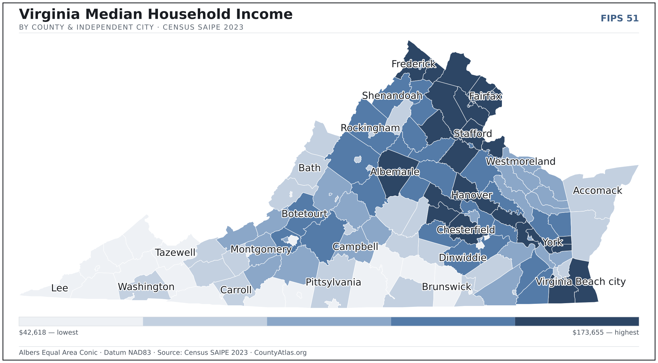
- Income tracks poverty. The gap from richest to poorest runs 4.1×, and the 10 highest-income counties and independent cities average 5.9% in poverty against 21.4% for the 10 lowest. Census SAIPE 2023
- Mostly small. Half of Virginia’s counties and independent cities have fewer than 27,197 residents, and half report a median household income below $64,903 — a few metros lift the statewide totals well above both. Census PEP 2023 · SAIPE 2023
- Lopsided density. Only 52 of 133 counties and independent cities are denser than Virginia’s statewide average of 221 people per square mile — the rest are more rural. Census PEP 2023 · TIGER
| Accomack County | 33,239 | $56,039 | 4.2% | 74/sq mi | 449 sq mi | Accomac |
| Albemarle County | 115,676 | $102,750 | 3.5% | 161/sq mi | 720 sq mi | Charlottesville |
| Alexandria city | 155,230 | $109,902 | 2.9% | 10,390/sq mi | 15 sq mi | — |
| Alleghany County | 14,595 | $58,215 | 4.0% | 33/sq mi | 447 sq mi | Covington |
| Amelia County | 13,480 | $71,112 | 3.3% | 38/sq mi | 358 sq mi | Amelia Court House |
| Amherst County | 31,396 | $61,499 | 3.4% | 66/sq mi | 474 sq mi | Amherst |
| Appomattox County | 16,864 | $64,701 | 3.3% | 50/sq mi | 334 sq mi | Appomattox |
| Arlington County | 234,162 | $138,416 | 2.8% | 9,006/sq mi | 26 sq mi | — |
| Augusta County | 78,247 | $72,831 | 2.9% | 81/sq mi | 967 sq mi | Staunton |
| Bath County | 4,051 | $60,234 | 2.5% | 8/sq mi | 529 sq mi | Warm Springs |
| Bedford County | 81,525 | $72,742 | 3.5% | 107/sq mi | 760 sq mi | Bedford |
| Bland County | 6,179 | $57,748 | 3.4% | 17/sq mi | 358 sq mi | Bland |
| Botetourt County | 34,125 | $84,395 | 3.2% | 63/sq mi | 541 sq mi | Fincastle |
| Bristol city | 16,807 | $45,240 | 3.8% | 1,306/sq mi | 13 sq mi | — |
| Brunswick County | 15,749 | $51,441 | 4.1% | 28/sq mi | 566 sq mi | Lawrenceville |
| Buchanan County | 19,087 | $43,446 | 6.4% | 38/sq mi | 503 sq mi | Grundy |
| Buckingham County | 16,978 | $57,701 | 3.6% | 29/sq mi | 580 sq mi | Buckingham |
| Buena Vista city | 6,566 | $53,778 | 4.1% | 1,020/sq mi | 6 sq mi | — |
| Campbell County | 55,270 | $69,570 | 3.4% | 110/sq mi | 503 sq mi | Rustburg |
| Caroline County | 32,640 | $80,562 | 3.5% | 62/sq mi | 527 sq mi | Bowling Green |
| Carroll County | 29,239 | $53,694 | 3.8% | 62/sq mi | 475 sq mi | Hillsville |
| Charles City County | 6,610 | $73,068 | 3.7% | 36/sq mi | 183 sq mi | Charles City |
| Charlotte County | 11,336 | $50,878 | 3.7% | 24/sq mi | 475 sq mi | Charlotte Court House |
| Charlottesville city | 44,983 | $72,542 | 3.0% | 4,389/sq mi | 10 sq mi | — |
| Chesapeake city | 253,886 | $91,582 | 3.6% | 750/sq mi | 338 sq mi | — |
| Chesterfield County | 383,876 | $99,401 | 3.5% | 906/sq mi | 424 sq mi | Chesterfield Court House |
| Clarke County | 15,466 | $101,205 | 3.3% | 88/sq mi | 176 sq mi | Berryville |
| Colonial Heights city | 18,393 | $70,161 | 3.7% | 2,446/sq mi | 8 sq mi | — |
| Covington city | 5,545 | $49,519 | 4.5% | 1,014/sq mi | 5 sq mi | — |
| Craig County | 4,843 | $61,531 | 4.2% | 15/sq mi | 328 sq mi | New Castle |
| Culpeper County | 54,973 | $90,465 | 3.3% | 145/sq mi | 379 sq mi | Culpeper |
| Cumberland County | 9,878 | $55,713 | 3.0% | 33/sq mi | 297 sq mi | Cumberland |
| Danville city | 41,837 | $45,423 | 5.6% | 978/sq mi | 43 sq mi | — |
| Dickenson County | 13,640 | $48,157 | 4.8% | 41/sq mi | 330 sq mi | Clintwood |
| Dinwiddie County | 28,343 | $83,334 | 3.6% | 56/sq mi | 504 sq mi | Dinwiddie |
| Emporia city | 5,463 | $45,894 | 7.3% | 824/sq mi | 7 sq mi | — |
| Essex County | 10,598 | $62,679 | 4.0% | 41/sq mi | 257 sq mi | Tappahannock |
| Fairfax city | 25,144 | $119,079 | 3.0% | 4,029/sq mi | 6 sq mi | — |
| Fairfax County | 1,141,878 | $141,353 | 3.4% | 2,920/sq mi | 391 sq mi | Fairfax |
| Falls Church city | 14,685 | $145,755 | 3.3% | 7,163/sq mi | 2 sq mi | — |
| Fauquier County | 75,165 | $111,254 | 3.0% | 116/sq mi | 648 sq mi | Warrenton |
| Floyd County | 15,679 | $61,164 | 3.2% | 41/sq mi | 381 sq mi | Floyd |
| Fluvanna County | 28,462 | $86,462 | 3.1% | 99/sq mi | 286 sq mi | Palmyra |
| Franklin city | 8,339 | $53,310 | 4.8% | 1,007/sq mi | 8 sq mi | — |
| Franklin County | 55,549 | $63,692 | 3.7% | 80/sq mi | 691 sq mi | Rocky Mount |
| Frederick County | 95,994 | $92,108 | 3.3% | 232/sq mi | 413 sq mi | Winchester |
| Fredericksburg city | 28,928 | $75,915 | 4.0% | 2,768/sq mi | 10 sq mi | — |
| Galax city | 6,717 | $46,891 | 3.9% | 815/sq mi | 8 sq mi | — |
| Giles County | 16,457 | $63,384 | 3.6% | 46/sq mi | 357 sq mi | Pearisburg |
| Gloucester County | 40,057 | $79,016 | 3.1% | 184/sq mi | 218 sq mi | Gloucester Courthouse |
| Goochland County | 27,197 | $122,002 | 3.2% | 96/sq mi | 283 sq mi | Goochland |
| Grayson County | 15,285 | $42,665 | 3.4% | 35/sq mi | 442 sq mi | Independence |
| Greene County | 21,301 | $83,927 | 2.9% | 137/sq mi | 156 sq mi | Stanardsville |
| Greensville County | 11,133 | $53,908 | 5.4% | 38/sq mi | 295 sq mi | Emporia |
| Halifax County | 33,432 | $50,813 | 4.5% | 41/sq mi | 818 sq mi | Halifax |
| Hampton city | 137,098 | $67,764 | 4.1% | 2,664/sq mi | 51 sq mi | — |
| Hanover County | 114,148 | $111,485 | 3.1% | 244/sq mi | 468 sq mi | Hanover Courthouse |
| Harrisonburg city | 51,082 | $58,597 | 4.5% | 2,946/sq mi | 17 sq mi | — |
| Henrico County | 334,760 | $85,877 | 3.4% | 1,433/sq mi | 234 sq mi | — |
| Henry County | 49,702 | $51,959 | 5.0% | 130/sq mi | 382 sq mi | Martinsville |
| Highland County | 2,339 | $56,021 | 3.4% | 6/sq mi | 415 sq mi | Monterey |
| Hopewell city | 22,752 | $49,111 | 4.8% | 2,198/sq mi | 10 sq mi | — |
| Isle of Wight County | 40,711 | $88,536 | 3.4% | 129/sq mi | 316 sq mi | — |
| James City County | 82,654 | $109,735 | 3.5% | 581/sq mi | 142 sq mi | — |
| King and Queen County | 6,720 | $66,578 | 3.0% | 21/sq mi | 315 sq mi | King and Queen Court House |
| King George County | 28,568 | $101,323 | 3.5% | 159/sq mi | 180 sq mi | King George |
| King William County | 19,030 | $88,124 | 3.0% | 69/sq mi | 274 sq mi | King William |
| Lancaster County | 10,859 | $66,220 | 4.7% | 81/sq mi | 133 sq mi | Lancaster |
| Lee County | 21,745 | $44,110 | 4.6% | 50/sq mi | 435 sq mi | Jonesville |
| Lexington city | 7,528 | $62,342 | 6.9% | 3,011/sq mi | 3 sq mi | — |
| Loudoun County | 436,347 | $173,655 | 3.4% | 846/sq mi | 516 sq mi | Leesburg |
| Louisa County | 41,037 | $79,459 | 3.6% | 83/sq mi | 495 sq mi | Louisa |
| Lunenburg County | 12,038 | $51,013 | 4.3% | 28/sq mi | 432 sq mi | Lunenburg |
| Lynchburg city | 79,535 | $58,962 | 4.8% | 1,626/sq mi | 49 sq mi | — |
| Madison County | 14,128 | $76,864 | 3.1% | 44/sq mi | 321 sq mi | Madison |
| Manassas city | 42,696 | $92,198 | 3.2% | 4,339/sq mi | 10 sq mi | — |
| Manassas Park city | 16,361 | $92,611 | 3.2% | 5,400/sq mi | 3 sq mi | — |
| Martinsville city | 13,763 | $44,547 | 5.2% | 1,256/sq mi | 11 sq mi | — |
| Mathews County | 8,514 | $73,034 | 3.5% | 99/sq mi | 86 sq mi | Mathews |
| Mecklenburg County | 30,648 | $53,288 | 3.8% | 49/sq mi | 625 sq mi | Boydton |
| Middlesex County | 10,924 | $67,586 | 3.3% | 84/sq mi | 130 sq mi | Saluda |
| Montgomery County | 98,666 | $67,620 | 4.5% | 255/sq mi | 387 sq mi | Christiansburg |
| Nelson County | 14,705 | $77,049 | 3.1% | 31/sq mi | 471 sq mi | Lovingston |
| New Kent County | 26,134 | $115,854 | 3.0% | 124/sq mi | 210 sq mi | New Kent |
| Newport News city | 183,118 | $63,911 | 4.0% | 2,654/sq mi | 69 sq mi | — |
| Norfolk city | 230,930 | $61,098 | 4.1% | 4,335/sq mi | 53 sq mi | — |
| Northampton County | 12,021 | $53,822 | 4.0% | 57/sq mi | 212 sq mi | Eastville |
| Northumberland County | 12,391 | $69,662 | 5.3% | 65/sq mi | 191 sq mi | Heathsville |
| Norton city | 3,492 | $42,618 | 4.2% | 467/sq mi | 7 sq mi | — |
| Nottoway County | 15,566 | $58,168 | 3.9% | 50/sq mi | 312 sq mi | Nottoway |
| Orange County | 38,574 | $82,738 | 3.5% | 113/sq mi | 341 sq mi | Orange |
| Page County | 23,741 | $57,960 | 3.6% | 77/sq mi | 310 sq mi | Luray |
| Patrick County | 17,509 | $51,200 | 3.9% | 36/sq mi | 483 sq mi | Stuart |
| Petersburg city | 33,309 | $46,216 | 5.0% | 1,466/sq mi | 23 sq mi | — |
| Pittsylvania County | 59,571 | $54,627 | 3.9% | 61/sq mi | 969 sq mi | Chatham |
| Poquoson city | 12,635 | $108,161 | 3.2% | 823/sq mi | 15 sq mi | — |
| Portsmouth city | 96,793 | $57,012 | 4.4% | 2,907/sq mi | 33 sq mi | — |
| Powhatan County | 32,105 | $100,814 | 2.9% | 123/sq mi | 260 sq mi | Powhatan |
| Prince Edward County | 22,049 | $55,264 | 5.5% | 63/sq mi | 350 sq mi | Farmville |
| Prince George County | 42,871 | $82,207 | 2.9% | 162/sq mi | 265 sq mi | Prince George |
| Prince William County | 489,640 | $128,758 | 3.5% | 1,460/sq mi | 335 sq mi | Manassas |
| Pulaski County | 33,655 | $59,839 | 3.8% | 105/sq mi | 320 sq mi | Pulaski |
| Radford city | 16,971 | $47,325 | 5.6% | 1,753/sq mi | 10 sq mi | — |
| Rappahannock County | 7,414 | $88,237 | 3.0% | 28/sq mi | 266 sq mi | Washington |
| Richmond city | 229,247 | $64,903 | 3.9% | 3,825/sq mi | 60 sq mi | — |
| Richmond County | 9,184 | $61,655 | 4.0% | 48/sq mi | 191 sq mi | Warsaw |
| Roanoke city | 97,171 | $51,782 | 3.7% | 2,285/sq mi | 43 sq mi | — |
| Roanoke County | 97,026 | $80,929 | 3.3% | 387/sq mi | 251 sq mi | Salem |
| Rockbridge County | 22,358 | $64,813 | 3.2% | 37/sq mi | 597 sq mi | Lexington |
| Rockingham County | 86,568 | $79,332 | 3.1% | 102/sq mi | 850 sq mi | Harrisonburg |
| Russell County | 25,477 | $51,459 | 4.4% | 54/sq mi | 474 sq mi | Lebanon |
| Salem city | 25,600 | $63,701 | 3.6% | 1,763/sq mi | 15 sq mi | — |
| Scott County | 21,433 | $46,015 | 4.2% | 40/sq mi | 536 sq mi | Gate City |
| Shenandoah County | 45,228 | $75,129 | 3.6% | 89/sq mi | 508 sq mi | Woodstock |
| Smyth County | 29,216 | $52,646 | 4.5% | 65/sq mi | 451 sq mi | Marion |
| Southampton County | 17,975 | $65,742 | 3.5% | 30/sq mi | 599 sq mi | Courtland |
| Spotsylvania County | 149,588 | $109,834 | 3.7% | 372/sq mi | 402 sq mi | Spotsylvania Courthouse |
| Stafford County | 165,428 | $130,751 | 3.6% | 616/sq mi | 268 sq mi | Stafford |
| Staunton city | 25,915 | $59,926 | 3.1% | 1,301/sq mi | 20 sq mi | — |
| Suffolk city | 100,659 | $81,297 | 3.7% | 252/sq mi | 399 sq mi | — |
| Surry County | 6,593 | $68,714 | 3.5% | 24/sq mi | 279 sq mi | Surry |
| Sussex County | 10,757 | $53,020 | 3.4% | 22/sq mi | 490 sq mi | — |
| Tazewell County | 39,120 | $45,959 | 4.9% | 75/sq mi | 519 sq mi | Tazewell |
| Virginia Beach city | 453,649 | $90,275 | 3.3% | 1,854/sq mi | 245 sq mi | — |
| Warren County | 41,843 | $89,337 | 3.3% | 195/sq mi | 215 sq mi | Front Royal |
| Washington County | 54,050 | $57,758 | 3.6% | 96/sq mi | 561 sq mi | Abingdon |
| Waynesboro city | 23,182 | $56,438 | 3.1% | 1,549/sq mi | 15 sq mi | — |
| Westmoreland County | 19,013 | $66,975 | 4.7% | 83/sq mi | 229 sq mi | Montross |
| Williamsburg city | 15,847 | $70,270 | 6.1% | 1,773/sq mi | 9 sq mi | — |
| Winchester city | 27,617 | $63,514 | 3.7% | 3,005/sq mi | 9 sq mi | — |
| Wise County | 35,174 | $50,442 | 4.5% | 87/sq mi | 403 sq mi | Wise |
| Wythe County | 28,104 | $59,026 | 3.4% | 61/sq mi | 462 sq mi | Wytheville |
| York County | 70,952 | $101,987 | 3.4% | 678/sq mi | 105 sq mi | Yorktown |
All 133 counties and independent cities, sortable by any column — click a heading. A suppressed estimate (coefficient of variation ≥ 0.30) shows a marker, never a guess. County seats are from Wikidata (CC0), each validated to a Census place inside its county; a county with no validated seat is left blank. See the methodology.
Download & print this Virginia map
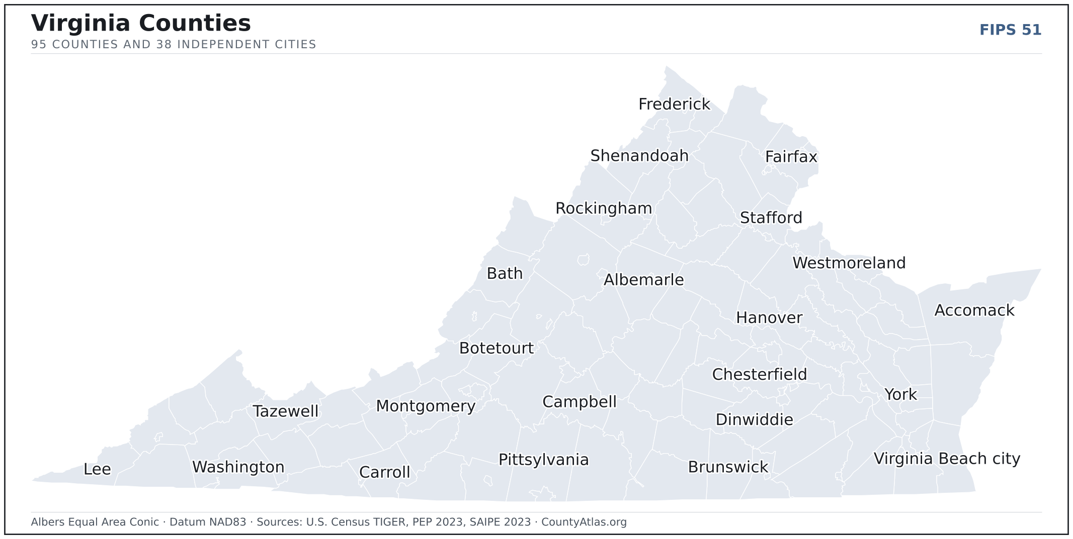
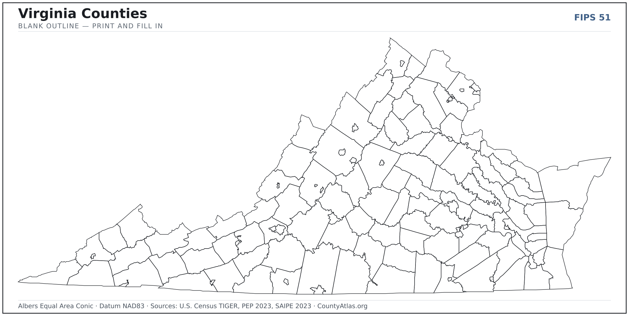
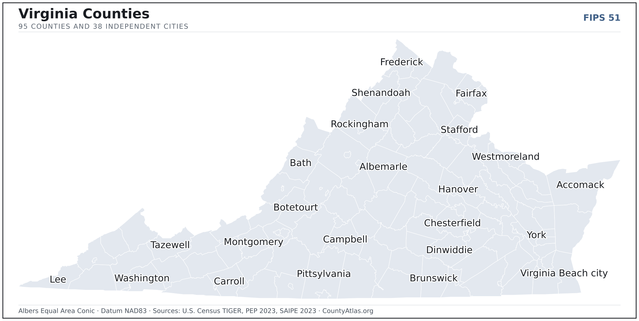
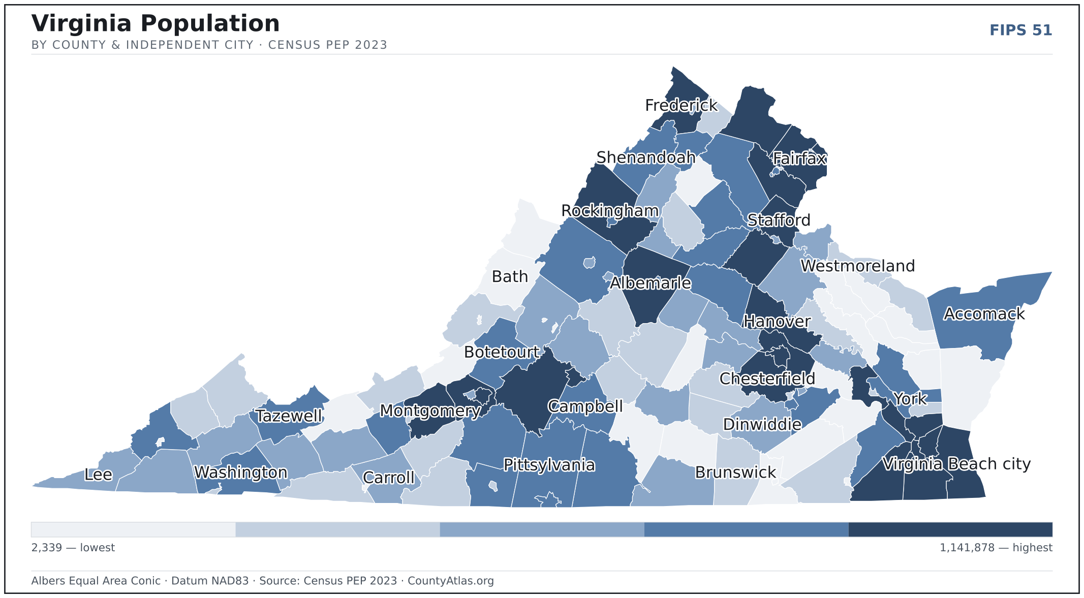
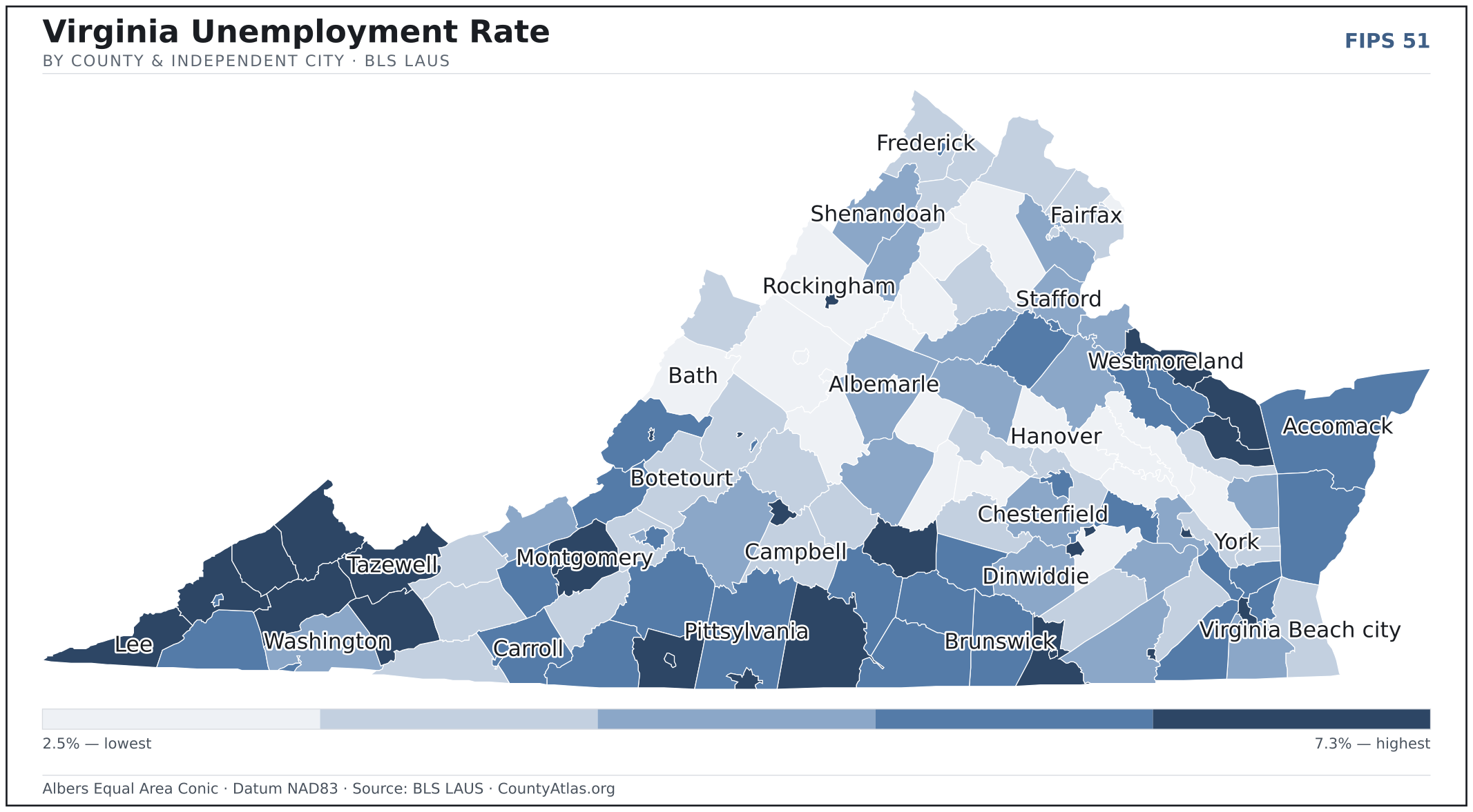
Virginia maps, coloured by the data
Cities in Virginia
Virginia has 227 incorporated cities and towns. The largest is Virginia Beach, an independent city, with 457,066 residents. Use the search on the map above to find any city and highlight the county it sits in.
| Virginia Beach | independent city | 457,066 |
| Chesapeake | independent city | 251,153 |
| Norfolk | independent city | 235,037 |
| Richmond | independent city | 227,595 |
| Newport News | independent city | 184,774 |
| Alexandria | independent city | 156,788 |
| Hampton | independent city | 137,334 |
| Roanoke | independent city | 98,677 |
| Portsmouth | independent city | 97,299 |
| Suffolk | independent city | 96,638 |
| Lynchburg | independent city | 79,255 |
| Harrisonburg | independent city | 51,492 |
| Leesburg (town) | Loudoun County | 48,788 |
| Charlottesville | independent city | 45,863 |
| Blacksburg (town) | Montgomery County | 45,288 |
| Manassas | independent city | 42,674 |
| Danville | independent city | 42,239 |
| Petersburg | independent city | 33,365 |
| Fredericksburg | independent city | 28,383 |
| Winchester | independent city | 27,981 |
| Staunton | independent city | 25,765 |
| Salem | independent city | 25,477 |
| Herndon (town) | Fairfax County | 24,529 |
| Fairfax | independent city | 24,478 |
| Hopewell | independent city | 22,944 |
| Christiansburg (town) | Montgomery County | 22,820 |
| Waynesboro | independent city | 22,574 |
| Culpeper (town) | Culpeper County | 20,437 |
| Colonial Heights | independent city | 18,210 |
| Bristol | independent city | 17,024 |
| Manassas Park | independent city | 16,923 |
| Radford | independent city | 16,505 |
| Vienna (town) | Fairfax County | 16,369 |
| Williamsburg | independent city | 15,564 |
| Front Royal (town) | Warren County | 15,152 |
| Falls Church | independent city | 14,593 |
| Martinsville | independent city | 13,584 |
| Poquoson | independent city | 12,556 |
| Warrenton (town) | Fauquier County | 10,151 |
| Purcellville (town) | Loudoun County | 8,974 |
| Pulaski (town) | Pulaski County | 8,937 |
| Smithfield (town) | Isle of Wight County | 8,729 |
| Abingdon (town) | Washington County | 8,332 |
| Wytheville (town) | Wythe County | 8,224 |
| Franklin | independent city | 8,212 |
| Vinton (town) | Roanoke County | 8,038 |
| South Boston (town) | Halifax County | 7,896 |
| Ashland (town) | Hanover County | 7,667 |
| Farmville (town) | Prince Edward County | 7,613 |
| Lexington | independent city | 7,420 |
Showing the 50 most populous — and 177 more. Search the map above for any Virginia city or village.
A city can span more than one county; each is listed in its primary county — the one its center falls in. Some Virginia cities are independent cities — each is its own county-equivalent, not part of a surrounding county — and are marked as such.
Which Virginia county is the richest, largest, most crowded? The answers
- Virginia’s highest median household income is in Loudoun County ($173,655); the lowest is in Norton city ($42,618). Census SAIPE 2023
- Virginia’s most populous county is Fairfax County (1,141,878); the least populous is Highland County (2,339) — a 488× spread. Census PEP 2023
- Virginia’s largest county by land area is Pittsylvania County (969 sq mi); the smallest is Falls Church city (2 sq mi). Census TIGER
- Virginia’s highest population density is in Alexandria city (10,390/sq mi); the lowest is in Highland County (6/sq mi). Census PEP 2023 · TIGER
- Virginia’s highest poverty rate is in Greensville County (27.3%); the lowest is in Loudoun County (4.1%). Census SAIPE 2023
- In Virginia, unemployment is highest in Emporia city (7.3%) and lowest in Bath County (2.5%), for May 2026. BLS LAUS
- Virginia’s highest median age is in Northumberland County (59.5); the lowest is in Lexington city (22.5). Census ACS 2019–2023
- Virginia’s highest share of bachelor’s degrees is in Falls Church city (79.7% of adults); the lowest is in Covington city (9.6%). Census ACS 2019–2023
- In Virginia, Chesterfield County borders the most neighbours (10); its interior county lines run 8,288 km in total, land only. Census TIGER, water-clipped
Every figure is a current official estimate from the source named — not a crowd-sourced or copied value. Suppressed estimates (coefficient of variation ≥ 0.30) are omitted, never guessed. See the full methodology.
Virginia counties: common questions
How many counties are in Virginia?
Virginia has 95 counties and 38 independent cities covering 39,481 sq mi and about 8.7M residents. Every one is on the map above and in the table below.
What is the largest county in Virginia?
It depends on the measure. By land area it’s Pittsylvania County (969 sq mi); by population it’s Fairfax County (1,141,878 residents).
What county is Virginia Beach in?
Virginia Beach (population 457,066) is an independent city — its own county-equivalent. Use the search on the map to find any Virginia city’s county.
What is the richest county in Virginia?
By median household income, Loudoun County is the richest at $173,655; the poorest is Norton city at $42,618 (Census SAIPE 2023).
What is the most populous county in Virginia?
Fairfax County, with 1,141,878 residents — about 13.1% of Virginia’s people, and 488× the least populous, Highland County (2,339).
Sources & vintages
- Population — PEP Vintage 2023 (July 1, 2023) — pep/charv
- Median household income & poverty — SAIPE 2023
- Unemployment — BLS LAUS May 2026 (preliminary)
- Geometry & boundaries — Census TIGERweb
- Cities & city population — Census TIGERweb Incorporated Places + ACS 5-year 2019–2023
Data current through .