CountyAtlas West Virginia
West Virginia County Map with Cities — All 55 Counties
All 55 of West Virginia's counties, mapped from official U.S. Census boundaries with population, income, and unemployment for every one. Colour the map by any measure, tap a county for its data, or download a print-ready copy.
Tap any county for its population, income, and more.
West Virginia at a glance
- Scale. West Virginia is divided into 55 counties across 24,041 sq mi of land — an average of 437 sq mi each. Census TIGER
- People. Its counties are home to 1,770,071 residents — an average of 32,183 each, or 74 per square mile statewide. Census PEP 2023
- Water. Another 189 sq mi is water — 0.8% of the state’s area, led by Mason County. Census TIGER
West Virginia’s 55 counties, by the numbers
Every county’s population, median household income, unemployment, density, and land area — sortable by any column, so you can find yours or rank by what matters to you. A few patterns run through the data:
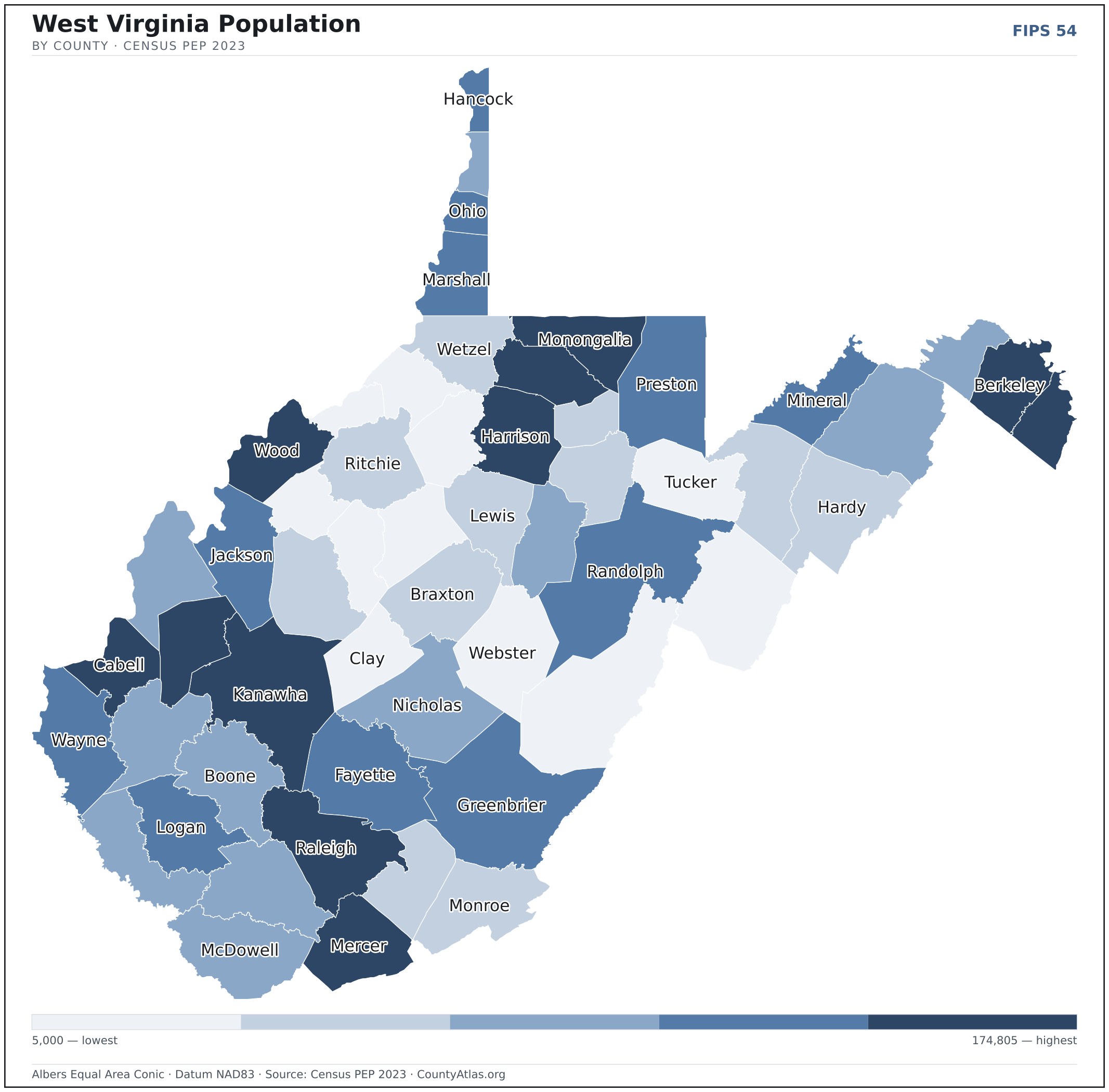
- Concentrated. Half of West Virginia’s 1,770,071 residents live in just 10 of 55 counties, and the five largest hold 33.3% of the total. Census PEP 2023
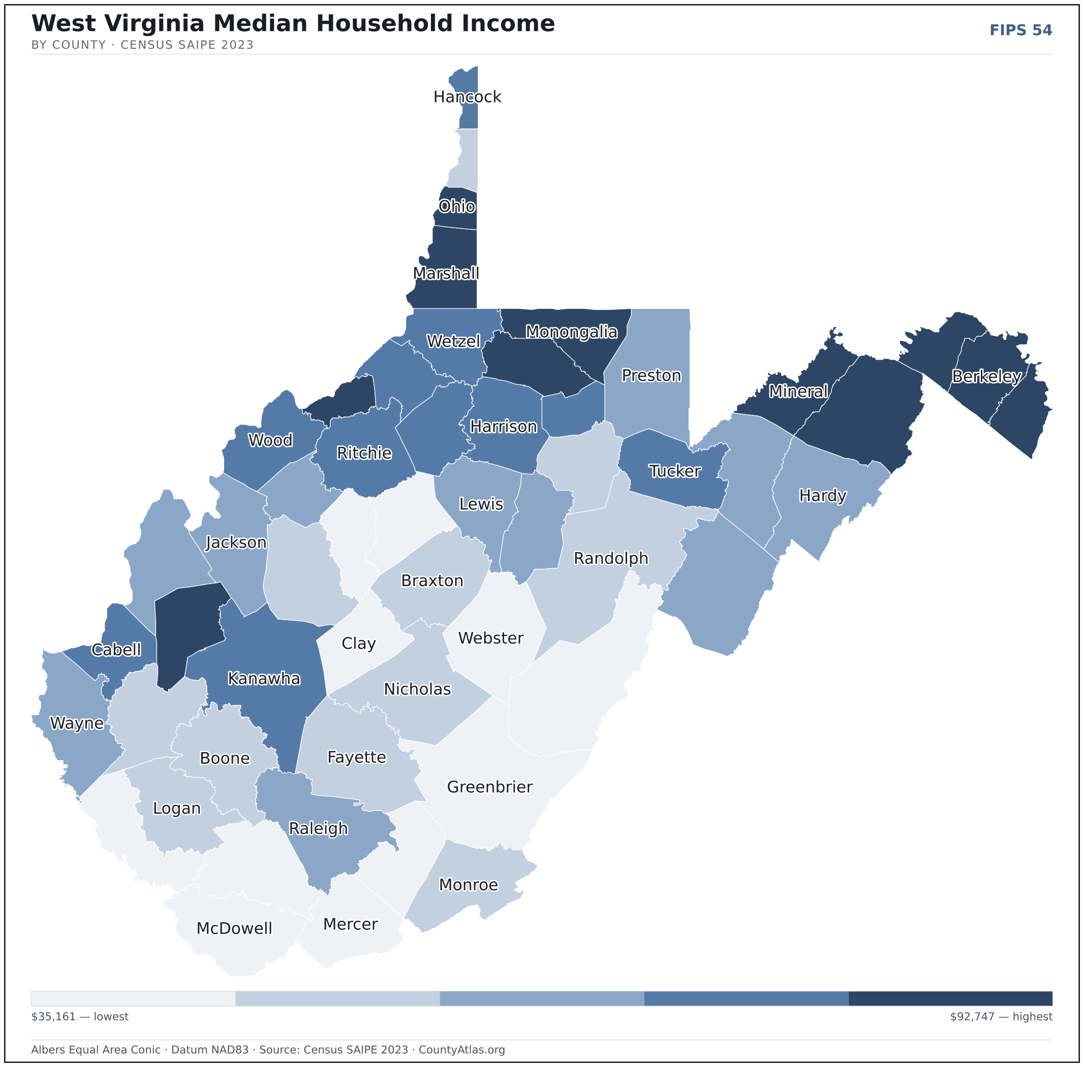
- Income tracks poverty. The gap from richest to poorest runs 2.6×, and the 10 highest-income counties average 13.3% in poverty against 24.6% for the 10 lowest. Census SAIPE 2023
- Mostly small. Half of West Virginia’s counties have fewer than 21,373 residents, and half report a median household income below $53,187 — a few metros lift the statewide totals well above both. Census PEP 2023 · SAIPE 2023
- Lopsided density. Only 19 of 55 counties are denser than West Virginia’s statewide average of 74 people per square mile — the rest are more rural. Census PEP 2023 · TIGER
| Barbour County | 15,378 | $51,353 | 4.2% | 45/sq mi | 341 sq mi | Philippi |
| Berkeley County | 132,440 | $78,995 | 3.2% | 412/sq mi | 321 sq mi | Martinsburg |
| Boone County | 20,576 | $48,034 | 4.6% | 41/sq mi | 502 sq mi | Madison |
| Braxton County | 12,162 | $50,038 | 3.3% | 24/sq mi | 511 sq mi | Sutton |
| Brooke County | 21,373 | $49,187 | 4.4% | 240/sq mi | 89 sq mi | Wellsburg |
| Cabell County | 92,082 | $55,031 | 3.4% | 328/sq mi | 281 sq mi | Huntington |
| Calhoun County | 5,959 | $45,793 | 4.4% | 21/sq mi | 279 sq mi | Grantsville |
| Clay County | 7,783 | $45,291 | 5.7% | 23/sq mi | 342 sq mi | Clay |
| Doddridge County | 7,680 | $56,985 | 2.8% | 24/sq mi | 320 sq mi | West Union |
| Fayette County | 39,072 | $49,739 | 4.2% | 59/sq mi | 662 sq mi | Fayetteville |
| Gilmer County | 7,254 | $43,671 | 3.5% | 21/sq mi | 339 sq mi | Glenville |
| Grant County | 10,921 | $53,187 | 3.3% | 23/sq mi | 477 sq mi | Petersburg |
| Greenbrier County | 32,149 | $47,309 | 3.5% | 32/sq mi | 1,020 sq mi | Lewisburg |
| Hampshire County | 23,649 | $63,290 | 3.2% | 37/sq mi | 640 sq mi | Romney |
| Hancock County | 28,145 | $58,478 | 4.1% | 341/sq mi | 83 sq mi | New Cumberland |
| Hardy County | 14,251 | $52,212 | 3.0% | 24/sq mi | 582 sq mi | Moorefield |
| Harrison County | 64,639 | $58,897 | 3.2% | 155/sq mi | 416 sq mi | Clarksburg |
| Jackson County | 27,593 | $52,503 | 4.3% | 59/sq mi | 464 sq mi | Ripley |
| Jefferson County | 59,787 | $92,747 | 2.9% | 286/sq mi | 209 sq mi | Charles Town |
| Kanawha County | 174,805 | $56,633 | 3.5% | 194/sq mi | 902 sq mi | Charleston |
| Lewis County | 16,500 | $52,827 | 3.7% | 43/sq mi | 387 sq mi | Weston |
| Lincoln County | 19,701 | $47,435 | 4.4% | 45/sq mi | 437 sq mi | Hamlin |
| Logan County | 30,827 | $48,745 | 5.5% | 68/sq mi | 453 sq mi | Logan |
| Marion County | 55,807 | $62,449 | 3.5% | 181/sq mi | 309 sq mi | Fairmont |
| Marshall County | 29,405 | $59,661 | 3.9% | 96/sq mi | 305 sq mi | Moundsville |
| Mason County | 24,765 | $52,054 | 2.7% | 57/sq mi | 431 sq mi | Point Pleasant |
| McDowell County | 17,439 | $35,161 | 9.1% | 33/sq mi | 533 sq mi | Welch |
| Mercer County | 58,057 | $47,084 | 3.9% | 139/sq mi | 419 sq mi | Princeton |
| Mineral County | 26,867 | $59,085 | 3.7% | 82/sq mi | 328 sq mi | Keyser |
| Mingo County | 22,023 | $38,358 | 6.9% | 52/sq mi | 423 sq mi | Williamson |
| Monongalia County | 107,718 | $62,330 | 3.1% | 299/sq mi | 360 sq mi | Morgantown |
| Monroe County | 12,382 | $47,797 | 3.5% | 26/sq mi | 473 sq mi | Union |
| Morgan County | 17,649 | $61,802 | 2.9% | 77/sq mi | 229 sq mi | Bath (Berkeley Springs) |
| Nicholas County | 24,169 | $48,515 | 4.1% | 37/sq mi | 647 sq mi | Summersville |
| Ohio County | 41,194 | $59,882 | 3.6% | 389/sq mi | 106 sq mi | Wheeling |
| Pendleton County | 6,029 | $53,640 | 2.4% | 9/sq mi | 696 sq mi | Franklin |
| Pleasants County | 7,428 | $60,991 | 3.6% | 57/sq mi | 130 sq mi | St. Marys |
| Pocahontas County | 7,765 | $43,632 | 5.9% | 8/sq mi | 940 sq mi | Marlinton |
| Preston County | 34,099 | $54,881 | 3.3% | 53/sq mi | 649 sq mi | Kingwood |
| Putnam County | 56,962 | $72,073 | 3.0% | 165/sq mi | 346 sq mi | Winfield |
| Raleigh County | 72,356 | $53,456 | 3.7% | 120/sq mi | 605 sq mi | Beckley |
| Randolph County | 27,350 | $50,868 | 4.5% | 26/sq mi | 1,040 sq mi | Elkins |
| Ritchie County | 8,167 | $55,110 | 4.1% | 18/sq mi | 452 sq mi | Harrisville |
| Roane County | 13,743 | $48,285 | 4.9% | 28/sq mi | 484 sq mi | Spencer |
| Summers County | 11,581 | $44,218 | 3.7% | 32/sq mi | 361 sq mi | Hinton |
| Taylor County | 16,388 | $57,821 | 3.2% | 95/sq mi | 173 sq mi | Grafton |
| Tucker County | 6,604 | $55,563 | 3.8% | 16/sq mi | 419 sq mi | Parsons |
| Tyler County | 7,919 | $58,892 | 4.1% | 31/sq mi | 256 sq mi | Middlebourne |
| Upshur County | 23,529 | $53,380 | 3.8% | 66/sq mi | 355 sq mi | Buckhannon |
| Wayne County | 37,686 | $51,532 | 3.9% | 74/sq mi | 506 sq mi | Wayne |
| Webster County | 8,045 | $40,727 | 4.2% | 15/sq mi | 553 sq mi | Addison (Webster Springs) |
| Wetzel County | 13,890 | $56,296 | 4.6% | 39/sq mi | 358 sq mi | New Martinsville |
| Wirt County | 5,000 | $54,506 | 4.9% | 22/sq mi | 233 sq mi | Elizabeth |
| Wood County | 83,052 | $56,353 | 3.9% | 227/sq mi | 367 sq mi | Parkersburg |
| Wyoming County | 20,277 | $47,212 | 5.1% | 41/sq mi | 499 sq mi | Pineville |
All 55 counties, sortable by any column — click a heading. A suppressed estimate (coefficient of variation ≥ 0.30) shows a marker, never a guess. County seats are from Wikidata (CC0), each validated to a Census place inside its county; a county with no validated seat is left blank. See the methodology.
Download & print this West Virginia map
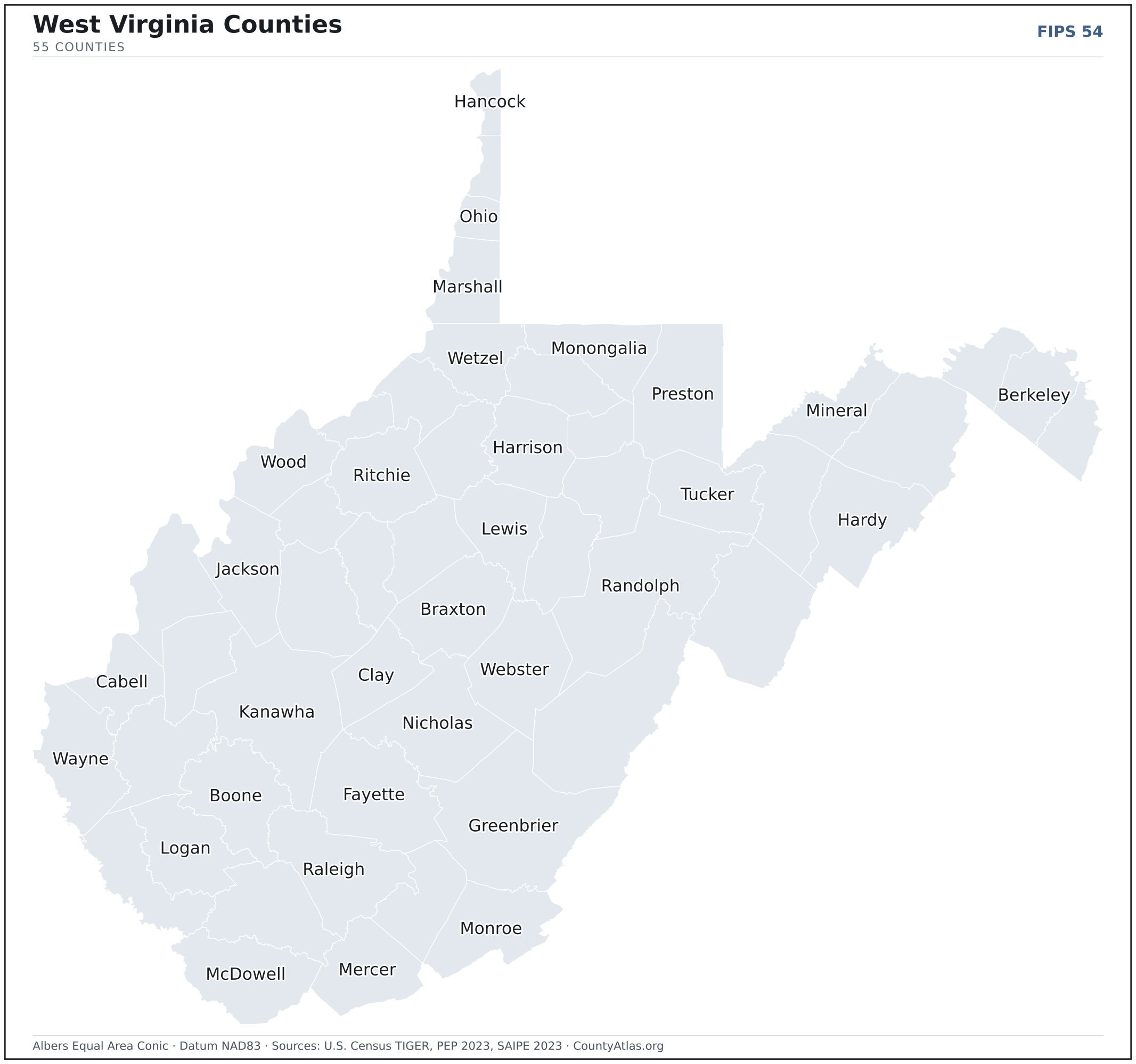
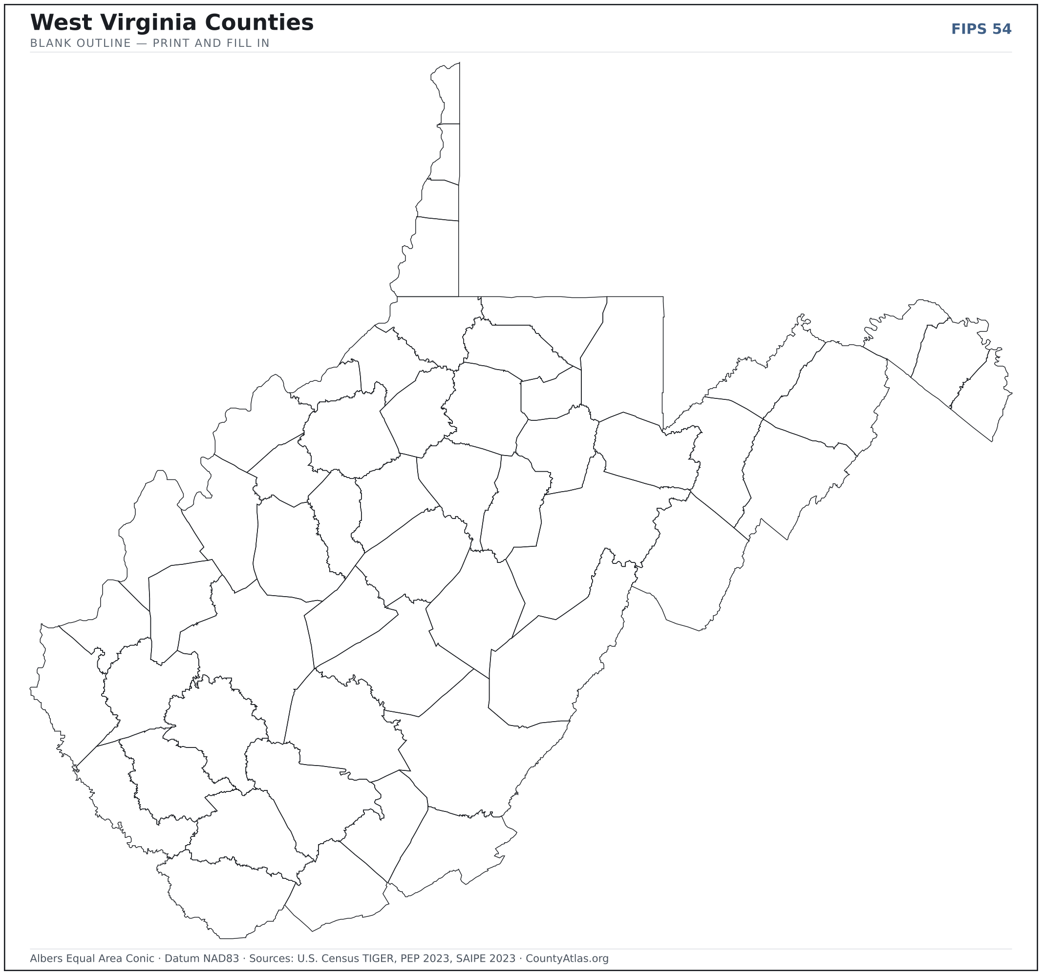
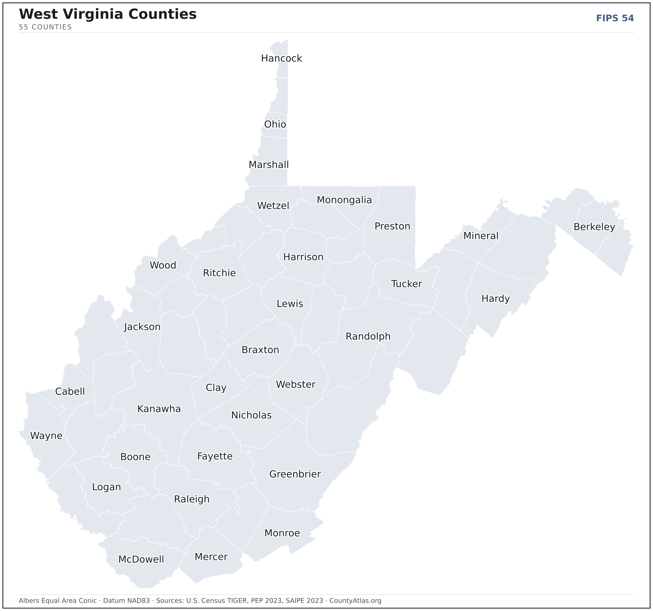
West Virginia maps, coloured by the data
Cities in West Virginia
West Virginia has 229 incorporated cities, corporations, villages, and towns. The largest is Charleston in Kanawha County with 47,918 residents. Use the search on the map above to find any city and highlight the county it sits in.
| Charleston | Kanawha County | 47,918 |
| Huntington | Cabell County | 46,189 |
| Morgantown | Monongalia County | 30,273 |
| Parkersburg | Wood County | 29,461 |
| Wheeling | Ohio County | 26,670 |
| Martinsburg | Berkeley County | 18,805 |
| Weirton | Hancock County | 18,785 |
| Fairmont | Marion County | 18,303 |
| Beckley | Raleigh County | 16,977 |
| Clarksburg | Harrison County | 15,829 |
| South Charleston | Kanawha County | 13,594 |
| St. Albans | Kanawha County | 10,637 |
| Vienna | Wood County | 10,575 |
| Bluefield | Mercer County | 9,511 |
| Bridgeport | Harrison County | 9,292 |
| Oak Hill | Fayette County | 8,057 |
| Moundsville | Marshall County | 7,934 |
| Dunbar | Kanawha County | 7,340 |
| Nitro | Kanawha County | 6,941 |
| Hurricane | Putnam County | 6,891 |
| Elkins | Randolph County | 6,875 |
| Charles Town | Jefferson County | 6,854 |
| Princeton | Mercer County | 5,780 |
| Ranson (corporation) | Jefferson County | 5,588 |
| New Martinsville | Wetzel County | 5,175 |
| Buckhannon | Upshur County | 5,144 |
| Keyser | Mineral County | 4,870 |
| Grafton | Taylor County | 4,671 |
| Barboursville (village) | Cabell County | 4,394 |
| Point Pleasant | Mason County | 4,009 |
| Westover | Monongalia County | 4,007 |
| Weston | Lewis County | 3,884 |
| Lewisburg | Greenbrier County | 3,871 |
| Ravenswood | Jackson County | 3,846 |
| Pleasant Valley | Marion County | 3,494 |
| Welch | McDowell County | 3,492 |
| Summersville | Nicholas County | 3,397 |
| Petersburg | Grant County | 3,172 |
| Ripley | Jackson County | 3,066 |
| Kingwood | Preston County | 2,980 |
| Williamson | Mingo County | 2,979 |
| Kenova | Wayne County | 2,977 |
| Williamstown | Wood County | 2,977 |
| Moorefield (town) | Hardy County | 2,952 |
| Philippi | Barbour County | 2,919 |
| Fayetteville (town) | Fayette County | 2,864 |
| Madison | Boone County | 2,840 |
| Follansbee | Brooke County | 2,790 |
| Milton (town) | Cabell County | 2,773 |
| White Sulphur Springs | Greenbrier County | 2,646 |
Showing the 50 most populous — and 179 more. Search the map above for any West Virginia city or village.
A city can span more than one county; each is listed in its primary county — the one its center falls in.
Which West Virginia county is the richest, largest, most crowded? The answers
- West Virginia’s highest median household income is in Jefferson County ($92,747); the lowest is in McDowell County ($35,161). Census SAIPE 2023
- West Virginia’s most populous county is Kanawha County (174,805); the least populous is Wirt County (5,000) — a 35× spread. Census PEP 2023
- West Virginia’s largest county by land area is Randolph County (1,040 sq mi); the smallest is Hancock County (83 sq mi). Census TIGER
- West Virginia’s highest population density is in Berkeley County (412/sq mi); the lowest is in Pocahontas County (8/sq mi). Census PEP 2023 · TIGER
- West Virginia’s highest poverty rate is in McDowell County (36.2%); the lowest is in Jefferson County (9.0%). Census SAIPE 2023
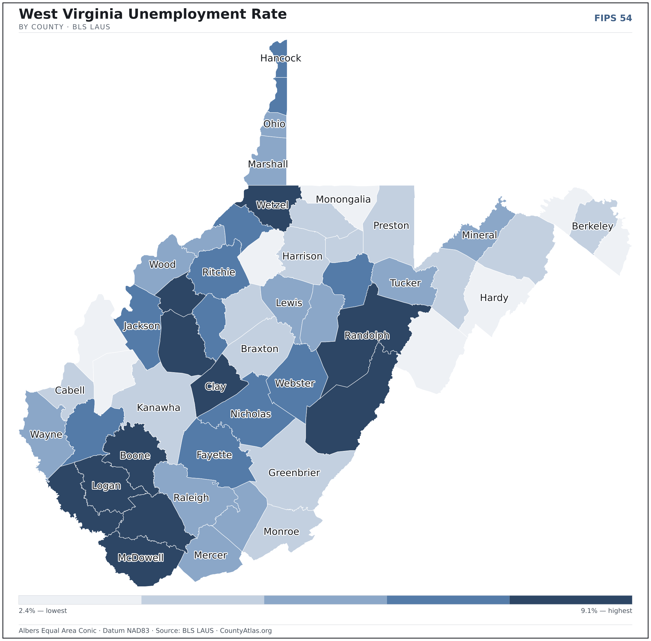
- In West Virginia, unemployment is highest in McDowell County (9.1%) and lowest in Pendleton County (2.4%), for May 2026. BLS LAUS
- West Virginia’s highest median age is in Tucker County (51.2); the lowest is in Monongalia County (32.5). Census ACS 2019–2023
- West Virginia’s highest share of bachelor’s degrees is in Monongalia County (47.9% of adults); the lowest is in McDowell County (5.7%). Census ACS 2019–2023
Every figure is a current official estimate from the source named — not a crowd-sourced or copied value. Suppressed estimates (coefficient of variation ≥ 0.30) are omitted, never guessed. See the full methodology.
West Virginia counties: common questions
How many counties are in West Virginia?
West Virginia has 55 counties covering 24,041 sq mi and about 1.8M residents. Every one is on the map above and in the table below.
What is the largest county in West Virginia?
It depends on the measure. By land area it’s Randolph County (1,040 sq mi); by population it’s Kanawha County (174,805 residents).
What county is Charleston in?
Charleston (population 47,918) is in Kanawha County. Use the search on the map to find any West Virginia city’s county.
What is the richest county in West Virginia?
By median household income, Jefferson County is the richest at $92,747; the poorest is McDowell County at $35,161 (Census SAIPE 2023).
What is the most populous county in West Virginia?
Kanawha County, with 174,805 residents — about 9.9% of West Virginia’s people, and 35× the least populous, Wirt County (5,000).
Sources & vintages
- Population — PEP Vintage 2023 (July 1, 2023) — pep/charv
- Median household income & poverty — SAIPE 2023
- Unemployment — BLS LAUS May 2026 (preliminary)
- Geometry & boundaries — Census TIGERweb
- Cities & city population — Census TIGERweb Incorporated Places + ACS 5-year 2019–2023
Data current through .