CountyAtlas Wisconsin
Wisconsin County Map with Cities — All 72 Counties
All 72 of Wisconsin's counties, mapped from official U.S. Census boundaries with population, income, and unemployment for every one. Colour the map by any measure, tap a county for its data, or download a print-ready copy.
Tap any county for its population, income, and more.
Wisconsin at a glance
- Scale. Wisconsin is divided into 72 counties across 54,168 sq mi of land — an average of 752 sq mi each. Census TIGER
- People. Its counties are home to 5,910,955 residents — an average of 82,097 each, or 109 per square mile statewide. Census PEP 2023
- Water. Another 11,328 sq mi is water — 17.3% of the state’s area, led by Door County. Census TIGER
Wisconsin’s 72 counties, by the numbers
Every county’s population, median household income, unemployment, density, and land area — sortable by any column, so you can find yours or rank by what matters to you. A few patterns run through the data:
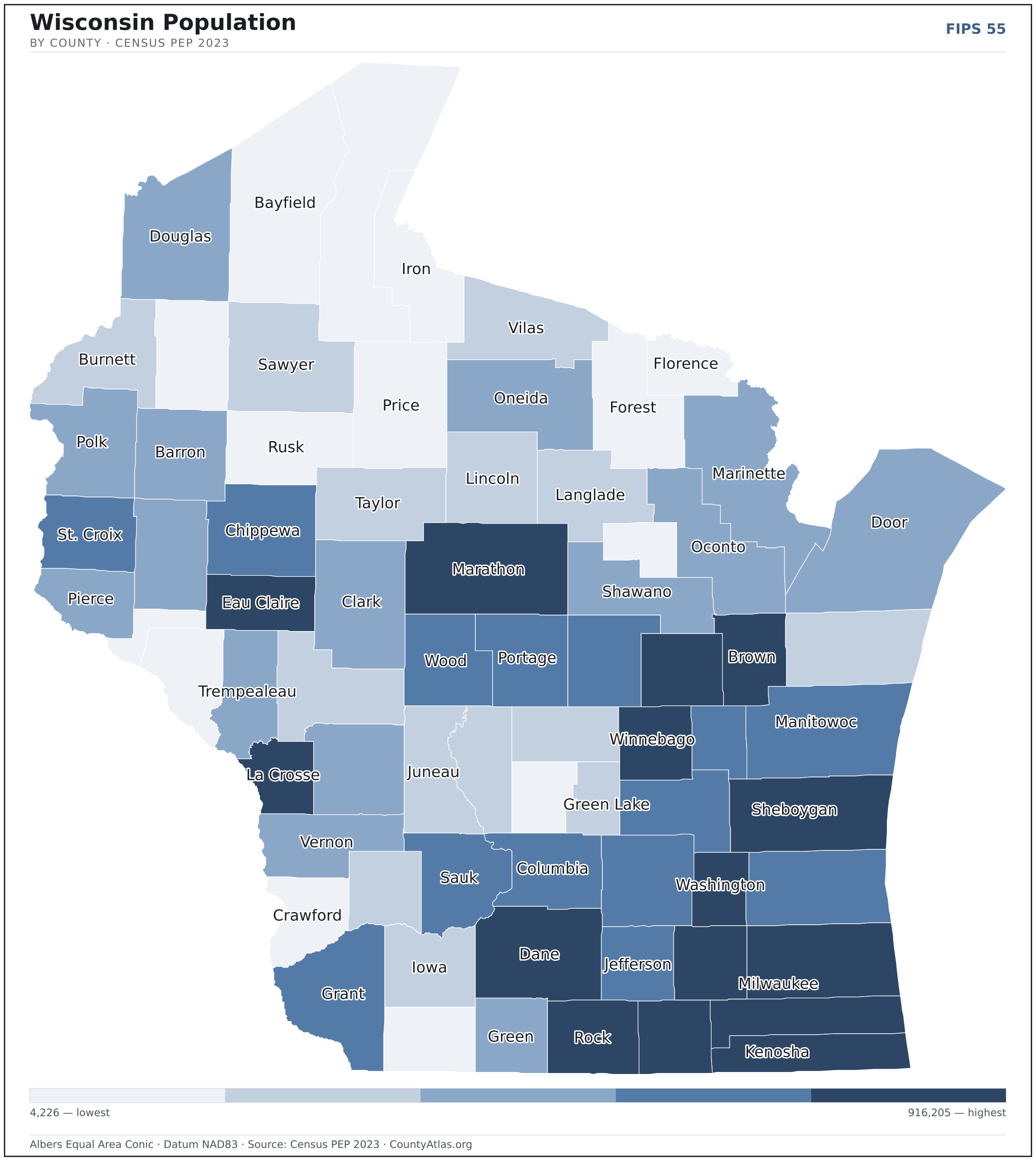
- Concentrated. Half of Wisconsin’s 5,910,955 residents live in just 9 of 72 counties, and the five largest hold 40.1% of the total. Census PEP 2023
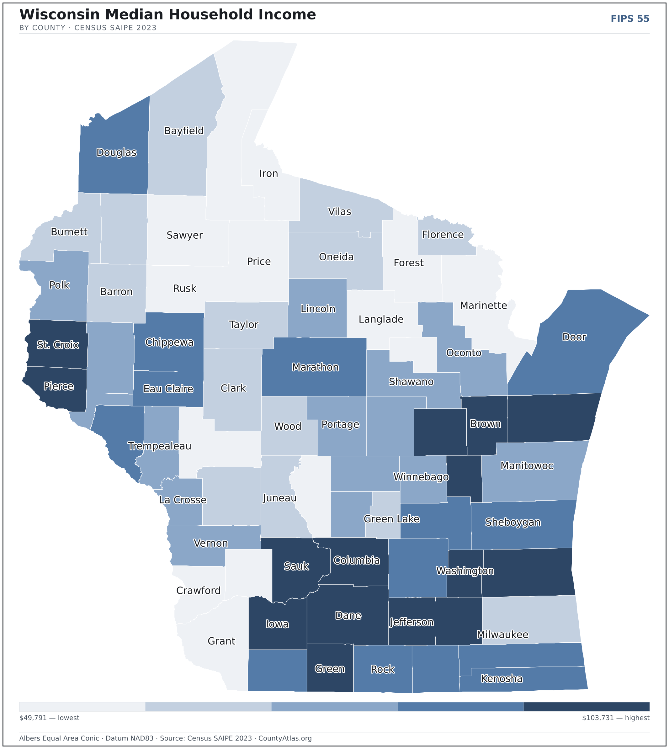
- Income tracks poverty. The gap from richest to poorest runs 2.1×, and the 10 highest-income counties average 6.8% in poverty against 15.2% for the 10 lowest. Census SAIPE 2023
- Mostly small. Half of Wisconsin’s counties have fewer than 41,608 residents, and half report a median household income below $70,174 — a few metros lift the statewide totals well above both. Census PEP 2023 · SAIPE 2023
- Lopsided density. Only 20 of 72 counties are denser than Wisconsin’s statewide average of 109 people per square mile — the rest are more rural. Census PEP 2023 · TIGER
| Adams County | 21,449 | $57,944 | 4.0% | 33/sq mi | 646 sq mi | Friendship |
| Ashland County | 16,079 | $52,158 | 2.8% | 15/sq mi | 1,045 sq mi | Ashland |
| Barron County | 46,833 | $66,507 | 3.1% | 54/sq mi | 863 sq mi | Barron |
| Bayfield County | 16,769 | $64,339 | 3.4% | 11/sq mi | 1,478 sq mi | Washburn |
| Brown County | 271,417 | $77,645 | 2.7% | 512/sq mi | 530 sq mi | Green Bay |
| Buffalo County | 13,419 | $73,869 | 2.9% | 20/sq mi | 676 sq mi | Alma |
| Burnett County | 17,092 | $67,061 | 3.7% | 21/sq mi | 822 sq mi | Siren |
| Calumet County | 53,199 | $86,890 | 2.3% | 167/sq mi | 318 sq mi | Chilton |
| Chippewa County | 66,970 | $76,637 | 2.7% | 66/sq mi | 1,008 sq mi | Chippewa Falls |
| Clark County | 34,774 | $66,994 | 2.4% | 29/sq mi | 1,210 sq mi | Neillsville |
| Columbia County | 58,091 | $79,582 | 2.7% | 76/sq mi | 766 sq mi | Portage |
| Crawford County | 15,944 | $57,014 | 3.4% | 28/sq mi | 571 sq mi | Prairie du Chien |
| Dane County | 575,347 | $84,190 | 2.5% | 481/sq mi | 1,197 sq mi | Madison |
| Dodge County | 88,231 | $73,861 | 2.4% | 101/sq mi | 876 sq mi | Juneau |
| Door County | 30,562 | $74,247 | 2.7% | 63/sq mi | 482 sq mi | Sturgeon Bay |
| Douglas County | 44,264 | $73,372 | 3.9% | 34/sq mi | 1,304 sq mi | Superior |
| Dunn County | 45,794 | $71,215 | 2.8% | 54/sq mi | 850 sq mi | Menomonie |
| Eau Claire County | 107,903 | $72,806 | 2.6% | 169/sq mi | 638 sq mi | Eau Claire |
| Florence County | 4,682 | $66,442 | 3.0% | 10/sq mi | 488 sq mi | Florence |
| Fond du Lac County | 103,948 | $73,485 | 2.6% | 144/sq mi | 720 sq mi | Fond du Lac |
| Forest County | 9,325 | $59,190 | 3.3% | 9/sq mi | 1,014 sq mi | Crandon |
| Grant County | 51,409 | $63,246 | 2.7% | 45/sq mi | 1,148 sq mi | Lancaster |
| Green County | 36,951 | $78,114 | 2.3% | 63/sq mi | 584 sq mi | Monroe |
| Green Lake County | 19,344 | $64,516 | 2.8% | 55/sq mi | 350 sq mi | Green Lake |
| Iowa County | 23,956 | $77,433 | 2.3% | 31/sq mi | 763 sq mi | Dodgeville |
| Iron County | 6,228 | $58,900 | 4.7% | 8/sq mi | 758 sq mi | Hurley |
| Jackson County | 20,855 | $61,023 | 3.1% | 21/sq mi | 988 sq mi | Black River Falls |
| Jefferson County | 85,743 | $82,356 | 2.5% | 154/sq mi | 556 sq mi | Jefferson |
| Juneau County | 26,594 | $63,587 | 3.0% | 35/sq mi | 767 sq mi | Mauston |
| Kenosha County | 167,488 | $75,699 | 3.1% | 616/sq mi | 272 sq mi | Kenosha |
| Kewaunee County | 20,690 | $77,472 | 2.4% | 60/sq mi | 342 sq mi | Kewaunee |
| La Crosse County | 120,486 | $71,260 | 2.6% | 267/sq mi | 452 sq mi | La Crosse |
| Lafayette County | 16,945 | $73,114 | 2.2% | 27/sq mi | 634 sq mi | Darlington |
| Langlade County | 19,404 | $57,907 | 3.2% | 22/sq mi | 871 sq mi | Antigo |
| Lincoln County | 28,405 | $71,871 | 2.9% | 32/sq mi | 879 sq mi | Merrill |
| Manitowoc County | 81,331 | $69,652 | 2.7% | 138/sq mi | 589 sq mi | Manitowoc |
| Marathon County | 138,612 | $74,505 | 2.6% | 90/sq mi | 1,545 sq mi | Wausau |
| Marinette County | 42,106 | $62,650 | 3.7% | 30/sq mi | 1,399 sq mi | Marinette |
| Marquette County | 15,838 | $67,207 | 3.0% | 35/sq mi | 456 sq mi | Montello |
| Menominee County | 4,226 | $49,791 | 4.0% | 12/sq mi | 358 sq mi | Keshena |
| Milwaukee County | 916,205 | $63,304 | 3.7% | 3,794/sq mi | 241 sq mi | Milwaukee |
| Monroe County | 46,151 | $63,372 | 2.5% | 51/sq mi | 901 sq mi | Sparta |
| Oconto County | 39,775 | $69,599 | 2.9% | 40/sq mi | 997 sq mi | Oconto |
| Oneida County | 38,226 | $66,650 | 2.8% | 34/sq mi | 1,114 sq mi | Rhinelander |
| Outagamie County | 193,234 | $86,098 | 2.5% | 303/sq mi | 638 sq mi | Appleton |
| Ozaukee County | 93,460 | $98,394 | 2.6% | 401/sq mi | 233 sq mi | Port Washington |
| Pepin County | 7,441 | $70,012 | 2.4% | 32/sq mi | 232 sq mi | Durand |
| Pierce County | 43,026 | $95,522 | 3.0% | 75/sq mi | 574 sq mi | Ellsworth |
| Polk County | 45,762 | $71,613 | 3.4% | 50/sq mi | 914 sq mi | Balsam Lake |
| Portage County | 71,024 | $71,295 | 2.8% | 89/sq mi | 801 sq mi | Stevens Point |
| Price County | 14,102 | $60,223 | 3.6% | 11/sq mi | 1,254 sq mi | Phillips |
| Racine County | 196,613 | $74,555 | 3.3% | 591/sq mi | 333 sq mi | Racine |
| Richland County | 17,197 | $60,639 | 2.6% | 29/sq mi | 586 sq mi | Richland Center |
| Rock County | 164,278 | $73,656 | 3.1% | 229/sq mi | 718 sq mi | Janesville |
| Rusk County | 14,143 | $58,513 | 3.7% | 15/sq mi | 914 sq mi | Ladysmith |
| Sauk County | 65,920 | $79,349 | 2.5% | 79/sq mi | 832 sq mi | Baraboo |
| Sawyer County | 18,552 | $59,053 | 3.3% | 15/sq mi | 1,258 sq mi | Hayward |
| Shawano County | 41,109 | $67,562 | 2.8% | 46/sq mi | 893 sq mi | Shawano |
| Sheboygan County | 117,752 | $73,970 | 2.6% | 230/sq mi | 512 sq mi | Sheboygan |
| St. Croix County | 96,763 | $103,731 | 3.0% | 134/sq mi | 722 sq mi | Hudson |
| Taylor County | 20,058 | $65,125 | 2.8% | 21/sq mi | 975 sq mi | Medford |
| Trempealeau County | 30,899 | $69,119 | 2.7% | 42/sq mi | 733 sq mi | Whitehall |
| Vernon County | 31,170 | $69,389 | 2.7% | 39/sq mi | 792 sq mi | Viroqua |
| Vilas County | 23,885 | $63,779 | 3.2% | 28/sq mi | 858 sq mi | Eagle River |
| Walworth County | 105,822 | $76,573 | 2.5% | 191/sq mi | 555 sq mi | Elkhorn |
| Washburn County | 16,930 | $63,438 | 3.4% | 21/sq mi | 797 sq mi | Shell Lake |
| Washington County | 138,168 | $93,830 | 2.6% | 321/sq mi | 431 sq mi | West Bend |
| Waukesha County | 412,591 | $99,168 | 2.7% | 751/sq mi | 550 sq mi | Waukesha |
| Waupaca County | 51,388 | $68,545 | 2.5% | 69/sq mi | 748 sq mi | Waupaca |
| Waushara County | 24,934 | $70,336 | 2.9% | 40/sq mi | 626 sq mi | Wautoma |
| Winnebago County | 171,735 | $70,720 | 2.7% | 395/sq mi | 435 sq mi | Oshkosh |
| Wood County | 73,939 | $67,068 | 3.1% | 93/sq mi | 793 sq mi | Wisconsin Rapids |
All 72 counties, sortable by any column — click a heading. A suppressed estimate (coefficient of variation ≥ 0.30) shows a marker, never a guess. County seats are from Wikidata (CC0), each validated to a Census place inside its county; a county with no validated seat is left blank. See the methodology.
Download & print this Wisconsin map
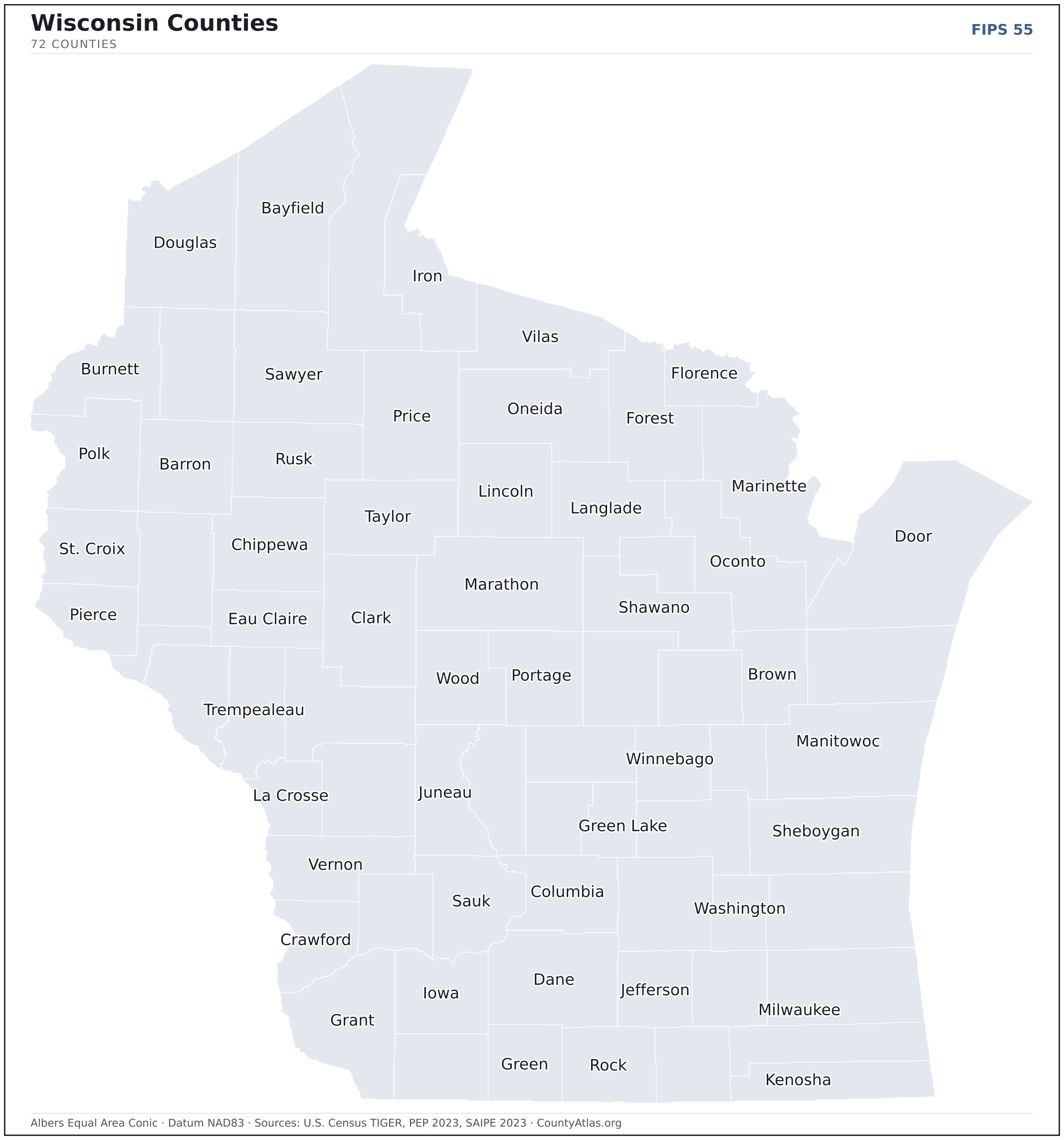
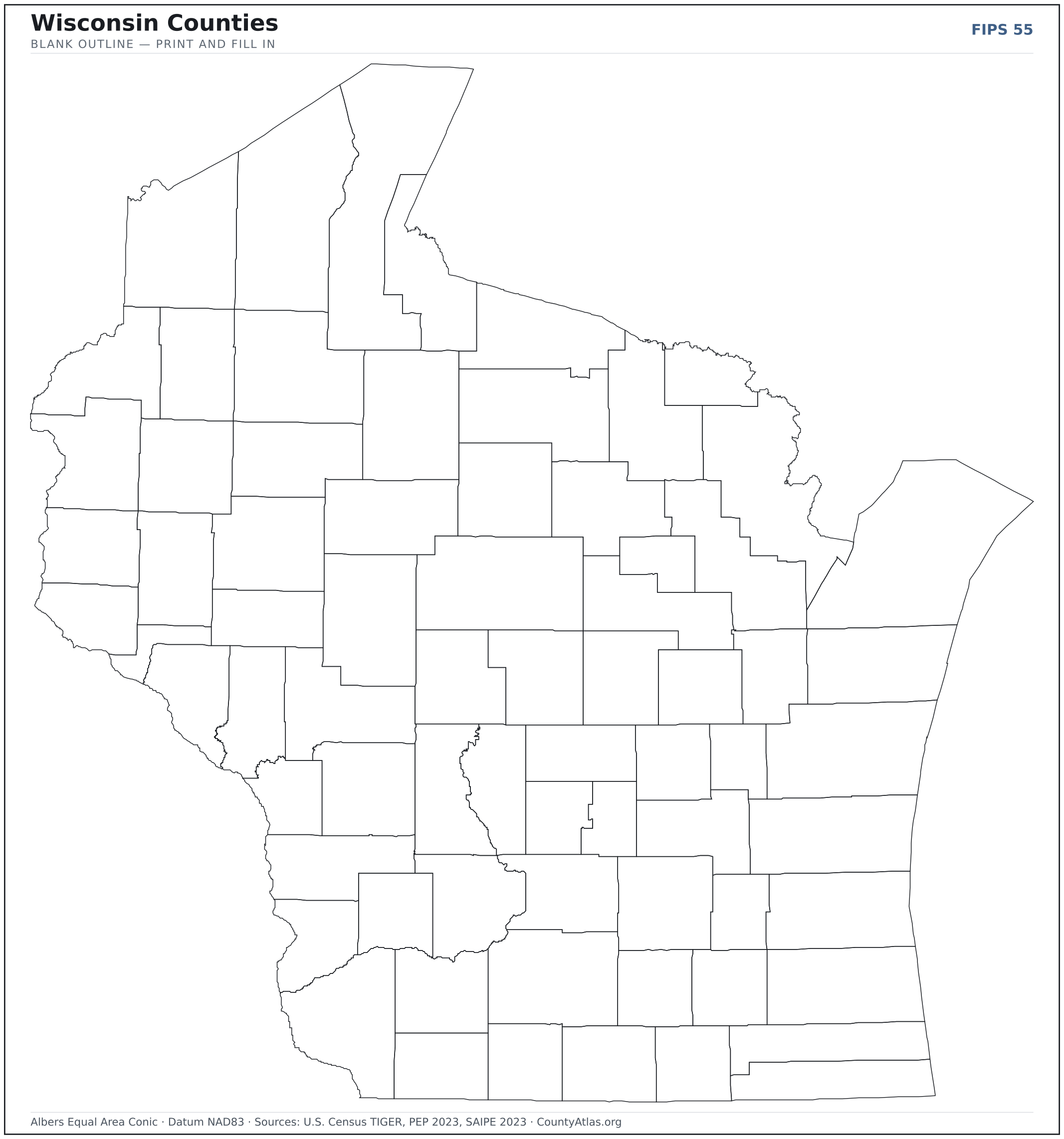
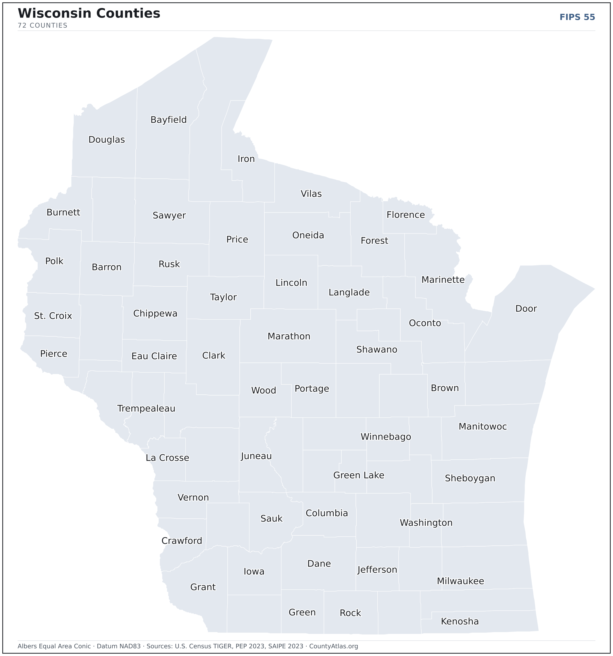
Wisconsin maps, coloured by the data
Cities in Wisconsin
Wisconsin has 608 incorporated cities and villages. The largest is Milwaukee in Milwaukee County with 569,756 residents. Use the search on the map above to find any city and highlight the county it sits in.
| Milwaukee | Milwaukee County | 569,756 |
| Madison | Dane County | 275,568 |
| Green Bay | Brown County | 106,585 |
| Kenosha | Kenosha County | 99,147 |
| Racine | Racine County | 77,155 |
| Appleton | Outagamie County | 74,873 |
| Waukesha | Waukesha County | 70,779 |
| Eau Claire | Eau Claire County | 69,274 |
| Oshkosh | Winnebago County | 66,247 |
| Janesville | Rock County | 65,813 |
| West Allis | Milwaukee County | 59,588 |
| La Crosse | La Crosse County | 51,791 |
| Sheboygan | Sheboygan County | 49,812 |
| Wauwatosa | Milwaukee County | 47,718 |
| Fond du Lac | Fond du Lac County | 44,491 |
| Brookfield | Waukesha County | 41,592 |
| New Berlin | Waukesha County | 40,384 |
| Wausau | Marathon County | 39,893 |
| Menomonee Falls (village) | Waukesha County | 38,963 |
| Greenfield | Milwaukee County | 37,361 |
| Beloit | Rock County | 36,554 |
| Oak Creek | Milwaukee County | 36,473 |
| Sun Prairie | Dane County | 36,455 |
| Franklin | Milwaukee County | 35,751 |
| Manitowoc | Manitowoc County | 34,553 |
| West Bend | Washington County | 31,722 |
| Fitchburg | Dane County | 31,566 |
| Mount Pleasant (village) | Racine County | 27,694 |
| Neenah | Winnebago County | 27,409 |
| Superior | Douglas County | 26,550 |
| Stevens Point | Portage County | 25,497 |
| De Pere | Brown County | 25,368 |
| Caledonia (village) | Racine County | 25,292 |
| Mequon | Ozaukee County | 25,259 |
| Muskego | Waukesha County | 25,156 |
| Watertown | Jefferson County | 22,873 |
| Middleton | Dane County | 22,235 |
| Pleasant Prairie (village) | Kenosha County | 21,515 |
| Germantown (village) | Washington County | 20,940 |
| South Milwaukee | Milwaukee County | 20,547 |
| Howard (village) | Brown County | 20,261 |
| Fox Crossing (village) | Winnebago County | 18,960 |
| Onalaska | La Crosse County | 18,909 |
| Wisconsin Rapids | Wood County | 18,756 |
| Marshfield | Wood County | 18,718 |
| Oconomowoc | Waukesha County | 18,385 |
| Menasha | Winnebago County | 18,130 |
| Cudahy | Milwaukee County | 17,964 |
| Kaukauna | Outagamie County | 17,237 |
| Ashwaubenon (village) | Brown County | 16,931 |
Showing the 50 most populous — and 558 more. Search the map above for any Wisconsin city or village.
A city can span more than one county; each is listed in its primary county — the one its center falls in.
Which Wisconsin county is the richest, largest, most crowded? The answers
- Wisconsin’s highest median household income is in St. Croix County ($103,731); the lowest is in Menominee County ($49,791). Census SAIPE 2023
- Wisconsin’s most populous county is Milwaukee County (916,205); the least populous is Menominee County (4,226) — a 217× spread. Census PEP 2023
- Wisconsin’s largest county by land area is Marathon County (1,545 sq mi); the smallest is Pepin County (232 sq mi). Census TIGER
- Wisconsin’s highest population density is in Milwaukee County (3,794/sq mi); the lowest is in Iron County (8/sq mi). Census PEP 2023 · TIGER
- Wisconsin’s highest poverty rate is in Menominee County (27.4%); the lowest is in Calumet County (4.6%). Census SAIPE 2023
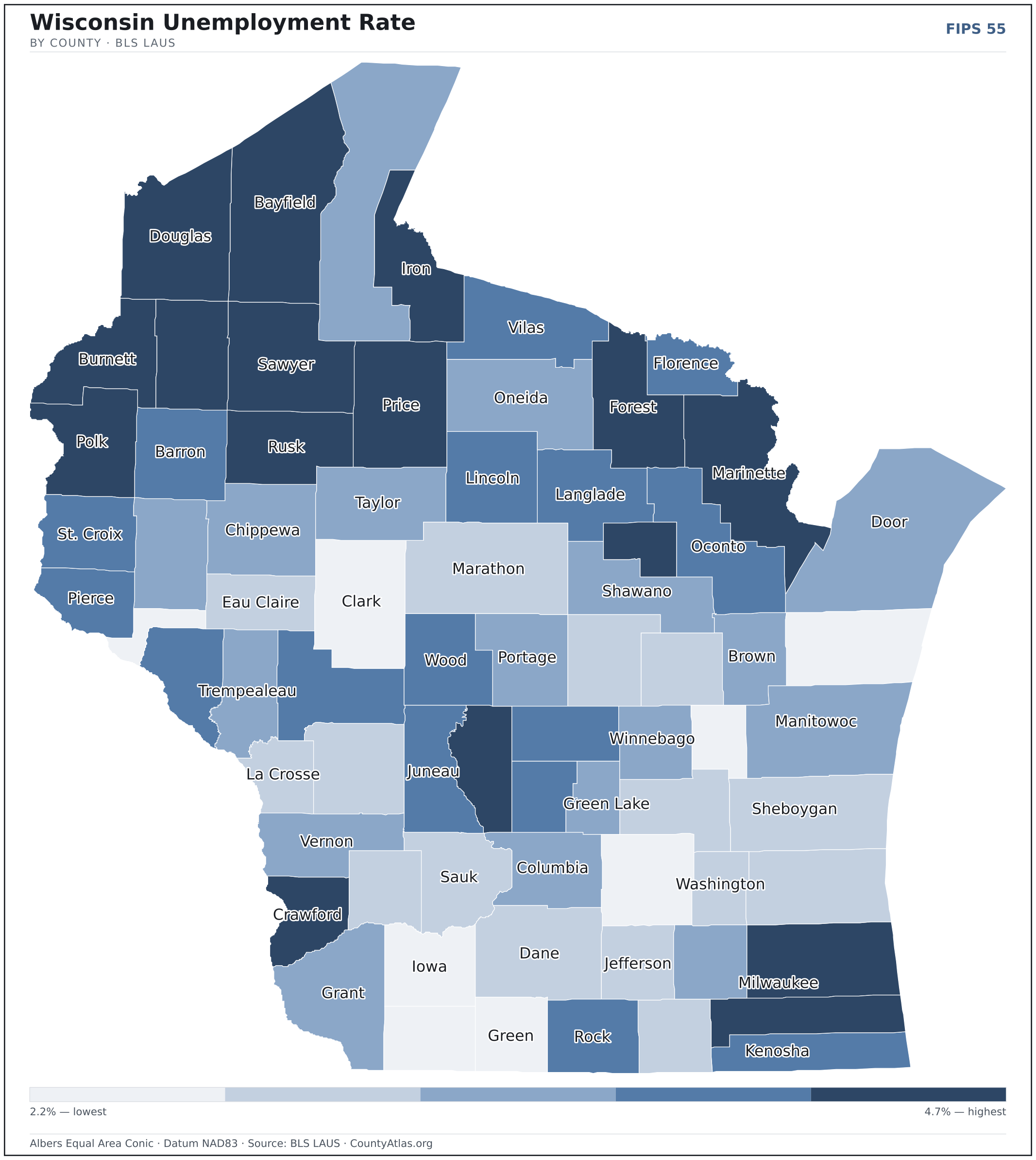
- In Wisconsin, unemployment is highest in Iron County (4.7%) and lowest in Lafayette County (2.2%), for May 2026. BLS LAUS
- Wisconsin’s highest median age is in Iron County (55.9); the lowest is in Menominee County (33.8). Census ACS 2019–2023
- Wisconsin’s highest share of bachelor’s degrees is in Dane County (54.4% of adults); the lowest is in Clark County (13.4%). Census ACS 2019–2023
Every figure is a current official estimate from the source named — not a crowd-sourced or copied value. Suppressed estimates (coefficient of variation ≥ 0.30) are omitted, never guessed. See the full methodology.
Wisconsin counties: common questions
How many counties are in Wisconsin?
Wisconsin has 72 counties covering 54,168 sq mi and about 5.9M residents. Every one is on the map above and in the table below.
What is the largest county in Wisconsin?
It depends on the measure. By land area it’s Marathon County (1,545 sq mi); by population it’s Milwaukee County (916,205 residents).
What county is Milwaukee in?
Milwaukee (population 569,756) is in Milwaukee County. Use the search on the map to find any Wisconsin city’s county.
What is the richest county in Wisconsin?
By median household income, St. Croix County is the richest at $103,731; the poorest is Menominee County at $49,791 (Census SAIPE 2023).
What is the most populous county in Wisconsin?
Milwaukee County, with 916,205 residents — about 15.5% of Wisconsin’s people, and 217× the least populous, Menominee County (4,226).
Sources & vintages
- Population — PEP Vintage 2023 (July 1, 2023) — pep/charv
- Median household income & poverty — SAIPE 2023
- Unemployment — BLS LAUS May 2026 (preliminary)
- Geometry & boundaries — Census TIGERweb
- Cities & city population — Census TIGERweb Incorporated Places + ACS 5-year 2019–2023
Data current through .